Sunday, March 17, 2024

Wantastiquet-Monadnock Trail Cheshire Rail Trail Part 3

 There was chances of rain in the forecast today, so I opted to stay low again, as has been the trend this Winter and finish the Cheshire Rail Trail section I needed on the Wantastiquet-Monadnock Trail. I parked my car at the parking area for the Cheshire Stone Arch Bridge on Rt 101, where I had turned around 2 weeks ago. Carefully crossing Route 101, there is a small connector path over to Marlboro St. You will see a WM Blue Diamond blaze on the guard rail at the end of the street. Follow down Marlboro St to the Eastern Ave intersection and turn right here. This busy street has a sidewalk, which was nice. Head ever so slightly uphill for just about a tenth of a mile and the Cheshire Rail Trail bears left off the road onto a dedicated Rail Trail with parking and kiosk. This was a nicely paved flat section, that they have done their best to "fancy" up with some greenery and benches periodically as it passes through an industrial area. Just under a mile from Eastern Ave, the trail enters a parking lot. Turn right here and then turn left alongside the back of a hotel with an outdoor seating area before entering Railroad Square in downtown Keene. It was quiet for me being relatively early on a Sunday morning, but I imagine it could be busy.. but also provides some snack stop options if needed with lots of restaurants and bars in the area! Crossing Main Street, the Rail Trail passes what looked like an old train station and continues down between parking lots to School Street. The trail is relatively well marked at turns with signs and occasionally a Blue WM blaze could be spotted as well, though I do recommend a good map which made it much easier to confirm I was making all the correct turns. Turn left on School St and continue for 1 block. At Emerald St, turn right and continue till the street runs out and the Rail Trail continues over a bridge. One word of caution if hiking this section around the same time as I did.. there is a road closure on Island Street which has detoured pedestrians one block over to the Ashuelot Rail Trail. You will pass the entrance to the Ashuelot Rail Trail and may notice a bright orange DETOUR sign... ignore this and continue straight on Emerald St, that sign is strictly for pedestrian access along Island St and does not affect the Cheshire Rail Trail or W-M Trail at all. Once you pass over the bridge at the end of Emerald St, you will reach Island St. Turn right here and head just about a tenth of a mile down to where the Cheshire Rail Trail heads off to the left on a dedicated pathway again. The trail crosses over the Ashuelot River and continues down to another bridge that crosses over Route 9. I have driven under this bridge so many times thinking about how I'd have to walk over it at some point in my redlining journey. Today was that day! The other side of the bridge becomes hard packed dirt trail for the next 1.8 miles or so and you leave downtown, entering a prettier area amongst houses. This is a long straight line with no elevation. The trail also passes through Keene Country Club along this section which is definitely much more scenic. After crossing several roads, eventually you will come to Whitcomb Mill Road which has a Rail Trail parking area and gate. Cheshire Rail Trail continues across Whitcomb Mill Road and into the woods. The Wantastiquet-Monadnock Trail turns left here and climbs up Whitcomb Mill Road, crosses Route 9 and continues up to Daniels Hill Road where there is signage for the Horatio Colony Preserve. Turn left onto Daniels Hill Road and continue down to the entrance for Horatio Colony Preserve. This was my turnaround point at 5.5 miles from my car. I basically backtracked the way I came with a couple shortcuts. It started to sprinkle when I had a couple miles left. I made it back to the car in just over 11 miles and within 5 minutes of being back the heavens opened and it started pouring. Couldn't have timed that any better had I tried!

Strava Activity

starting point on Rt 101

connector path from Rt 101 to Marlboro St

onto Marlboro St

right on Eastern Ave


left onto the Cheshire Rail Trail

some fun benches


right in the parking lot

across Railroad Square


left on School St

Right on Emerald St

end of Emerald St where the Rail Trail continues

right on Island St

left onto the Rail Trail

across the Ashuelot River


crossing Rt 9


through Keene Country Club

left on Whitcomb Mill Rd


left on Daniels Hill Rd

Horatio Colony Preserve


Saturday, March 9, 2024

Sunapee Ragged Kearsarge Greenway - Section 12

 Still working on lower elevation hikes while the weather is questionable, I decided to head a little further north this weekend before some incoming snow was to hit and grab Section 12 of the Sunapee Ragged Kearsarge Greenway. I parked at the Lincoln Trail head for Mt Kearsarge and was 2nd car in on this somewhat gloomy Sunday morning. I geared up and instead of heading up towards Mt Kearsarge, I crossed Kearsarge Valley Road and headed about 20 yards down the road to head into the woods on the Kearsarge Valley Trail. Section 12 is roughly 4 miles long and incorporates both trail and road sections. The first mile was in the woods and was logged last year. The SRKG trail maintainers have done an exceptional job of marking this entire section and create a path through the logging slash as best they could, but it was still rather messy. The trail was also quite wet in places after some recent rains. About 3/4 of the way through this section, the trail started following the logging truck access road which was just slightly better, then improved as it passed by the logged area for the last quarter mile or so. The trail popped out on Shaker St, turned left and followed the road a couple hundred yards before turning right onto North Road. The trail continued along North Road under I-89, crossed over North Road and continued on Gile Pond Road before turning right onto Gile Road. A couple tenths down Gile Road, the trail returns to the woods in the Shadow Hill State Forest. This section was very pleasant meandering down towards Gile Pond before turning away from the pond, crossing back over Gile Pond Road and heading back into the woods on the other side. Here the trail climbed gently up to a field opposite Kearsarge Regional Middle School skirted the edge of the field, then re-entered the woods. I wondered if this area was also used by the cross country team for the school as I saw some bright orange blazes marked on trees and rocks. The trail crossed the access road for the school, re-entered the woods and meandered down to Rt 114. Crossing Rt 114, the trail headed back into the woods and here is where things started getting a little messier. Mud became the name of the game. The trail climbed gently up to Wadleigh Road, followed Wadleigh Road, which was dirt and headed back into the woods. The next mile skirted alongside some wetlands and was really wet and muddy. I kept thinking it was shoe sucking, soul crushing mud. I wasn't upset to see the end of that section when it popped out on Wadleigh Hill Road. There was a nice view looking back towards Mt Kearsarge at this point, but today it was mostly hidden in low cloud. I passed a road closed sign, which was for vehicles due to mud and continued down to the entrance of Wadleigh State Park. The next half mile or so was delightful and I was relishing this change after all the mud. Then right at the very end, with less than a tenth of a mile left the trail became all ice. I gently walked over the ice breaking through being careful not to fall, and then it turned to shin deep water covered in a thin layer of ice. This was the straw that broke the camels back for me. Once I reached the end of Section 12 at Penacook Road, I looked at my maps and saw I could easily road walk back to my starting point avoiding retracing steps in all that mud. So I did just that and called Section 12 complete!

Strava Activity

SRKG coming off Lincoln Trail

start of Section 12 on Kearsarge Valley Rd


well marked through logging slash

out of the slash onto the logging road

and finally some nice trail

left on Shaker St

right on North Rd


right on Gile Rd

left into Shadow Hill State Forest


the other end of Shadow Hill State Forest at Gile Pond Rd

cross Gile Pond Rd

blowdown that you could duck under

Kearsarge Regional Middle School

one of the more pleasant areas

cross the access road for the school


right on Wadleigh Rd


here comes the mud


Kearsarge hiding in the clouds from Wadleigh Hill Rd


ice and shin deep water

end of Section 12 at Penacook Rd


Sunday, March 3, 2024

Wantastiquet-Monadnock Trail - Cheshire Rail Trail Part 2

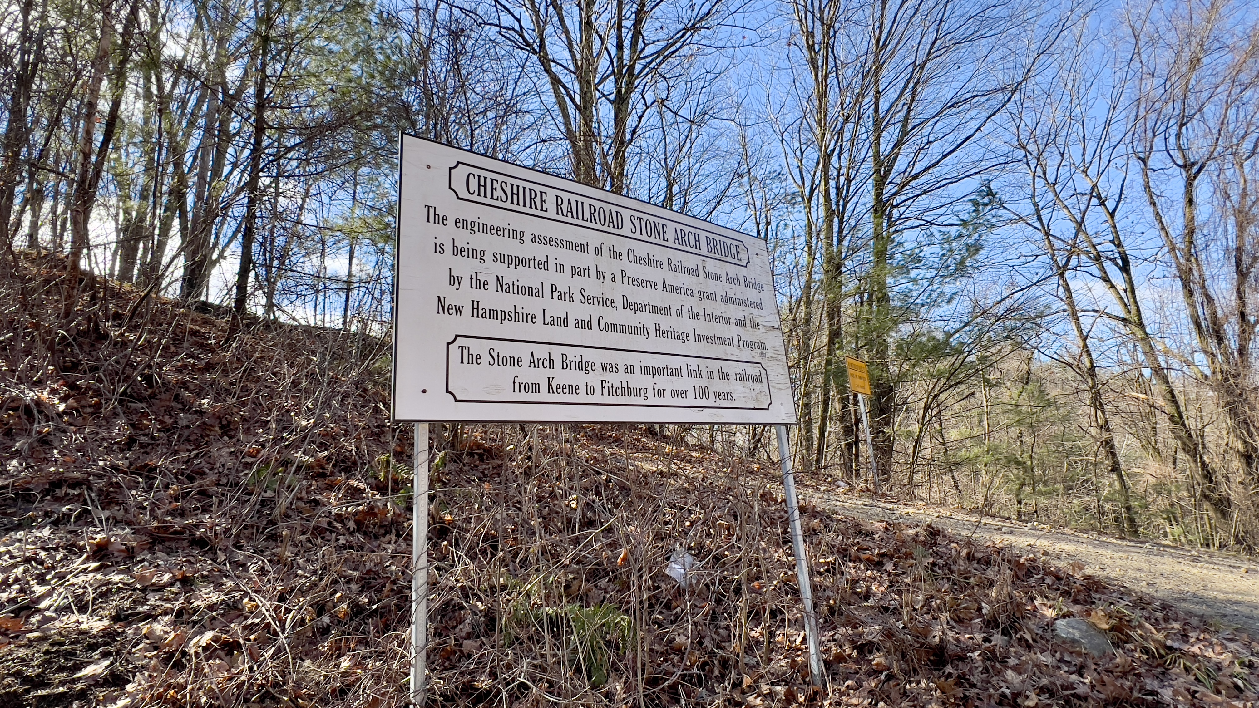
 Coming off a sick week I knew I couldn't do anything too strenuous, and after a pleasant experience last week on the Cheshire Rail Trail, I decided to head back and grab the next 4 miles from my turnaround point last week. The Wantastiquet-Monadnock Trail incorporates a roughly 12 mile stretch of the Rail Trail from Keene to Troy, so I'm just exploring it small section by small section. I had noticed a pull off near my turnaround point last week on Webb Depot Road, so headed there to see if parking would be an option. There were no signs saying not to park, and the pull off area was large enough to get the car completely off the road, so I parked. There was even a small connector trail down to the actual Rail Trail which gave me the opportunity to pick up right where I had left off. This week the trail, at least along the 4 miles I covered, was completely free of any snow or ice. It was soft in some places and there were some very minor areas of mud, but overall it was in great condition. Whereas last week I started in a residential area and walked into the woods, this week I started in the woods and walked into a residential area. I found it just as pleasant overall considering it really is basically a long, straight line with very little elevation at all. We have had some decent rain this week, so in some places some pretty cascades were trickling down. The drainage along the trail is built very intentionally, so the trail itself was kept mostly dry. There was more of the high rock area that the old rail trail had been cut through with some more pretty ice formations. When I started the clouds were low which gave off a mystical vibe through this part. As you pass through Swanzey and get closer to Keene, the houses are a little closer to the trail and I did encounter one dog that had wandered from its yard and yapped at me a little, thankfully it got bored and headed back home. Right at the end of my 4 miles next to Route 101 you cross over the Cheshire Stone Arch Bridge. It is very high over the river and has no side railings, so from the top just looks like a regular road. I saw a little side path that looked like it may go down the side to get a view of the bridge, so I carefully stepped down. It is really high over the water with no fencing or protection at all, so I did not venture far, but I was able to see the beautiful old bridge and grab a picture. At Rt 101, I turned around and retraced my steps back to the car. I'm sure the next stretch I need to do through downtown Keene will be less desirable, but I really did enjoy the 8 or so miles from Rt 101 to Troy way more than I had anticipated. 

 Strava Activity


op top of Cheshire Stone Arch Bridge

on top of Cheshire Stone Arch Bridge

on top of Cheshire Stone Arch Bridge