Saturday, September 21, 2024

Wantastiquet-Mondanock Trail - Keene Connector

 Chipping away at this long trail. Per some intel from a fellow hiker, I drove to California Brook Rd in Swanzey to do an out and back on the Wantastiquet-Monadnock Trail. When I arrived initially at the point where the Class VI portion of California Brook Rd begins, I saw some No Trespassing signs that threw me off.. but the more I looked at them, I believe they were referring to the land alongside the road itself, as there was a sign that said "Pass with Caution" and "Unmaintained Road" so I figured they wouldn't have those signs if it was forbidden to access. So I carefully headed down as far as you could drive. For a Class VI road, it was actually in really great shape. A couple rough spots, but nothing compared to some of the Class VI roads I have driven down to access a trail ;) I parked in a small cleared area just before the trail intersection and got myself ready. Once on trail, I needed to do an out and back in each direction, so I headed to my left first. It was about 1.5 miles back to the last place I reached in April, but totally different conditions as it was snowy back then. I was surprised that there was quite a bit more actual trail than I had anticipated, I was expecting a Class VI type road the entire way, and while there was definitely some of that, there was also a lot of trail. It was rather overgrown in some places, but thankfully well blazed so I had no navigation issues. It was very leafy on the trail portion which hid lots of rocks and roots. I really didn't enjoy this section so much, so by the time I reached the small pond I had chosen as my turnaround point in April, I decided I was done for the day. I backtracked to the car and instead of doing an out and back in the other direction, called it a day. Fast forward a week, and I came back to grab the next out and back section. Expecting more of the same from last week, I was pleasantly surprised that this section was much more pleasant. There was still more trail than I had anticipated, but there were no overgrown sections, which just makes Class VI walking so much nicer. I actually went a little further than I had planned as I was enjoying myself so much. Once I reached the Horatio Colony Preserve along Forest Ave (Class VI), I ventured down Bailey Brook Trail for just over half a mile, choosing a random spot that I could easily identify on the map as my turnaround point. There was absolutely nothing of scenic value along this entire section, but I did see 2 porcupines! I have just over 3 miles left in Horatio Colony Preserve to finish the Wantastiquet-Monadock Trail in full. 

Strava Activity

Strava Activity Part 2

This is where I left off on my last visit in the snow!

the Class VI road

friendly little guy

some overgrown trail section

and some really pleasant trail sections

more overgrown stuff

way more "technical" than I had anticipated at some points


thankfully well blazed


approaching California Brook Rd

parking along California Brook Rd

trip 2 from California Brook Rd

so much nicer than last week

right into the woods and alongside some logging


cross a logging swath


entering Horatio Colony Preserve


my turnaround point along Bailey Brook Trail

made more friends on my return


Saturday, September 14, 2024

Mowglis Trail

 I've had the completion of Mowglis Trail on my radar forever.. initially I had wanted to do it as part of a car spot. The descriptions of this trail that I have previously read didn't make it sound overly enticing, so if I could just do it in one direction, that would be great. As it turns out, my car spot buddy has been otherwise occupied for a while.. I miss hiking with her, but life first always. So with options running low as I near the end of this project, and a concern about limited fitness having not been out so much of late, I decided to just go ahead and do an out and back of the 3.5 mile section I needed to complete Mowglis Trail. From what I could gather, parking at the Sculptured Rocks Rd end of the trail was limited, if not non existent. I know you can park at the actual Sculptured Rocks area, but that adds roughly a mile road walk in each direction, which I was not interested in. So I decided to try driving in on New Colony Road all the way to the Mowglis Trail intersection. Having hiked it as Orange Cove Trail last year, I felt this might be doable. Once on the unmaintained section, it was definitely rough in a couple places, but overall not so bad and I was able to get all the way in. The section of Mowglis Trail I would be hiking was a Class VI road for the entire length. Starting at this end effectively means it's downhill first, then uphill back. The road started out somewhat eroded, and I can imagine it would get quite wet and muddy if there had been a lot of rain, but another reason I chose this weekend to hike this was because we haven't had any rain in quite some time.. so although I did encounter some dampness and mud, it was not bad at all. After not near as much erosion as I had expected, the road smoothed out and was more like a dirt or gravel road for the most part. Way better than I had expected! I passed a driveway, which I wasn't expecting and a little further down the road, a man in an ATV passed me by, he must have come from that driveway. He would be the only person I saw all day.. and he passed me again going in the other direction a little while later, perhaps he had gone to check the mail! As the road got closer to the end it followed alongside a relatively dry brook, but it was actually kind of pretty. There were also glimpses through the trees of the ridge up where Elwell Trail is and the Fall colors were starting to pop. Once I reached Sculptured Rocks Rd I just turned around and retraced my steps. The uphill was tougher at this point in the hike and I felt it but overall, this was nowhere near what I had anticipated, and I didn't hate it at all! A really pleasant surprise!

Strava Activity

I parked at the intersection of Mowglis and Orange Cove Trail

started off nice

got a bit muddy

this was the worst of the mud

then was really quite pleasant the rest of the way

passed some snowmobile signage


peekaboo up to the Elwell Trail ridge

started seeing some interesting artifacts

this was actually at the bottom of the driveway


turnaround point at Sculptured Rocks Rd

the eroded section looked a bit more eroded on the uphill

driving out on New Colony Rd looking up at Firescrew


Sunday, September 1, 2024

Finishing Monadnock

 Today I completed all the trails at Mt Monadnock. Took me 10 hikes over 4 years, but I got it done! I parked at the Old Toll House parking and was surprised how few cars there were by 9am, though on my return the lot was almost full. I started on the Old Halfway House Trail which runs alongside the Old Toll Road for much of the way, but is an actual trail. At times it is higher than the road, and does take a turn in about halfway. It was a nice alternative to the road and was much quieter, in fact I saw no one. Once at Cart Path, I took an established herd path up to the road and continued up to the White Trail/Monte Rosa intersection. I stayed straight onto Monte Rosa Trail, which is a short, steep climb up to the Monte Rosa peak. The clouds were very low this morning and it was cool hiking up into the mist. There were a couple of scrambly bits near the top, but nothing crazy. I saw my first 2 people just below the summit. No views today, but that's OK, I had seen the view the last time I was here several weeks ago. The wind picked up as I broke treeline, and I put on a long sleeve, but it was deceivingly warm considering and thankfully no precipitation. I continued up to the summit on Smith Summit Trail, passing just a couple people along the way. I actually enjoy this climb. I had no views today, but I enjoy climbing up the rocks. The 2 times I have done this climb, it's a challenge, but not scary. As always, the summit itself was very busy, in fact there was a large group of children right on the actual summit sitting around. I did not attempt to go over and put my foot on the survey marker as I didn't want to fight through all those kids. With no views whatsoever, and it having taken me a long time to get up there, I didn't linger and began my descent after a quick break. On top of my regular turtle pace, I took my time on this hike, knowing it was my last. This mountain is far too busy for my liking, so it's not a place I intend to revisit unless someone wants me to accompany them on a hike! I needed the top section of White Arrow Trail, so headed over to take that trail down. Look for the trail descriptions painted on the rocks. I knew White Arrow was steep, but it was way steeper than I had anticipated. It was busy with folks ascending as well. Lots of butt sliding and gymnastics to get down the initial descent. I actually thought it was kind of fun! The clouds started to lift as I descended and I had some peek a boo views. Once down to Amphitheatre Trail, I took that back over to Smith Summit. That is a challenging trail in my opinion. My first time on that trail I was going in the opposite direction, which I think I preferred to this time. By the time I reached Black Precipice, the view had just about completely cleared, so I took a few minutes enjoying it before continuing. I climbed back up to Monte Rosa and continued down Great Pasture Trail, which is really steep. This is where I started to bonk and just wanted to be done! I was really glad to reach the Mossy Brook Trail, but found it tiresome because it's very mossy (imagine that!) and rooty. The trail follows a brook that is super mossy, which was kind of cool. It was pretty messy though with storm debris, and very little water flow. I finally reached my final trail of the mountain, Cart Path. This was much smoother, which I was very grateful for. Once back at the Old Toll Road, it was bittersweet. I have a love/hate relationship with this mountain. I did enjoy all my hikes. Every single one challenged me. 

Strava Activity


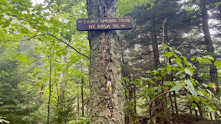
Monte Rosa Trail


Monte Rosa Trail


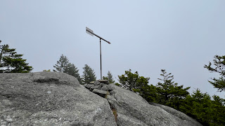
Smith Summit Trail


Looking down White Arrow Trail

looking back up what I had just come down


looking up what I had just come down

looking up White Arrow Trail


Amphitheatre Trail


Black Precipice


one little early splash of Fall color

funky rock/tree on Great Pasture Trail

Great Pasture/Mossy Brook/Marian intersection