Monday, October 22, 2018
Mt Pisgah
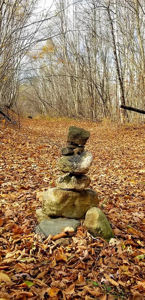
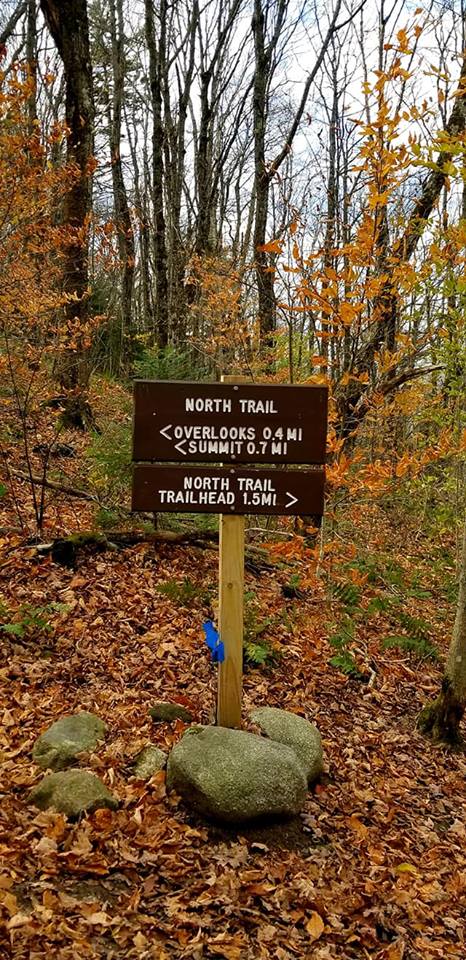
My husband wanted 1 more weekend mountain biking at the Kingdom Trails before they close for the season. I will never turn down a road trip, and Vermont's Northeast Kingdom has begun to feel like a second home to me. I adore it up there. While the boys played on their bikes, I set out for a crisp Fall hike. The weather forecast had gone from rainy and miserable to partly cloudy. It ended up being in the 50s and perfect for a hike. I chose Mt Pisgah having seen several other of my friends hike it and knowing it was relatively close. I researched the different trails and opted for the East Trail as the description read 900ft of elevation gain vs 1400 +/- and 1500 +/- on the more popular South and North Trails. What I have to continually remind myself (and I actually didn't realize until I uploaded my Suunto activity) that a trail description is solely for that particular trail.. when it merges with another trail, that portion takes on a whole different description. In retrospect, I'm glad I didn't know this ahead of time, otherwise I wouldn't have done it. I have barely hiked over the past 2 years and my fitness has suffered for it. I didn't want to get in over my head. I located the trailhead and headed off on the trail. The first 1.6 miles is on old logging roads with very little ascent. The trails were leaf covered and peaceful. At 1.6 miles you enter Willoughby State Forest and the trail ascends a little more to merge with the North Trail. What I hadn't realized, I had now done my 900ft of ascent.. the North Trail takes a steep turn at this point and for approximately 0.5 miles it is up, up, up.. I puffed and panted and very slowly made my way up. What I was thinking was "wow, 900ft of ascent really feels more than that"... to which I can laugh now, because my total gain for the day was 1759ft! I finally reached the Overlooks and tentatively made my way down the side path to the North Overlook. I had read and seen pictures of how precarious these were, so I wasn't sure I would actually make it all the way to the overlooks (I have an insane fear of heights) and was hoping I could still peep a view from a safe vantage point. The North overlook while very scary (to me) did have enough space that I could stand as far back as possible and still get some pictures. It was quite windy at this point, which added to my fears. A couple of Canadian girls came onto the overlook as well, which just added to my anxiety.. they were much closer to the edge than I and I always fear what may happen.. anyway, we all safely made it back to the main trail and I continued on up the 0.3 miles to the viewless summit. The summit had a firepit and small sign tacked to a tree covered in graffiti. I sat and ate a granola bar and silently cheered myself on for actually making it to the top. I briefly stopped at one of the other overlooks, which again made me super anxious as there was a family with small children climbing on the rocks. Eek! The only negative on the way down was all the leaves hiding mud which made some of the descents a little slippery.. but overall, I think the euphoria of having actually made it up had me flying back down! And that is why I love hiking.


Sunday, October 14, 2018
Craney Hill & Pitcher Mountain
It was a gorgeous afternoon and I was feeling the need to take in some views. I had read about Craney Hill fire tower in Henniker. It's accessible year round, but supposedly only open 2 weekends a year. I couldn't find anything relevant for 2018 dates, but based on past years the 2nd and 3rd weekends in October seemed to be the go. So I took the chance and headed over to Henniker. Craney Hill Road sure is one steep road, but I found the gated entrance easily enough. I didn't notice the sign that some had suggested would be out if the tower was in fact open, but there were several other cars so I kept my hopes up. A brief walk up an access road, with about 200ft of elevation gain brings you to a clearing with the tower. As I began, a couple on a tandem bike with a pup started riding up. I don't know how they did it, some of the trail was filled with pretty large rocks and it was quite wet from rain the week prior. But they did! I was impressed. I had expected to find people at the tower since there were at least 3 cars at the gate, but no one was around and the tower was all locked up. I was disappointed. There are no views from the base of the tower, the trees are too tall. I tried wandering around a little to see if there were any clearings. The trail did continue on past the tower, which I'm guessing is where the occupants of the vehicles as well as the cyclists had gone on to, but without knowing the area or where that trail went I opted not to go too far. As I headed back down the trail to my car, a couple with a baby carrier came up and mentioned they had hoped the tower would be open too. At least I can check Craney Hill off my fire tower list and maybe I'll try again next year to get up the tower!
Strava Activity


Not being satisfied with the views I got from Craney Hill, I ventured back to Pitcher Mountain having been there twice before and knowing I could get big bang for my buck with relatively little effort. This time I decided to make a loop of it and headed up the Blue Trail, which I hadn't done before. A little shorter at only roughly 0.3 miles and a little steeper, this made for a nice loop.. even if I did trip on a rock and smash my shin creating a nice lump and hematoma! The views from the top were amazing, especially on such a beautiful day. I was greeted by a little field mouse on the tower today, he was so cute! I then returned via the Monadnock-Sunapee Greenway savoring the views across the open field about halfway down. Perfect Fall day!


 |
| views heading down the MSG |


Saturday, September 8, 2018
Bald Mountain - Deer Valley
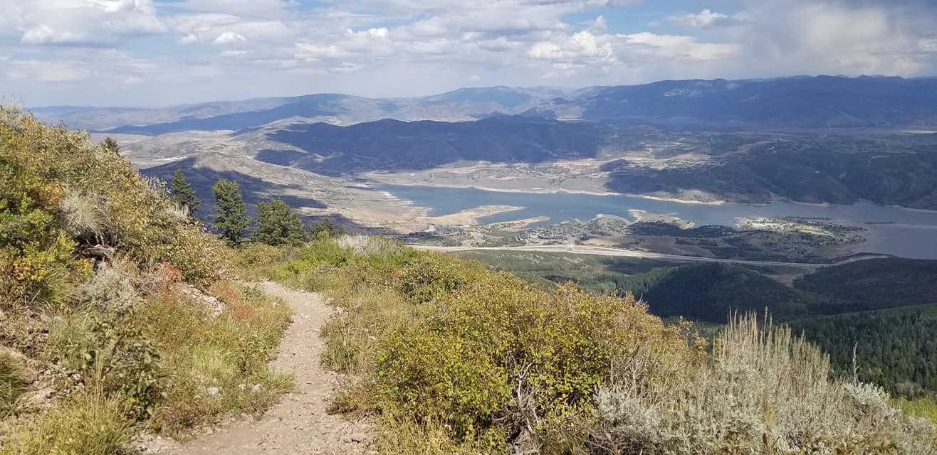
I flew out to Salt Lake City, and drove to Park City to meet up with my husband after he had a work conference all week to spend the weekend celebrating our 22nd anniversary! Our first full day we headed over to Deer Valley so he could try some downhill mountain biking. I decided to hike Bald Mountain. Having only been at elevation for just over 24 hours and having lost a lot of my hiking fitness over the past 12 months, I decided to go easy on myself and took the chairlift up with him and hike down. I did this twice. We took the Sterling Express and took a few pictures from the top of the chairlift before he took off on his bike. I did a quick little up and down to the actual summit of Bald Mountain before picking up the Ontario Trail to hike back down. The trails over here are very different than what we have in the White Mountains. Smooth footing makes for easy going, it's just the elevation you have to contend with at just over 9000ft, which thankfully didn't give me too many problems. The views were incredible. It was a beautiful day and I just kept stopping and taking it all in. I could have taken a million pictures. The Ontario Trail was about 2.6 miles down. I then rode the chairlift back up and took the Silver Lake Trail down. This one was just about 2 miles down, a little steeper in places, but still relatively easy going. These were some of the most spectacular views I've ever seen!
Strava Activity - Ontario Trail
Strava Activity - Silver Lake Trail
 |
| Sterling Express Chairlift |


 |
| Bald Mountain Summit |


 |
| Ontario Trail first |

 |


 |
| back up and now down Silver Lake Trail |


Subscribe to:
Comments (Atom)