Saturday, January 27, 2024

Metacomet-Monadnock Trail Section 3 (almost)

 Another week of almost completing my planned hike. We have had a little snow plus both freezing and warmer temperatures.. so conditions are just all over the place. I headed south thinking it may be less messy, but I was wrong. I parked on Old County Road at the intersection of Dean Farm Road, start of Section 3 on the Metacomet-Monadnock Trail. Starting out the trail was immediately very slushy. I had spikes on, but it was that kind of sticky, wet snow that balls up under the spikes rendering them pretty useless. I stuck it out for about a mile before taking them off. This section starts out up Dean Farm Road which had seen some vehicle action, so there were tire ruts which were a mix of standing water and ice. The road gradually ascends and at roughly 0.7 miles turns off the trail at a stake with 2 white rectangle blazes. Here it descends a little bit steeply into the valley. Conditions here were wet snow covering a lot of leaves covering some mud.. that was why I kept the spikes on for a little extra traction. The trail is really well marked in this area, which was good because the only prints I had to follow were animal prints.. sometimes helpful, but I had to keep reminding myself they weren't necessarily following the trail and to be careful not to wander off course! At the bottom of the gully there is an intersection with an alternate route to avoid a marshy area. Having seen how slushy the trail already was, I didn't take my chances and took the Dry Shod Bypass. This weaved in and out of some pretty forest with a couple of water crossings. The trail rejoined the main trail at Tully Brook  where there was a trail logbook to sign. Here there was a larger water crossing that was somewhat tricky. The water was high and running fast. The rocks were slippery and a little further apart than my legs could reach comfortably.. I had to go upstream just a little until I found a section of rocks that I could more comfortably cross. From here the trail started a gentle climb up what I knew was heading towards Little Monadnock Mountain. My original goal had been to make it to the Widow Gage Forest access trails and turn around, but by the time I reached Morgan Road, I was so tired from trudging through the slushy, heavy snow... plus it had been off and on rain/snowing (which hadn't been in the forecast) I called it and turned around a little earlier than planned. I will get that remaining piece when I come back to do Section 4. 

Strava Activity

where I parked/started

turning off Dean Farm Rd 


I chose Dry Shod Bypass


even the Dryshod Bypass was wet

back at the main trail 

Tully Brook.. tricky water crossing today

my turnaround point at Morgan Rd


Saturday, January 20, 2024

SRKG - Section 4 - Half of it

 My day started with receiving the wrong breakfast order from my trusty drive thru pre-hike breakfast establishment.. then when I got to my intended parking for my hike, I found it wasn't plowed.. after a momentary hesitation that maybe it wasn't in the cards for today, I checked out the other end of my intended hike and surprisingly found that parking area was plowed. My plan had been to do an out and back on Section 4 of the Sunapee-Ragged-Kearsarge Greenway. That would be roughly 8 miles. Temperatures were arctic today with wind chills sub zero.. but I've hiked in those conditions before. It's all about layering appropriately. What I hadn't factored (because I hadn't seen it in the forecast) was snow. When I arrived at Plan B parking on Route 114 in Springfield it was very lightly flurrying. I had seen on an interactive snowmobile map that this entire section is a snowmobile corridor and currently had "Limited Availability".. I hoped that meant it had been traveled and was packed down. When I started out, I was pleasantly surprised to find, not only was it packed down.. it was groomed! I decided to bareboot, with my spikes packed. There were only a few inches on the ground at this point, so I wouldn't be doing too much damage by not wearing snowshoes. Amazingly, I floated across much of the trail from the groomer. There were definitely a few chunky sections, but those were very brief. This section of the SRKG in this direction starts on Class VI Mcalvin Road and is signed Protectworth Trail, like at the other end on Deer Hill Road. The trail descends very slightly at first, then gently ascends for roughly 1.3 miles before ending at Nichols Hill Road, another Class VI road. Towards the approach for Nichols Hill Road, the snow thinned out on the ground and turning right onto Nichols Hill Road was basically frozen dirt. The trail then turned into rock, which surprised me, but the reason became apparent as it opened up to a field on one side, and a logging operation on the other. The snow was starting to fall more now in earnest and in the area of the logging operation, the wind was more evident. Looked like there may have been views of the surrounding hills here, but it was fairly white out, so I couldn't see much. The trail had climbed up and over a small hill before descending again and meeting an intersection that was blocked off straight ahead. The ground had become snow covered/groomed again as the logging operation was now behind us. The trail here turns left onto Mcgann Road (Class VI) and descended, then ascended up quite a moderate little climb towards Deer Hill Road. At roughly 2.5 miles from the car, I was starting to feel the fatigue of my first Winter hike. Even though I was bare booting, walking in snow is tiring.. along with the snow falling and the cold temps and a recent tragedy in the White Mountains, I was not about to push my limits so made the decision to turn around. I screenshot where I was on the map, so I could come back another day and do an out and back from Deer Hill Road to this same point. From here, I just retraced my steps back to the car. The trail was sparsely blazed, definitely at the turns which was crucial and a couple others along the way. Surprisingly, I saw no snowmobiles today! Just me, myself and some beautiful woods walking. 

Strava Activity

My start off Route 114


turning onto Nichols Hill Rd


logging operation on Nichols Hill Rd

turning onto Mcgann Rd
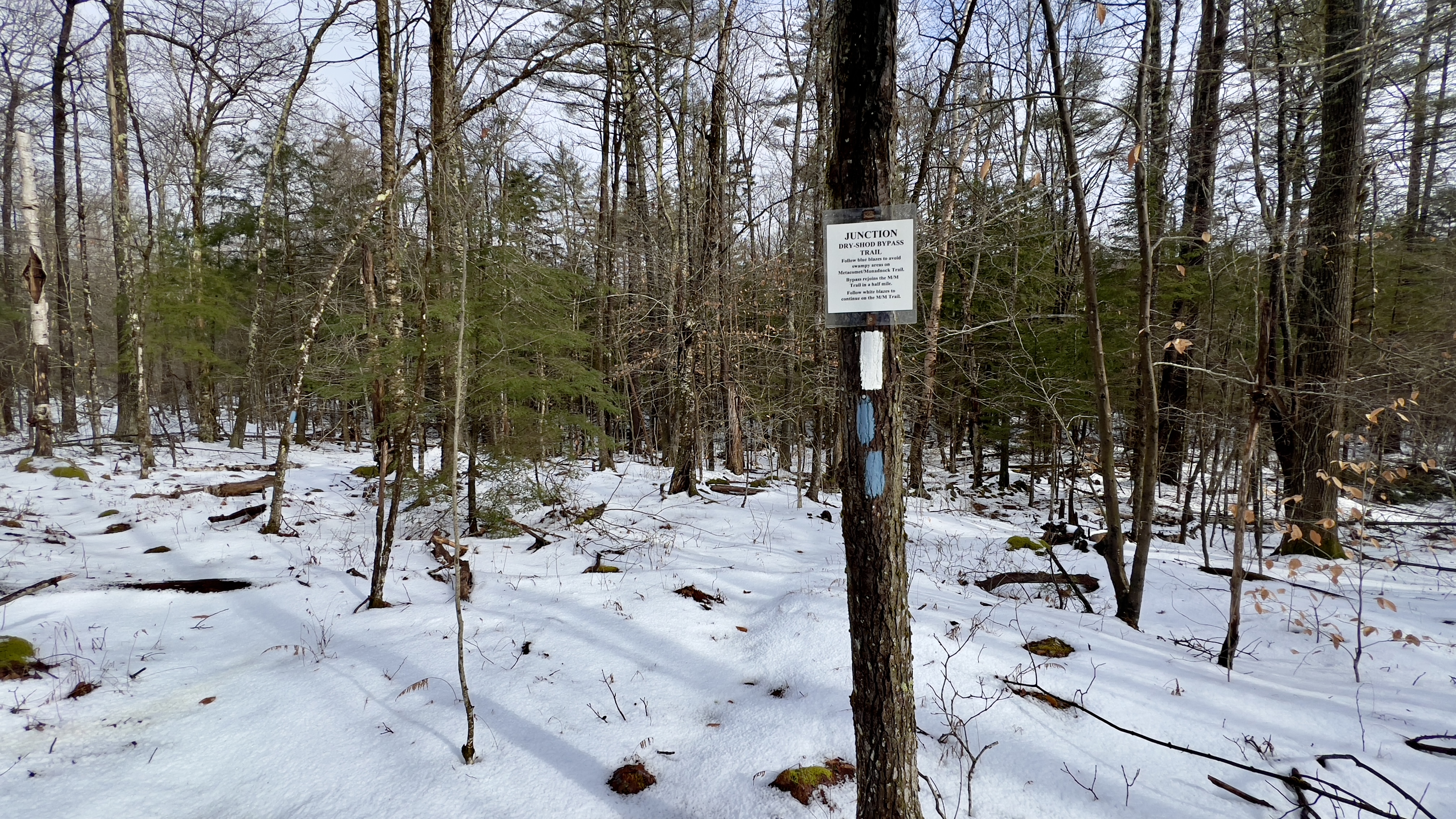
my turnaround point


Saturday, January 6, 2024

SRKG Section 10

 Snow is coming! I've been down with a cold this week, so while I wanted to get out, I didn't want to overdo it and also wanted to get out and home before the snow arrives. Sunapee-Ragged-Kearsarge Section 10 it was. My bestie Laura accompanied me again today and bless her with the car spots. We dropped a car at Proctor Academy in the parking area of Farrell Field House per the SRKG website and headed over to Winslow State Park. The gate is closed for the season, so we had to park roadside at the bottom of the access road. There were already a couple cars there. We geared up and started off with an out and back of the access road, which was basically all our elevation gain for the day! It's a paved road, though steep at times, but we were able to make decent time. At the top, we enjoyed the surrounding views for a moment, played a little on the playground and headed back down. Back at the car, we continued on Twist Hill Road which started off paved and then turned to hard packed dirt before transitioning to a true Class VI road. It was fairly eroded in places and had some ice, but we were able to avoid without needing traction. At the intersection with Morey Hill Road, was a cool remnant of an old house with fireplace still standing. The road turned back to hard packed dirt briefly with a very pretty frozen stream alongside the road and then turned right (at the bear) onto Dawes Road. This was probably the most eroded/iciest section of the day which slowed us down a bit, but overall wasn't too bad. At the intersection with Bridge Road, it turned back to hard packed dirt and we were back in a residential area. At the end of Bridge Road is Keniston Covered Bridge and just before that a stack of mailboxes with a snowmobile trail opposite. The SRKG blaze was on the mailboxes and facing in the direction as if you were coming off the snowmobile trail, I had a printed out copy of the map as well as a digital download and all indicated the trail went down the snowmobile trail.. which is where we went. This meandered alongside a river and popped out at the base of the Proctor Ski area, followed a field around to the parking area and then turned left crossing an old bridge, which looked very unstable, but thankfully held up before meeting up with the Northern Rail Trail. We had thought it odd that this section had no SRKG blazes at all, since the rest of this section had been relatively well marked. I wondered if the trail had been rerouted back at the mailboxes up to the covered bridge and along the Northern Rail Trail instead of following the snowmobile trail. Once we reached the NRT crossing we could see that this was in fact the case. We did an out and back of that 0.4 mile section of the NRT to the covered bridge just so I could say I had "hiked the trail". Back where we had started on the NRT the trail turns left and heads through a maintenance area for Proctor Academy before popping out at some athletic fields and crossing Route 4 and back to the car.

Strava Activity

Bottom of the access road to Winslow State Park

views from Winslow State Park


looking up at Mt Kearsarge from the parking area

back at Winter parking and onto Twist Hill Rd


cool relics at the intersection with Morey Hill Rd

you never know what you'll see on a hike


right onto Dawes Road

this was a bit icy along here

Keniston Covered Bridge

do no go down this snowmo trail off Bridge Road

instead continue up to the bridge and turn right on the Northern Rail Trail

the Northern Rail Trail at Keniston Covered Bridge

back to Proctor Academy

coming from the school look for this blaze to continue