Saturday, May 25, 2024

Ragged Mountain - Mud Pond/Bulkhead/Balanced Rock

 I haven't had a chance to hike with Laura in quite a while and tomorrow it's her birthday.. so what better way to celebrate than hike up a mountain with a billion mosquitoes. The weather, thankfully, was perfect. I'd had this hike on my radar for a while for a couple of reasons. It's described on the harder side of things. I'd heard steep and scrambly as well as navigation possibly being a little difficult. The navigation part has been mostly rectified with someone blazing/flagging the route in the past several months. We only encountered a couple of spots where we had to look around a bit for the next blaze, but found it without too much trouble. The rest of the way was well marked even if the treadway was not always easily identifiable. For those reasons I had kept this hike aside until I had a buddy. We arrived at Proctor Academy and discovered today was Graduation Day, however we were early enough that we were able to park in the far corner near the trailhead without anyone giving us any trouble. By the time we returned, the celebrations had come and gone and were in the process of being cleaned up. For this reason perhaps, we saw no one until the very end of our hike when we encountered a trail runner and her pup. The trail starts out on a gravel driveway from the parking area up towards the tennis courts, Here there is a kiosk with map and the trail marked Ragged Mountain Trail. We started out on the Ragged Mountain Trail, which is also Section 9 of the Sunapee, Ragged, Kearsarge Greenway so marked with the white trapezoid blazes. The lower section of the mountain has been revamped in recent months by Proctor Academy for mountain biking/cross country skiing, so there are quite a few trails all over the place, not all are signed and it could easily get confusing. In fact, we did find it a bit confusing at times, even with a digital downloaded map to follow. The SRKG is no problem, it's all the other Proctor Trails, and I wasn't entirely sure what was required for redlining. I had researched and tried to emulate what I had seen others do/what the guide describes to the best of my ability. The SRKG climbs a moderate little climb before leveling out a little and we came to an intersection with a map (the only one we saw all day like this). We took the right onto the trail which connected the Greenway with what I called "the other side" of the Proctor trail network. This descended slightly before reaching the other end and a junction marked Wilson's Wonder. We turned left here and headed up towards Mud Pond. There were 2 signed spur paths down to the pond. We took them both. The first had a tent platform and campsite, the second had a lean-to shelter, plus a much better view over the pond and the surrounding peaks. We backtracked to the main trail and continued on to an intersection pointing towards a cabin. The trail descended a little here before climbing back up and coming up to the cabin and tent platform. Behind the cabin was a sign pointing towards the Bulkhead. We continued on this trail which crossed a "road" and continued on towards the Bulkhead. The trail was relatively gentle at first but about half a mile in the fun begins. This was the section I had anticipated to be rather difficult. We found it very steep, but nothing crazy technical. About half a mile in there was a short rock scramble, which opened up to an amazing view towards Mt Kearsarge and over Proctor Academy and surrounds. We had a perfectly clear, bluebird day and it was glorious. Continuing up a little more rocky area the actual Bulkhead was marked with a sign, but I actually found the views from the lower overlook to be better. Feeling really quite good once we reached this point, I thought we had the hard stuff behind us. I was anticipating a rolling ridge walk for the next half mile over to Balanced Rock. It was not that at all. It was steep, rugged and steep (yes, I said it twice). I think the mental piece of a hike is just as important as the physical. If I know something is going to be hard, I can mentally prepare for it and that changes my entire perspective. Doesn't make it any less physically difficult, but my attitude is ready for the challenge. When a hike is difficult that I am not anticipating it to be so, the wind leaves my sails much more quickly. And that's what happened today. Had we known this section was going to be like this, I think the hike would have gone much differently. That being said, we did it and were grateful for the beautiful day. I think ascending this trail would be much more preferable than descending. It's under a mile but felt like 10 miles! Just before Balanced Rock is an open ledge area that you have to cross. I had seen this in pictures and was prepared for this section. It wasn't as hard as I had imagined it might be, but care is definitely needed as slipping would not be good. The views from these ledges was also spectacular. Same direction as from the Bulkhead, just a little closer towards Kearsarge. Balanced Rock is not too far past these ledges, and is basically a huge rock that has come to rest on another. We used this opportunity to stop for a snack. Initially my hike plan had been to continue up on the Greenway to East Ridge Trail, and take that out to Old Top, however we were pretty much cooked at this point. Laura encouraged me to at least take the section up to East Ridge Trail, so I wouldn't have that little "hanging chad" when I come in from the New Canada Rd side to finish the trail. As difficult as that was, even for just 2/10 of a mile, I was grateful to get that done. We descended back down the SRKG, which was steep, but the footing was much better. We were tired though so were a bit slower than normal making sure we didn't slip and fall on any rocks or roots. Once back at the intersection with the map we had crossed over at the start of our hike, we did the same and returned to the car via the "Proctor Trail" part of the network so I could cross that off my redlining spreadsheet. This was the area we got the most confused as none of the trails are labeled, but with the help of our digital maps and a screenshot I had taken of the trail network at the kiosk, we made it down without incident. A successful first trip to Ragged Mountain. 

Strava Activity

start of trail at Proctor Academy

top of the gravel driveway


Laura at an intersection

we took a left on Wilson's Wonder

1st spur to Mud Pond

campsite along the 1st spur

Mud Pond from the 1st spur

2nd spur to Mud Pond

shelter on 2nd spur

Mud Pond from 2nd spur

we headed towards the cabin


tent platform at the cabin

heading to the Bulkhead

crossed a road and continued to the Bulkhead

these signs for the Bulkhead were cute

new blazes and flagging

looking up some of the steep climb to the Bulkhead

just before the rock scramble section

views from the lower overlook at the Bulkhead


actual Bulkhead sign a little higher up

on towards Balanced Rock

the slab cross over

gorgeous pink quartzite

over the slabs and on to Balanced Rock

views from the slabs

Balanced Rock

intersection with SRKG beyond Balanced Rock

our turnaround point at East Ridge Trail

coming back down the SRKG


Sunday, May 19, 2024

Cardigan Mountain - Cathedral Forest/Vistamont Trails

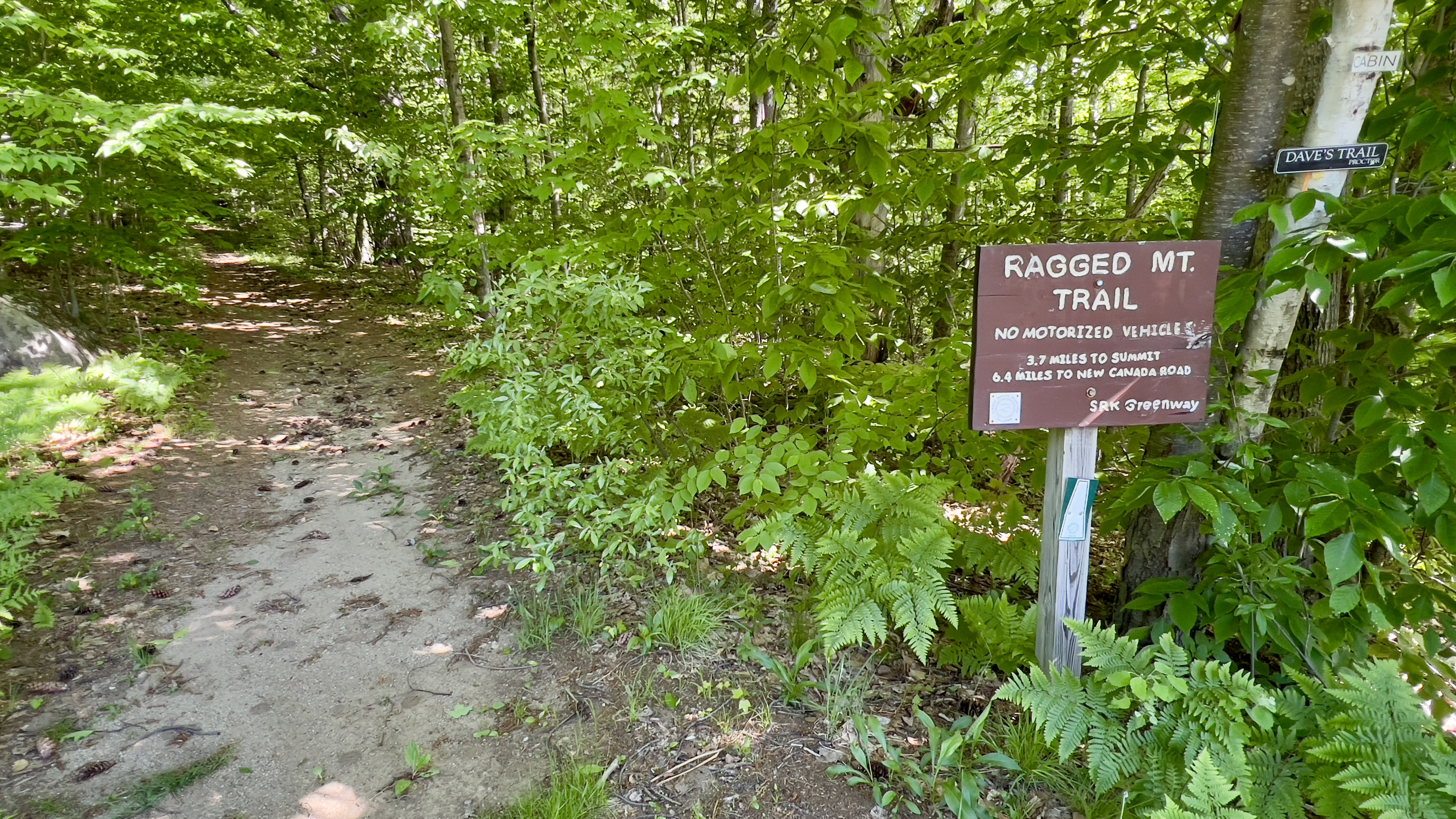
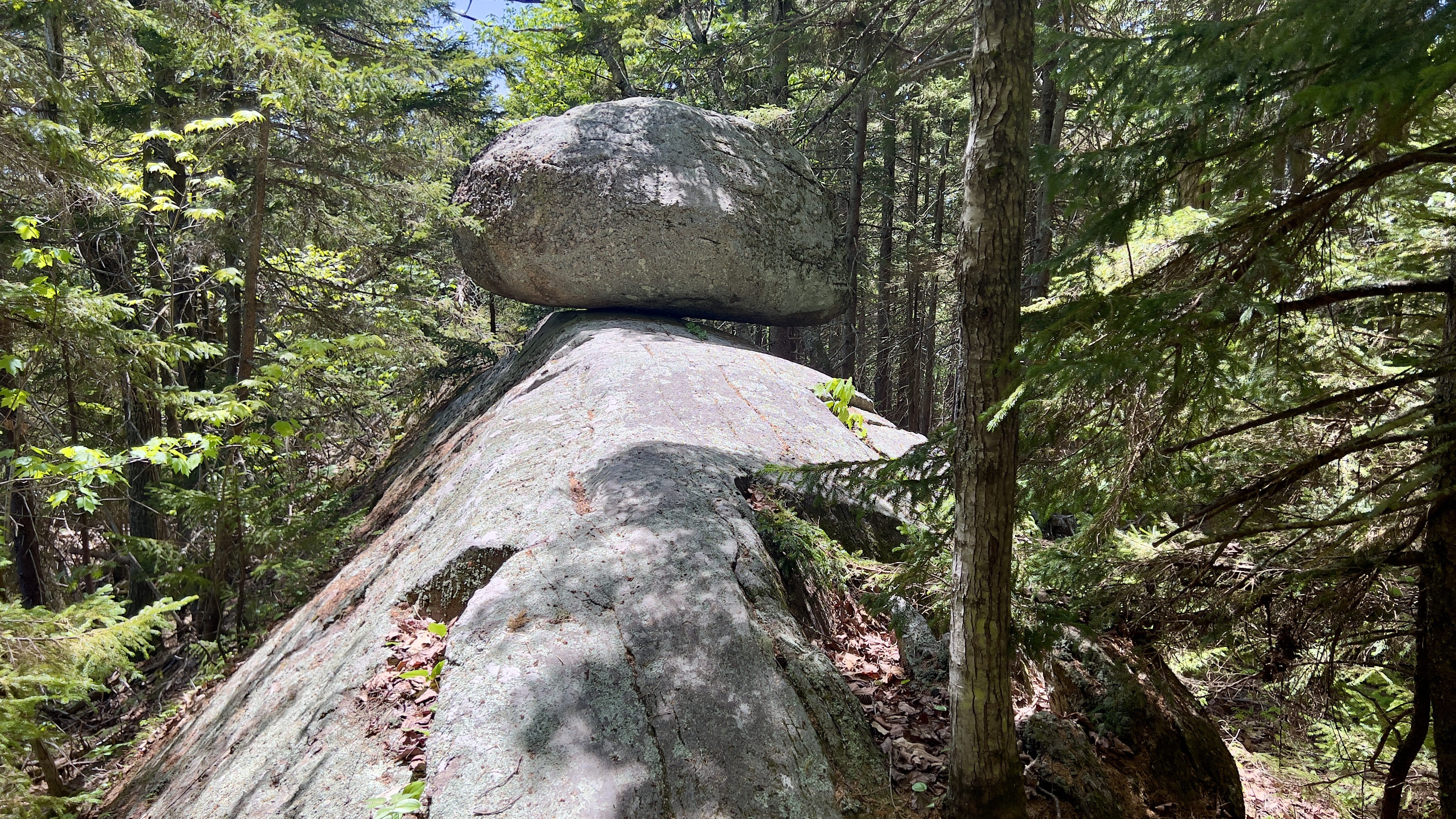
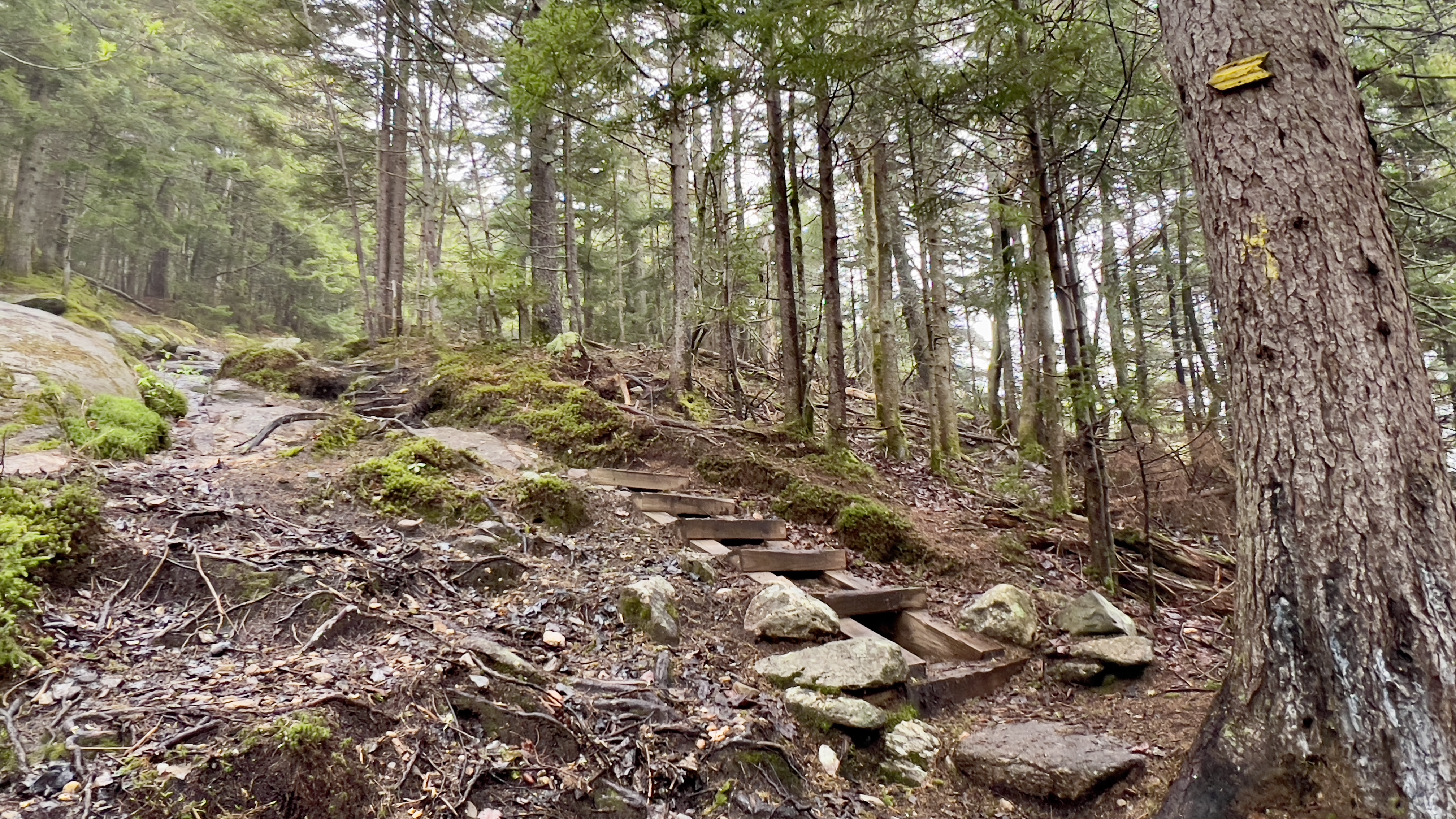
 I've not been out in a month due to family commitments.. and while I cherish each and every one of those moments, I've missed the trails, so it felt good to get back out and continue exploring. I haven't been up an actual mountain in a really long time, and have mostly trails in the Cardigan and Monadnock areas left to hike on my quest for the AMC South Redline patch. I decided to head to Cardigan and grab a few sections there. It had been raining the past couple of days and was misty and sprinkly on my drive up. I managed to avoid any actual rain, but had some wet trails to contend with. Nothing impossible, just some extra care taken on those rocks and roots. I never seem to have good luck with parking at the AMC Cardigan Lodge, and this weekend was no different. Even though I arrived just after 8am, the lot was completely full and cars were even parking down the road despite the very obvious NO PARKING signs. Turns out there was a large group of Boy Scouts from CT who had been camping. I saw several cars parked just outside the AMC Cardigan Reservation sign, where there aren't any signs against parking, and hesitantly turned around to find myself a spot there. This would only had about a half mile dirt road walk each way. I geared up including bug spray as it was rather mosquitoey and headed out. Just as I got a few hundred yards from the car, several of those campers passed by leaving. I hightailed it back to my car and headed for the parking area to grab one of those empty spots. Feeling better about this, I headed back out again down the Manning Trail, and onto Holt Trail. The section to Grand Junction is just under a mile and is really quite pleasant. A very gentle ascent initially, then across Bailey Brook on a bridge before hitting the more technical area with quite a few rock steps. The trail follows along Bailey Brook and there are some lovely cascades. At Grand Junction I turned onto Holt-Clark Cutoff/Cathedral Forest Trail which was about 0.7 miles. The grade was a little steeper now, but not as bad as I had anticipated. I was going really slow though, cognizant of the fact I need to rebuild mountain fitness, but I felt pretty good overall. At Clark Trail, I turned right. Very easy grades at first, the trail takes a right hand turn alongside a big rock cliff covered in moss and starts the climb in earnest. Made just a bit trickier today with the wet rock, overall it still wasn't as bad as I had expected. I was pleasantly surprised. At the Hurricane Gap intersection there is a lovely little bench at an overlook. Unfortunately today it was socked in with cloud, but that's OK, I have been here before and seen the gorgeous view. I continued up Hurricane Gap Trail which was fairly eroded in places. The AMC High Cabin is along this trail, and was a flurry of activity this morning as some campers were cleaning up preparing to head out. The view is cleared in front of the cabin which must be gorgeous at sunrise/sunset when the skies are clear! At the end of Hurricane Gap Trail, which was technically as far as I needed for redlining, I did take a left turn and head up the short tenth to the South Peak summit, despite knowing there would be no views. My second time on this summit and I had the same conditions both times! It was moody though as the clouds cleared ever so slightly and I could occasionally see the Cardigan summit as I had my snack. Descending the clouds cleared even more and back at the cabin and also the bench, I had more of a view, which was lovely to see. Back on Clark Trail, I continued past Cathedral Forest down to Vistamont Trail. The trail beyond Cathedral Forest definitely seemed less traveled, but was still well maintained and easy to follow. At the Vistamont intersection, the trail heading off towards Skyland Trail was completely obstructed with a huge blowdown, but as I wasn't heading in that direction today it caused me no issue. I took Vistamont back to Cathedral Forest and Holt back towards the car. Instead of a complete retracing of my steps, at the newly opened All Person Trail, I decided to follow that as the last time I had taken this trail it was still under construction. Unfortunately this was the buggiest portion of my day, so I didn't stop to read any of the story pages along the route. Back at the car, I was feeling pretty good and as I had parked right at the Woodland Trail entrance, I decided to head in and do the Nature Trail. I knew nothing of this trail other than it existed and I had passed it when I had done this section of Woodland Trail a couple years ago. After crossing a wooden bridge that is in need of a little repair on the ramp, but still able to be crossed, the first entrance to Nature Trail came up soon after. I decided to start here. The trail sign says 0.5 mile loop, and it did end up being just about that. The first part was low and wet and muddy with lots of bog bridges. All day, I had been very conscious crossing any wooden bridge, knowing the wood would be slick in the wet and had done alright up until now. Stepping from one bridge to another, I went down hard. Annoyed with myself, I got up and continued, now just ready to be done. The lower portion of the trail was a little more rustic, but still easy enough to follow. It basically meanders alongside the brook which travels alongside the road to the Lodge. In fact, you could see the road for almost all the length of the trail. I saw 2 little placards along the way, I had thought there may be more of those as is often the case on a "Nature Trail". Once reaching the lowest point along the trail right at the road, the trail turns in and surprisingly had a short, steep little climb, though good footing made it no issue. From here on back to Woodland Trail, it was a very pleasant walk through the woods. Once back at Woodland Trail, I returned to the car for a successful day bringing me to 94.3% on my redlining spreadsheet!

Strava Activity

My initial parking spot was here

Heading out from the Lodge


This short section of Clark showed signs of storms

but quickly got lovely again

This is where the real climbing begins


no views on the way up


AMC High Cabin

view from the cabin on my way up


South Peak summit

view from the cabin on my way down

looking over at Skyland Trail from the cabin

views on my way down


Vistamont heading towards Skyland blocked


Woodland Trail


the bridges that took me out