After my adventure on Monadnock last Fall, I had been hesitant to go back, but had also been anxious to make amends with this mountain and get to work on redlining. The best part was I hiked with Laura today. She kept me sane when I got scared and made the 7 hours it took tolerable! We parked at the State Headquarters (reservations are required) and geared up. It was very chilly to begin. We took the White Dot Trail up, which is 2 miles. It was super muddy for the first half mile or so, which wasn't unexpected as we had some decent rain over the last couple of days. We wore our Winter boots to keep our feet warm and dry. While this was a hindrance on some of the steep climbs with smaller footholds, it was also a massive benefit with traction. We were happy with our decision. After the White Cross Trail and Cascade Link intersections, we reached a stone staircase. I joked that on Pumpelly Trail last year I encountered a similar scenario, not realizing at that time it was the beginning of the never ending ups and downs! Much the same here, just half the distance thankfully. We took our time. There were some areas of wet that we were able to avoid. The trees not being fully in bloom yet provided us some peekaboo views which made it nice. We reached an awesome outlook and enjoyed for a moment. As we had been driving in, it looked like the summit was in clouds, so we hoped this wasn't the only view of the day. We continued to go up and up and the trail got steeper and steeper. I don't like trail that just drops right off the side, which this felt like it did in some places. That's where Laura was able to keep me calm and we safely got to the ledges where you can see the summit and it looks close, but also really far at the same time! The trail started to get busier and we stepped aside and let many people pass. Finally at the summit, what felt like gale force winds met us, it was difficult to stand upright at times! It was also very cold. But clear and the winds kept all bugs at bay. We quickly took some videos and pictures and headed down Pumpelly Trail to find a nook to sit and have some lunch. After a bite, we continued down Pumpelly to Red Spot Trail. The first section of this trail I just loved. It meandered down some ledges, but wasn't overly steep and there were amazing views across to the Wapack Ridge. We could even see the Boston skyline! We did eventually hit a point where the trail just went straight down. It was very rocky and several times I had to sit and slide a bit as it was too far for my knees to jump! This section also had quite a bit of water from the rains, but we were able to safely navigate around most of it. Even though this section was steep, I preferred it to the White Dot Trail as it didn't just drop off a cliff on the side. There were trees that gave you a bit more of a sense of safety! The climb down seemed endless, but we eventually reached the section of trail that was more "trail" than rock climb. We were so tired at this point and Cascade Link was a welcome sight.. knowing it was just over a mile left, but the hard part was done. There is a gorgeous section along Cascade Link which gives it its name, cascades almost as far as you can see. Just little baby ones, but so pretty. A couple water crossings on this section also, but all were easily crossed by rock hopping. Back at White Dot Trail which also seemed endless on tired legs. We made it!
Strava Activity
 |
| Just about all rock from here up |
 |
| more rock! |
 |
| Yup, more rock! |
 |
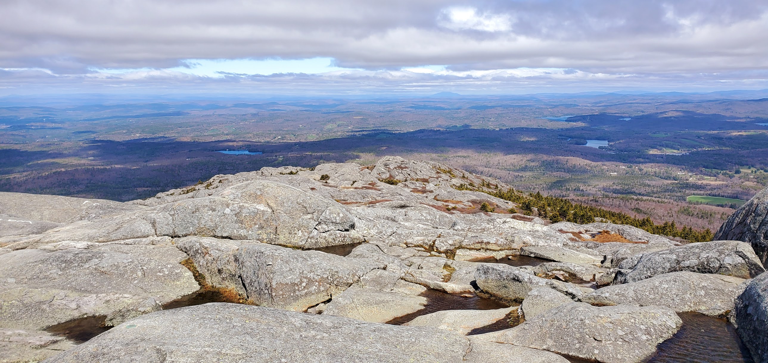
| first big viewpoint |
 |
| looking up at the summit |
 |
| it was sooooo windy and cold! |
 |
| looking back at summit from Red Spot Trail |
 |
| if you look carefully you can see Boston! |
 |
| North Pack and Pack Monadnock mountains |
 |
| going down... straight down |