I've had this area on my radar for a while, but the long drive is always a negative when selecting my destination. Today I decided to go for it. We have had some unseasonably hot days and I just wanted no snow/ice. I got a late start, and by the time I arrived at the trailhead on Gulf Road, the lot was almost full. I chatted with a couple ladies who I would encounter several more times throughout the day, and geared up, excitedly leaving all traction in the back of my car! What I should have had with me was bug spray. Note to self to repack that for next time. Starting out by crossing a marsh, a spur to the old ruins of Madame Sherri's castle is almost immediately on the right. I headed up and took some pictures. I would have loved to have seen the ruins before the staircase collapse, but it's still a neat area to explore. I headed back to the main trail and continued on the Ann Stokes Loop. At the intersection for the loop, I took a right towards Indian Pond wanting to get the steeper side out of the way first. Immediately it started a moderate climb up towards the pond. The leafless trees made the entire forest so light and bright. At the next intersection, I stayed right again onto Mine Ledge Trail. Very shortly after this intersection is a short spur to an overlook of Indian Pond. After this the climbing started in earnest. Thankfully alternating between quite steep and some flatter sections, the trail climbed up and through lots of mountain laurel, which must be spectacular when in bloom. The trail was well marked and really well maintained, I was loving it. Again, with the leafless trees, I could see all the surrounding views. I reached the Mine Ledge spur, which was my turnaround point. The guide says to use caution on this spur as it traverses the top of a cliff, so I was a bit worried it would be rather scary.. but I actually found it quite safe (but yes, I can see the need for concern especially with little ones or dogs) as it does drop right off. This was a great view over to Wantastiquet Mountain and beyond into Vermont. I encountered a couple here thinking they were on a loop back to the parking area. I let them know that in fact they were heading for Brattleboro and got them back on track before doubling back myself to Indian Pond. I continued around Ann Stokes Loop, which climbed up and over East Hill before meeting up with Daniels Mountain Loop Trail. I stayed on Ann Stokes Loop which took me back to the trailhead. Once over East Hill in the lower part of the trail was the only area where I really encountered any water or mud, but this seems to be a permanent fixture on the trail as there were plenty of well placed rocks for hopping across these areas. Maybe it was the bright sunshine, maybe it was the no snow.. but I found myself really enjoying this area.
Saturday, April 15, 2023
Saturday, April 8, 2023
Nottingcook Forest
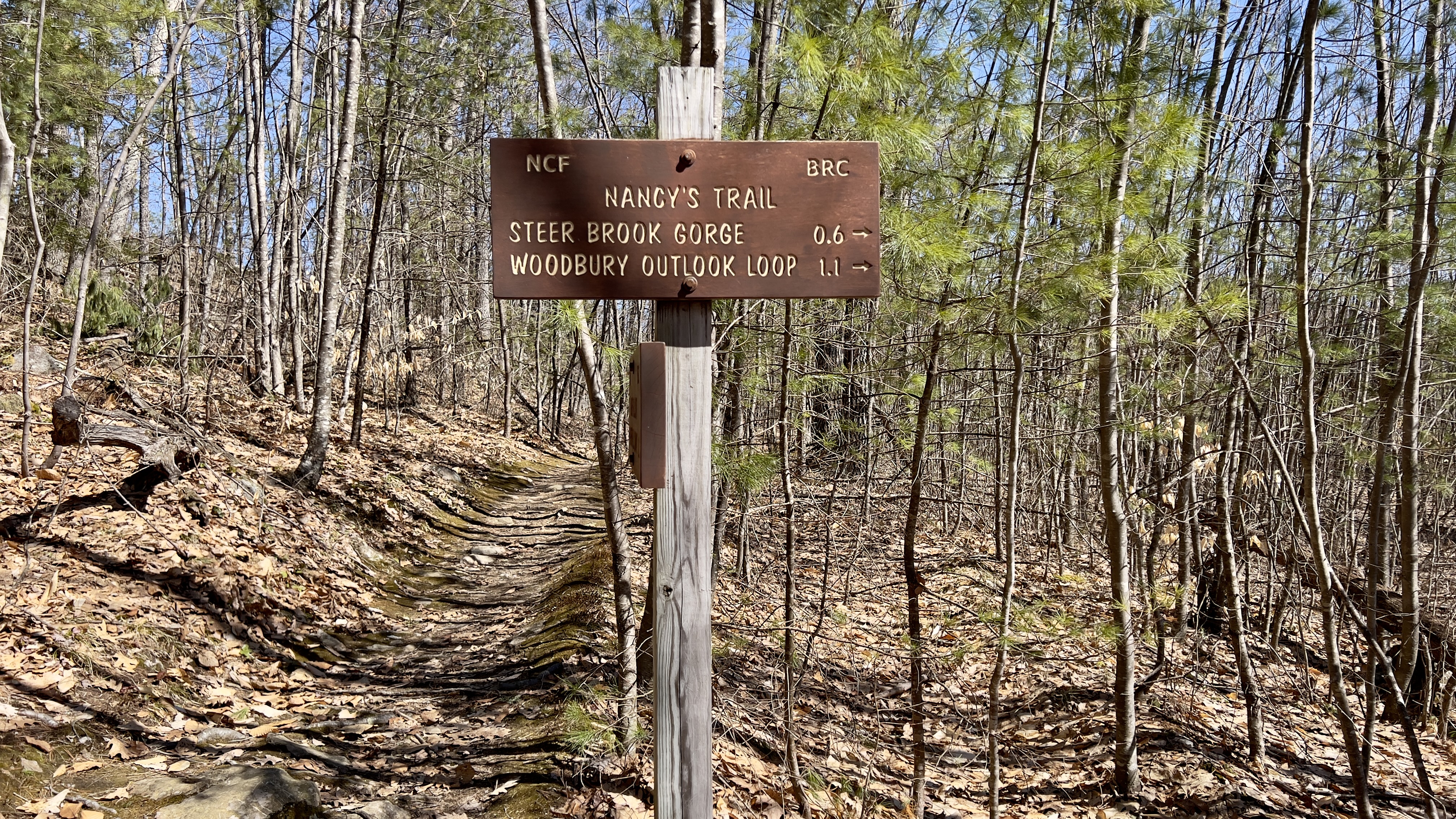
I've had in the back of my mind to add the remainder of the trails at Nottingcook Forest to my redlining spreadsheet for a while now. Although not described in detail, the forest is mentioned in reference to Great Hill, which I hiked with Cameron a couple of years ago. I've seen a few other of my redlining compadres doing the other trails, and having really had enough of the snow for now, I decided to go for it. I mapped out a route that would encompass all the trails I had left (besides the 3 on Great Hill already done) which would bring me to roughly 7 miles. It was a simply gorgeous day, but I was starting to feel under the weather, so my goal was to take it easy and see what I could do. I had options to bail if needed. I parked on Woodhill Hooksett Road at the kiosk and parking area, which is large enough for several cars. I was first car in, but the lot was full upon my return. I knew there was snow in the area, but I could see lots of bare trail, so I took a punt and left all my Winter traction in the car. I started on Sheridan's Way, which shortly crossed back over the Class VI section of Woodhill Hooksett Road. The trails were really well marked and nicely maintained. With the leaves off the trees still, it was very bright and airy feeling. I'm actually grateful for the good blazings as the forest was so open it often looked like trail when it wasn't.. after veering off a couple times, I always made sure I could see the next blaze from then on and continued with no issues. At the first intersection, I took Steer Brook Trail. This trail crossed over several snowmobile trails before reaching another intersection with a 65ft trail called Gorge Link Trail. I continued on Steer Brook Trail to the end and sort of did a figure 8, picking up Glacial Erratic Trail following that up to the top intersection with Nancy's Trail and did a short out and back on Nancy's Trail up to the Great Loop Trail intersection, where I had been a couple years ago. I took Nancy's Trail back to the Gorge Link Trail. Just before this intersection was a signed area that said Steer Brook Gorge. It was a mini gorge, but I'm sure is super pretty with a bit more water flow. I completed my figure 8 by finishing off Glacial Erratic Trail, then repeated a short section on Steer Brook Trail before jumping back on Nancy's Trail. I did an out and back on Crescent View Trail which went up to a cul-de-sac neighborhood in Bow. Back on Nancy's Trail, I followed to the second intersection with Upper Black Gum Trail to loop back around. Hidden Cave Trail was off this with a short hike up to a huge rock area with cave. I didn't get too close as I was getting tired, didn't want to fall and get hurt, plus I'm not really a cave fan, too scary! LOL I repeated the short section of Nancy's Trail and continued on to the second intersection with Woodbury Outlook Loop. This was the only real wet section with the blazes a little bit harder to see. I took Woodbury Outlook Loop and was surprised to find it was a real little climb up to this outlook. Steeper than I had been anticipating and at the end of my day, my legs were feeling it! At the top was a lovely outlook as the name suggests. Passing Duck Bill Ledge I made it back to Nancy's Trail and continued onto Wolfe Cascade Brook Trail, which was lovely following a meandering brook with lots of little cascades. I passed Buffalo Rock, which is on the NH 25 Rocks that Rock list! Instead of taking Sheridan's Way back, I continued straight on a little connector, which was the snowiest portion of the entire day and a little hard to follow but thankfully short and met up with Woodhill Hooksett Road which I took back to the car. There were some flooded sections along the road, but I was mostly able to skooch around the sides. So while nothing overly scenic, a really, really beautiful area with well marked trails and the best part for me at this time of year.. no bugs and no snow/ice!
![]() |
| rarely seen Sock Tree |
![]() |
| top end of Crescent View Trail at the cul-de-sac |
![]() |
| along Woodbury Outlook Loop |
![]() |
| view from Woodbury Outlook Loop |
![]() |
| view from Woodbury Outlook Loop |
![]() |
| Wolfe Cascade Brook Trail |
![]() |
| walking back along Woodhill Hooksett Rd, Class VI section |
Sunday, April 2, 2023
Fox State Forest - Part 5
I called an audible mid commute to my hike today. Had been heading for something else and decided to do Fox State Forest instead. I have 2 planned hikes left of the area and felt like knocking one of them off today. Was hoping with some warmer temps that some of the snow may have melted. Knowing that several trails on the West Side have been closed for logging, I had spied a gate on Center Road at St Marys Cemetery that was at an intersection of Proctor Road and Hurricane Road in the forest. This spot was along my intended hike, so I hoped parking here might be an option. When I arrived I actually found 2 gates, one for each road, no signs saying no parking, just not to block the gates.. there was a large enough area, I could park safely without blocking anything. I thought to myself, I'm going to leave my snowshoes behind, which means I'll need them... isn't that always the way?! It also turned out to be somewhat true. I started out on Hurricane Road, heading back to Ledges Trail. It was a mess. Debris, snow, ice, a few bare patches.. I figured if it continued like this, I would cut it short and come back another day.. as it turns out, the deeper into the park I got, the less snowy it became.. I turned onto Ledges Trail and this was where I encountered some of the deepest snow of the day. Some knee deep snow was still on this section, making my going slow. In what felt like hours, I made it to Ridge Trail and headed down to Swamp Trail, where I needed to grab the section over to White Cross Trail. This passed by Black Gum Swamp, which was marked with a sign. Doubling back to Ridge Trail, I continued on to Chestnut Corner Road and took a right onto White Tail Pass. It was here the snow finally started letting up and I decided to continue on my intended route instead of cutting it short. Harvey Road was a real mess with trees down, thankfully I only needed the short section to Proctor Road. Proctor Road was snowy and wet. Back at the intersection with Ridge Trail and just about a tenth of a mile from my car, I contemplated finishing up, grabbing snowshoes or just continuing. Looking down Ridge Trail it looked less snowy, so I just said to myself "I'm here, let's do it" the trail descended down to a very wet, flooded area which took some careful navigation to try and keep my feet dry. Then it gently ascended and was well packed down. At the area where a side trail heads into a neighborhood and towards Hillsboro-Deering HS is where the well traveled path ended, and from here back to Harvey Road on Ridge Trail was snowy again, and slushy as the temps started to warm up. Back on Harvey Road, I followed to Proctor Road again and retracted my steps back to the car. Overall, it wasn't a super fun day.. as has been my trend at Fox Forest, I keep choosing days with less than ideal conditions! But I was outside, the weather was nice and I saw no one! One more hike left at Fox Forest!
![]() |
| Gates where I parked |
![]() |
| Harvey Road was a mess |