Saturday, March 28, 2020

Mine Hill & Jeremy Hill

The weekly airing of the teenagers resulted in two fairly short but pleasant walks to reach two more sites on the NH Fire Tower list. First we hit up Mine Hill in Auburn, NH. There is a small area to park alongside Lake Massabesic on Rt 121 (Chester Road) in Auburn, directly across from Fire Road 42, which is the access road taken for this fire tower. I had printed out another description, which I'm glad I did, and even still we managed to get off course briefly. Very quickly after beginning this walk you will encounter an open area. Stay to the right and follow the old access road. You will come to what I'll call a Y intersection that at the time we walked had a small log in the middle and some pink flagging tape on a tree just to the right of the intersection. We headed down this way and encountered a firepit and thankfully friendly homeowner who redirected us in the correct direction. Therefore, once you reach this intersection, keep left and continue uphill. Shortly after you will encounter another intersection, this time with Private Property signs clearly marked ahead. Keep to the right at this one and head uphill to the end of the old access road. There is a very old, very mossy wooden staircase that leads up a steep, short incline. Here you will see a private residence "uncomfortably close" as I had read. Even knowing ahead of time the house would be there, I was taken aback at how "uncomfortably close" it actually was. Clearly marked however where their property line is, it's easy to stay on the public side and make your way to the summit and cement fire tower footings. Some peekaboo views out to Lake Massabesic is about all there is to see up here.

My Strava app recorded some wacky tracks today on both walks, but I'll post for posterity. I'm one of those "if you don't record it, it didn't happen" people!

Strava Activity
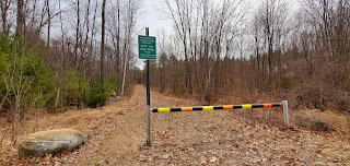


the gate we started/ended

Lake Massabesic


Then we headed over to Jeremy Hill in Pelham. Again, I'm glad I printed out directions, and we still managed to start down the wrong trail! Park in the cul de sac at the very end of Jeremy Hill Road. There is an obvious place to pull off to the right of the circle, that is clear of all driveways. Do not head down the unmarked chained path to the left of the circle, instead look to your right and you will see an actual gated pathway a little ways behind some brush. This is the pathway you want to take. A private pond will be to your left. Head in a little ways and take a left into Jeremy Hill State Forest and up to the summit. There is a lollipop loop around the actual summit which again has some cement footings from the previously standing fire tower. No views or anything exciting to see, but it was a nice stroll (once we found the right way) and we are able to check off 2 more fire towers on the list.

Again, Strava recorded some whacked out pathways for us, which we didn't take, but in there somewhere is the actual path taken.

Strava Activity


This is the incorrect pathway to take...

This is the correct pathway hidden behind some brush


No comments:

Post a Comment