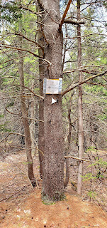
I've vaguely been looking at New Hampshire town high points as a new list to kind of work on while the quarantine lockdown has prevented earning credit from any of the lists maintained by the Grid. So, today found me in Hancock and heading up Skatutakee Mountain, the high point. While researching the trails to this summit, I found out the Harris Center for Conservation encompasses two mountains with a trail linking the two to create a loop, so this was my plan. The neighborhood the Harris Center is in is really pretty and I found the location easily and pulled into the parking lot. Two cars were already there, but I saw noone on my ascent, so they both must have taken the loop also and were way ahead of me. I got myself together and headed for the Harriskat Trailhead which is in front of the Harris Center. The trail crosses Kings Highway (which is actually a very lightly trafficked dirt road) and headed into the woods. I had read ahead of time that this trail is very moderate and you don't even feel like you're climbing. I'm always skeptical of descriptions like that knowing my own abilities and effort required. In this case, it was accurate. After 0.6 miles from Kings Highway you encounter the intersection with Thumbs Down trail, which would be my descent route. The trail after this point really gently meanders up the mountain, lots of twists and turns, roots and rocks, but nothing major as far as effort is required. The grade does steepen a little right before the summit, but again nothing crazy and before you know it, you're at the summit! The summit has a large cairn and a large meadow with lots of brush and rocks to take a rest. The view is OK, but is mildly obstructed by the tops of surrounding trees. My nemesis this hike was mosquitoes. They were brutal and despite dousing myself with bug juice and wearing long sleeves and pants, I am absolutely covered in bites from head to toe. I had hoped for a reprieve at the summit, alas it was not to be, so I didn't linger. I passed several parties on my descent, and was amazed at my timing yet again! Thumbs Up trail is the trail off Skatutakee towards Thumb Mountain. The trail starts off with a steep little descent then was a relaxing woods walk between the two mountains that was relatively flat. About a mile from the Skatutakee summit, you reach the intersection with Thumbs Down trail, which I'd take after a quick out and back to Thumb Mountain summit. The start of the out and back was a steep little climb before easing off and heading a little ways further to the summit. A great bench/cairn set up is at the summit. The trail continues a few hundred yards to a rock ledge clearing with another large cairn and incredible view to Mt Monadnock, the Wapack Range and back over to Skatutakee Mountain. Due to the mosquito situation, I very briefly stopped here before heading back to Thumbs Down trail which passes a pretty pond before rejoining Harriskat Trail and back to the car.
Strava Activity


No comments:
Post a Comment