Saturday, January 30, 2021

Oak Hill

Another super cold but bluebird day. I think it was even colder this weekend than last, but the sun was shining! I headed to Concord, NH and the Oak Hill trail network. I have been to Oak Hill once before several years ago with my boys on our Fire Tower Quest. That day we did the Tower Trail from Shaker Road with a detour via Dancing Bear Trail on our return. Today I planned on cleaning up the rest of the network besides the actual road access trail which does not connect to any of the trails I was on today. I parked on Oak Hill Road at the Luti Loop trailhead which has room for 3 cars if parked cleanly. I was first one in this morning. I geared up and headed out. There was snow on the ground, but I was able to bare boot the entire hike without any issues. Any ice was avoidable and the snow was hard packed and maybe 2 inches deep at most with plenty of bare ground in between. I carried my spikes with me, but never needed to use them. I headed up Luti Loop to Winn's Way and a pretty scenic vista with benches and a sign showing the mountains out on the horizon. I then worked my way down Visa Way Trail to Shaker Road, across the Lower Trail to Tower Trail, back across Ledges Pass to Vista Way and the scenic vista again. It was here I saw 2 of the 3 people of the day. I wasn't the only one braving the frigid temps! I then took Upper Trail back to Tower Trail. Dancing Bear Trail was the snowiest/iciest portion of the day, but I was still able to bare boot without any issues. I stopped at the cleared viewpoint on Swope Slope until I started to actually feel the cold! I did all of Krupa Loop with an out and back on Ron's Way. As I saw the fire tower come into view, I contemplated going up to it, but decided against it as I was starting to get tired and knew I still had a couple miles left. Krupa Loop was also the prettiest part of the day. All the trails were well maintained and easy to follow. Krupa Loop was a little more "rugged" (I use the term lightly as it's not really rugged at all, just the most technical of all the trails I did) and the light was so pretty as I passed through. I am definitely enjoying Winter hiking with the contrasts of light and snow and the greenery that survives through Winter! Back to Tower Trail and this time I took Potter Ridge Trail, which was the only unmarked trail of the day. It was blazed, but there was no sign at the beginning to indicate which trail it was. I had my peakbagger app and a copy of the trail network screenshot on my phone, so I knew I was going the right way. This was also where I saw the 3rd person of the day, a trail runner zoomed past me as I was taking the intersection. Potters Ridge Trail took me back to Winn's Way with an out and back on Terry's Turn. I'm listing everything here in case anyone trips across my blog and is interested in doing the same thing I did with redlining! I have used other people's trip reports when planning a big coverage day, so I want to be helpful too! From Winn's Way, I doubled back and took Ovenbird Scuttle down to Murray Bluff and headed back up. Ironically the very last trail of the day had the "steepest" climb which I think felt much steeper after 7 miles and 4 hours! I came to a point where the blazes went in 2 different directions and I noticed an old sign that said "Original Murray Bluff Trail - Over the Bluff".. I wondered where that headed but stayed on the path that I thought was the official path as I didn't want to get lost. After a small ways I looked on my peakbagger app and realized I wasn't tracking on an official trail anymore, so the section I was on must be new and was built to go around the super steep climb of Murray Bluff. I figured if I could see where the top of the "Original Murray Bluff Trail" came up, I would take that back down. Sure enough, not far down the trail I saw the other end with a sign much the same as the bottom. I continued back to Potter Ridge Trail to finish that section and then when I doubled back took the "Over the Bluff Trail". I'm actually glad I went down instead of up, it was very steep (for a very short section) and I would have been super gassed climbing up that being already tired! I was a bit concerned coming down that it would be icy as there were a couple of almost straight down sections, but thankfully it was almost bare ground. I was aware that there was some ice hiding under the leaves, but was able to get down without even sliding once! Fun little section and I can see why they built a bypass option! Back to Ovenbird Scuttle and Luti Loop and there was the car. 8 miles total and 4.5 hours elapsed time. We are so blessed with so many amazing trail networks in New Hampshire. It has been so fun exploring somewhere different each weekend!


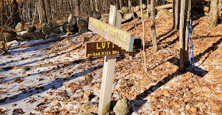
Luti Loop Trailhead on Oak Hill Rd


Scenic vista at the end of Winn's Way along Vista Way


Map mailbox at the Shaker Rd trailhead of Vista Way


Thinking of making a coffee table book about benches in the wild

Swope Slop vista

zoomed in view at Swope Slope Vista


interesting.. at the intersection of Ron's Way and Krupa Loop


The top end of the "Over the Bluff" trail along Murray Bluff Trail


Saturday, January 23, 2021

Wapack Trail

 After a few weekends of "flat" hiking, I decided to tackle another mountain... or 4. I headed south to avoid the deeper snow areas and settled on a small section of the Wapack Trail in New Ipswich. The Wapack Trail is 21.9 miles long in total, stretching from Mt Watatic in MA to North Pack Monadnock. I opted for a 4.5 mile section in the middle. I parked opposite the former Windblown XC Ski Centre in the Wapack parking designated area. I had read strict instructions prior about not parking at Windblown, even though the Ski Centre is now closed, it appears there are still campsites and the area is clearly signed for no hiker parking. As I arrived at the parking, 2 other gentlemen were just finishing gearing up and headed out. I would leapfrog them a couple times throughout the day and ended up having a nice conversation at my turnaround point. They were continuing on with a car spot a little further down the trail. It was frigidly cold today, with wind chills in the single digits. I hoped I dressed appropriately and headed out. Turns out I didn't feel the cold much at all, so my layers were good. The weather probably kept most people off the trails as besides the 2 guys, I only saw 1 other man near my turnaround point and a couple heading up as I was finishing. Quiet, beautiful day on the trails. The gusty winds made it crystal clear and I had bluebird skies and sun all day. I had filled my pack with water as I've been testing the freeze point. It froze almost immediately, so it seems I'm OK to about 25°F. Thankfully I had my new Nalgene bottle and insulated case that I got for Christmas, so I was ready! The trail from this point starts out up the Windblown driveway then turns onto one of the outer trails from the old cross country network. This trail was a little uneven with frozen snow and ice. It appeared it had received traffic with people just wearing boots when the snow was soft, so when it froze, it made it an uneven surface to walk on. I had microspikes on the entire day, so it was OK as far as traction, I just had to be careful as I rolled my ankles a few times in boot marks.. the trail starts off descending (which is always a bummer on the return) and then climbs up to the summit of Barrett Mountain. The Windblown property boundary is just before the summit where there are signs indicating shelters and camping with permission. The summit is wooded, but was pretty with sunlight shining through the trees. Once up on the ridge, the trail became less icy and more solid hard packed snow, less ankle rolling. I continued on to New Ipswich Mountain, which was just over a mile from the summit of Barrett. There is a gorgeous outlook just below the summit over to Mt Monadnock, the first of many in that direction. The summit of New Ipswich is also wooded, currently marked with a cute little snowman. This is also the high point of the town of New Ipswich! Next up was Stony Top and finally (for me) onto Pratt Mountain. After New Ipswich, the woods clear and the views open up on both sides. It's a really, really pretty walk. Pratt Mountain summit is also wooded. I decided to make this my turnaround point at 4.5 miles one way. The climbs up to each summit were enough to get the heart rate up, but nothing really crazy. I would imagine many hikers create a traverse with a car spot, like the 2 gentlemen I passed today. Really great trail for that sort of hike with enough opportunities for parking to make the hike as long or as short as you'd like. I look forward to exploring the remaining 17 miles!

Strava Activity

Pictures uploaded in reverse

New Ipswich Mt summit

between Pratt and Stony Top

looking at Monadnock from just below Pratt summit

Pratt Mt summit


looking at Stony Top and Pratt from New Ipswich


Barrett Mt summit


Sunday, January 17, 2021

Beaver Brook Association - Southern Trails

 We had terrible weather yesterday, so I took the opportunity to begin de-Christmassing my house.. one of my least favorite things to do :( Sunday was clear and I was ready to get back out on the trails. I'm on limited time on Sunday's for the moment, so when deciding where to go I had to factor time as well as conditions. I didn't really want to break trail, so I kept the elevation low and flat, and south where we got little to no snow.. back to Beaver Brook I went. This time to start tackling the southern trail network. There are a lot of trails on the southern side of Beaver Brook, and it was a little overwhelming trying to come up with a way of not having to double over too many places. I parked at the Brown Barn on Brown Lane where several trails begin, and headed out on a loop-de-loop of a couple different areas. I began on Love Lane Trail which basically is a Class VI road that connects Brown Lane to Love Lane, I then took Howe Meadow Trail to Ridge Road, back to Howe Kibby Connector and onto Kibbys Climb back to the car. I found the trails pretty much bare. There was some standing water, dampness, ice in some places, but all easily avoidable. I was able to make good time and enjoyed the trails. Much like the northern side, there isn't really anything to see, just the serenity of being out in the woods on a well maintained network. I really liked Kibbys Climb, it ascended a little baby ridge which was narrowish, it was fun being able to see down both sides while cruising across the top. This brought me back to the car and I actually had to layer down. While it was brisk and windy, I couldn't feel the wind amongst the trees and got too hot. From here I headed for Red Pine Trail, but ended up on Brown Lane Trail. I hadn't realized Red Pine Trail started in the middle of the woods. I reached Cow Lane and turned onto Campsite Trail. Red Pine Trail met up with Campsite Trail, so I was able to do an out and back to complete that. It was a steep little incline, but very short. Many of these trails are all 0.5 mile or less, so out and backs aren't too bad. There is a cabin and huge firepit at the end of Campsite Trail. I went back to the intersection with Brown Lane Trail and continued straight on Cow Lane. This was probably the area I encountered the most ice, but it was still easily avoidable. I turned onto Maple Leaf Trail, then Leatherwood Trail, which was the prettiest trail of the day. It followed a brook with a little cascade area, where I surprisingly found 2 chairs that one could sit and enjoy the waterfalls on! Back on Cow Lane and I doubled back this time taking the Self Guided Nature Trail, which climbed up a short, steep incline back to the Brown Barn. I took Brown Lane Trail again back to Cow Lane and this time followed the second half of the Self Guided Nature Trail, which crisscrosses Cow Lane several times. There are many little numbered plaques, which correspond to a separate guide/map of a variety of species of plants. Being Winter, everything was hibernating for now. I'm sure in the Spring/Summer, it's a pretty trail to follow and explore if you're into that kind of thing. This was also the only trail I had some trouble following. In some areas the blazes are sparse and the footbed wasn't always obvious. I used the little numbered plaques when needed to keep me on track. Once back on Cow Lane, I followed it to Wigwam Trail and took that back to Teepee Trail. Did a couple of very short out and backs to fill in some blanks where I had missed earlier along the way, ending up in an open field and back at the Brown Barn. I called it a day here, although I could have kept going. I was happy with the progress I made starting out on this side of the park and look forward to coming back and exploring more! One note, if you're planning on hiking here, I would highly recommend having a paper map with you and potentially an online app with map as well. I primarily used the paper map, but confirmed I was where I thought I was on the Peakbagger app. This particular area has trails all over the place and it can get very confusing where you are at any given time without a map!

Strava Activity

Brown Lane Barn parking. Trails off in all directions.


End of Campsite Trail


Along Leatherwood Trail


Sunday, January 10, 2021

Beaver Brook Association

 Double header weekend at the same place. My initial attempt at getting all the trails on Saturday fell a little short, which ended up a blessing. I have been to the Beaver Brook Association several times for snowshoe races and one trail race.. but all were several years ago, and on the southern side of the trail network. Beaver Brook is broken into 2 sections, that I've dubbed the Northern and Southern side of Rt 130 in Hollis. I had never been to the northern side and was very pleasantly surprised at how wonderful these trails are. Considering there are no real scenic landmarks, it's just a really well laid out trail network. Well marked, well maintained and just a really pretty natural area. I do feel like some of the areas in the Spring and Summer may become a little overgrown and messy with mud, but I lucked out with weather and conditions this weekend. There was a mixture of snow/ice and bare ground. I kept microspikes on for almost the entire hike. It was easier than taking them off and on. Most of the bare ground involved soft leaves or pine needles so I didn't think it would damage the spikes too badly.. and when I needed them, I was grateful to have them. The icy areas were just that. I had remembered reading another hikers trip report about redlining the entire area in 3 hikes, so I tracked down his old report and basically followed his steps as far as which trails to take in which order. I had been a little overwhelmed trying to figure it out prior to that, so I was thankful to just see where he went and follow suit. Turned out to be a great route. I started at the parking area on Rt 130 at the Dam Road/Wildlife Pond Loop trailhead, 2 trails head off in different directions. I headed down Dam Road then turned onto Jeff Smith Trail and headed into the woods. This was a gorgeous start to my hike. The trail follows a brook most of the way, which was just beautiful. I found there was a lot of greenery still in the area, I don't know vegetation, so I don't know what it was, but the contrast of the green with the snow on the ground and the morning sun shining through the bare trees.. just put me at peace. I followed Jeff Smith Trail all the way to the road, then backtracked to Wood Duck Pond Trail and Tupelo Trail. It wasn't until almost the end of Tupelo Trail that I finally saw some people. I turned onto Old City Trail and followed that to Rocky Pond Road where I was surprised with a lovely waterfall right alongside the trail. Old City Trail was really the only super messy trail the whole day. Some areas were icy and muddy and yuck. The spikes were essential here. From here I turned onto Hatfield Trail West and followed that to the end, where there is a spur to an overlook of Merganser Pond. I stopped here for a snack. I continued back out to Rocky Pond Road and followed Whaleback Road which ended in a residential neighborhood. Back to Hatfield Trail East which looped around. I did an out and back on Hidden Pond Trail, including the spur to the Whaleback Overlook. The rock formation is supposedly reminiscent of an old whale! I could sort of see where they were coming from. It was here that I knew I was getting tired. I had a couple of options and figured I'd continue until the time I'd have to make a decision. Just before that time I encountered another little waterfall area, dubbed The Falls, which was another very pretty surprise! I reached Old City Trail again, which was my "bail" point for Saturday if I decided to do so. It was getting overcast, I was feeling some blisters developing and I just wasn't feeling it anymore. I knew I could have pushed through and done it, but figured I'd come back and enjoy it more on fresh legs. I didn't realize at that time it would be the very next day... it really wasn't until I woke up on Sunday morning that I made the decision to go back and clean up what I missed the day before. What a blessing that turned out to be. I was feeling fresh, the sun was shining and when I got back to my "bail" point on Old City Trail at Rocky Ridge Trail and headed off, I realized I had absolutely made the right decision. Rocky Ridge Trail was just tricky enough that I would have been crying yesterday. A couple very short, but steep up and downs over some glacial erratic's on my tired legs yesterday would not have been fun. Today, I loved it. There were just a couple spots I had to sit and slide down, due to my shortness, but I made it without incident. Rocky Ridge Trail is short at 0.6 miles, but I really cannot stress how grateful I was to be doing it today. I finished out the northern section of trails on the Wildlife Pond Loop trail, which was the complete opposite of Rocky Ridge Trail.. a relatively flat loop around a giant pond, that is frozen right now, but I imagine lives up to its name of "wildlife" in the Spring and Summer! Overall, I ended up with just over 14 miles of hiking and 10 new trails checked off my redlining spreadsheet! I hope the southern side is as pleasant and look forward to exploring there sometime soon. 

Strava Activity Saturday                                                                                Strava Activity Sundayl


Along Jeff Smith Trail

Along Jeff Smith Trail

Jeff Smith Trail at Rt 130


Intersection of Wood Duck Pond Trail and Tupelo Trail


kiosk on Old City Trail at Rocky Pond Road

Historical site of Worcester Mill

along Old City Trail near the old mill site


thankful it says "Old"

snack stop


being Winter I could see the "Whaleback" overlook from below


not sure what this was overlooking, but the tree is cool!

the "Whaleback" from above


Rocky Ridge Trail living up to its name