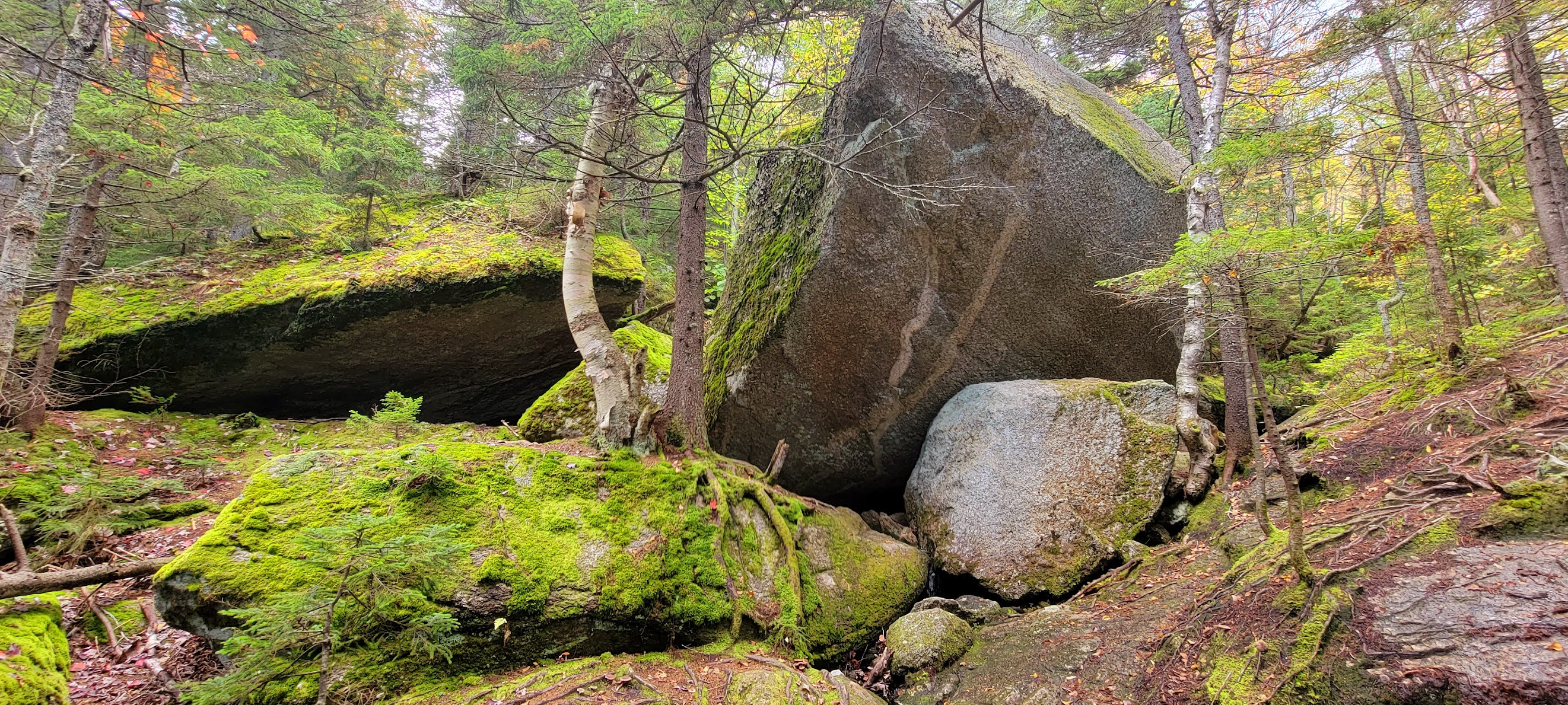
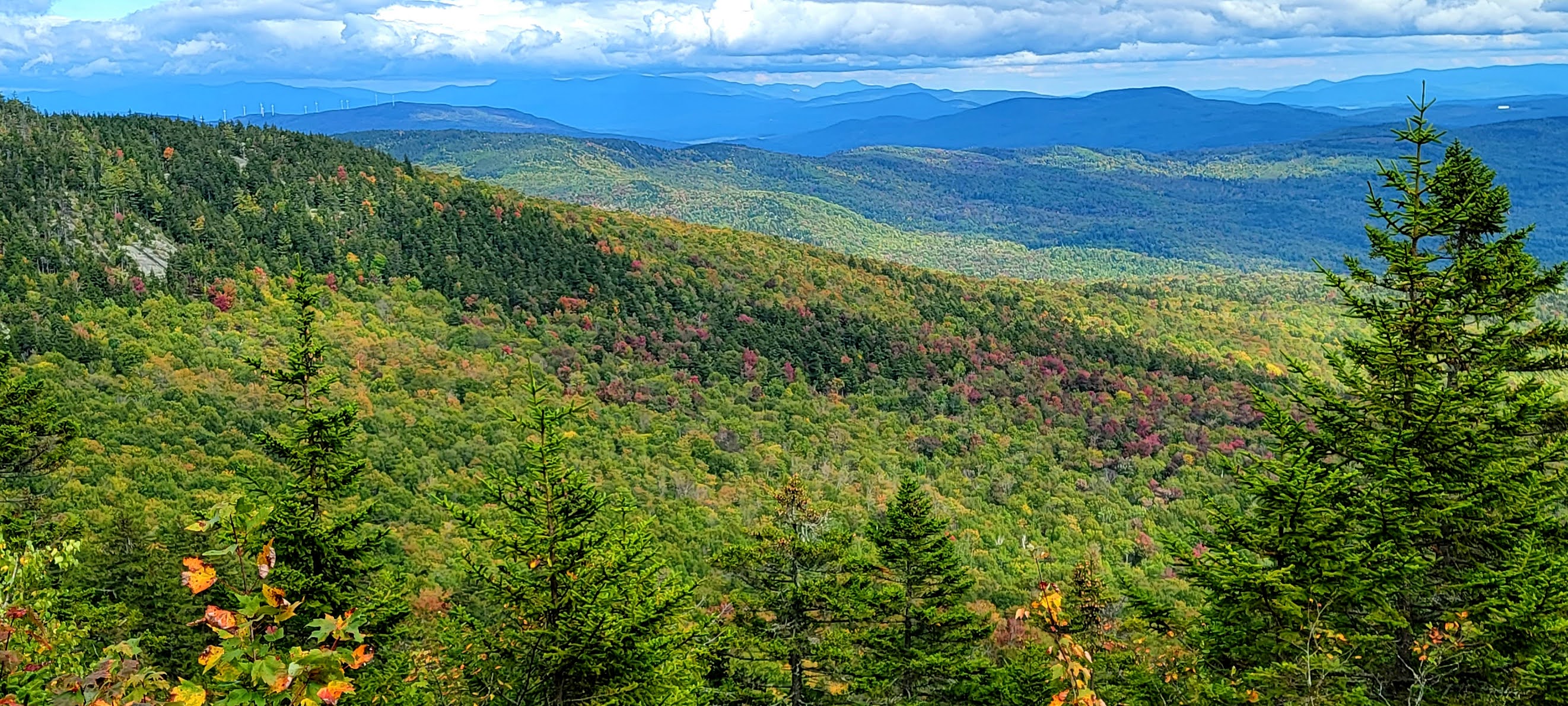
Today's lesson was that sometimes things don't go according to plan, and that's OK. I arrived at the AMC Lodge in Alexandria to find the last spot just taken and half the parking area closed due to a wedding event. There was signage all over indicating parking on the road was prohibited, so after a couple times circling around wondering what to do, I pulled out my phone to create a Plan B. I know there are lots of trails in this area. I saw that Clark Trail, which I had planned to partially descend on, continued to a side street not far from where I was, so I decided to investigate and see if parking was available. Following the map, the side street turned out to be an unmaintained class VI road, which I was thankfully able to carefully navigate down. There was a house at the end of the drivable portion with a car parked, but no signs indicating private property or no parking. Across from the house was a small cleared area with space for 2 cars. There was already another car there, so I took the chance and parked hoping my car would still be there when I returned (spoiler alert - it was). I geared up and headed down the road, which was a continuation of the class VI road, though much rougher than the portion I had driven down and was almost immediately met with concrete barricades and a sign saying "Bridge Closed".. I noticed a wooden footbridge over the brook and started to cross, but not far in chickened out as it felt too wobbly and had no rails to hold on to for balance. Although the water was flowing at a decent pace, I carefully made my way across the mossy rocks without getting my feet wet and wondered if this was how the day was going to continue. I came to Woodland Trail and took a right. This trail, though lightly used was a pleasant wander through the woods and before too long I was back at the AMC Lodge and my original starting point. Here I picked up Manning Trail which begins as a road passing several campsites before turning off onto an actual hiking trail. The trail crosses several cross country ski trails, which are restricted for hikers and climbs moderately. Eventually the trail starts to hit a rock slab area, and somehow I ended up off course. I figured it out relatively quickly, but was a bit confused as there were random cairns around, but nothing seemingly leading anywhere. I could see the trail on my phone tracker and tried to make my way to it, but ended up in rather thick woods that were very mossy and started getting steep.. so I turned around and tried to backtrack the way I had come to figure out where I had gone wrong. Eventually I heard voices and tried to head in that direction and after what seemed like forever, I finally saw a blaze and was back on track. *phew*. It made me realize the importance of being prepared for any situation! The trail from here started to get quite technical and steep, with some wet rock making it interesting. I was able to use trees and roots in the steeper parts and when I hit the steep rock slab even my hands and knees came into play. Behind me the views opened up and it was so beautiful. The wind also picked up, so I put on my jacket and continued climbing. The Firescrew summit was marked with a small cairn and incredible vista, especially over to Cardigan Mountain, which looked so far away! Having previously done that section with my kids several years ago, I knew it wasn't too bad. I stopped for a brief snack and continued on to pick up Mowgli's Trail. The ridge walk with open views all around is just gorgeous. I had to keep stopping and taking it all in. A quick drop back into some woods and then more super steep slab up to the Cardigan summit. I kept thinking back to doing this with my kids and how young they were. I don't remember feeling panicked with them, but I'm sure I was. It is really steep. I also kept thinking about the Holt Trail up to Cardigan, and if this trail was as scary and steep as it was, what was that like? If I'm ever going to complete redlining, I will have to tackle that beast at some point.. for now, I just tried to focus on the trail I was actually on. Way quicker than I had anticipated the firetower was in front of me and I was on the summit. There were a few people around, but I think the overcast skies had kept lots of people away. It was very windy, almost hard to stand windy! Some pictures and videos and I headed for Clark Trail. Another really steep section of slab, I was grateful for the grippy rock and the winds dying down as I slowly made my way off the cone. This reminded me of North Percy which I did about a year ago. I reached the Fire Warden's cabin and continued down Clark Trail. It was steep, but not exposed which made it a little less scary. The rock was wet in a lot of places, so my main concern was not slipping and hurting myself. There was a lot of mud in places too. At the intersection with Hurricane Gap Trail, a little wooden bench with wonderful views appeared. From here it was more wet climbing down mixed with mossy rocks now. All of a sudden the trail seemed to ease and became like a walk in the park compared to the steep sections above. I continued on Clark Trail when other trails turned off and was able to make some really good time back to the car. This time at the wooden footbridge I decided to go for it and walked/basically ran across the bridge and made it without incident. Fall has arrived and although I'm not ready, it's nice to hike without the bugs!


No comments:
Post a Comment