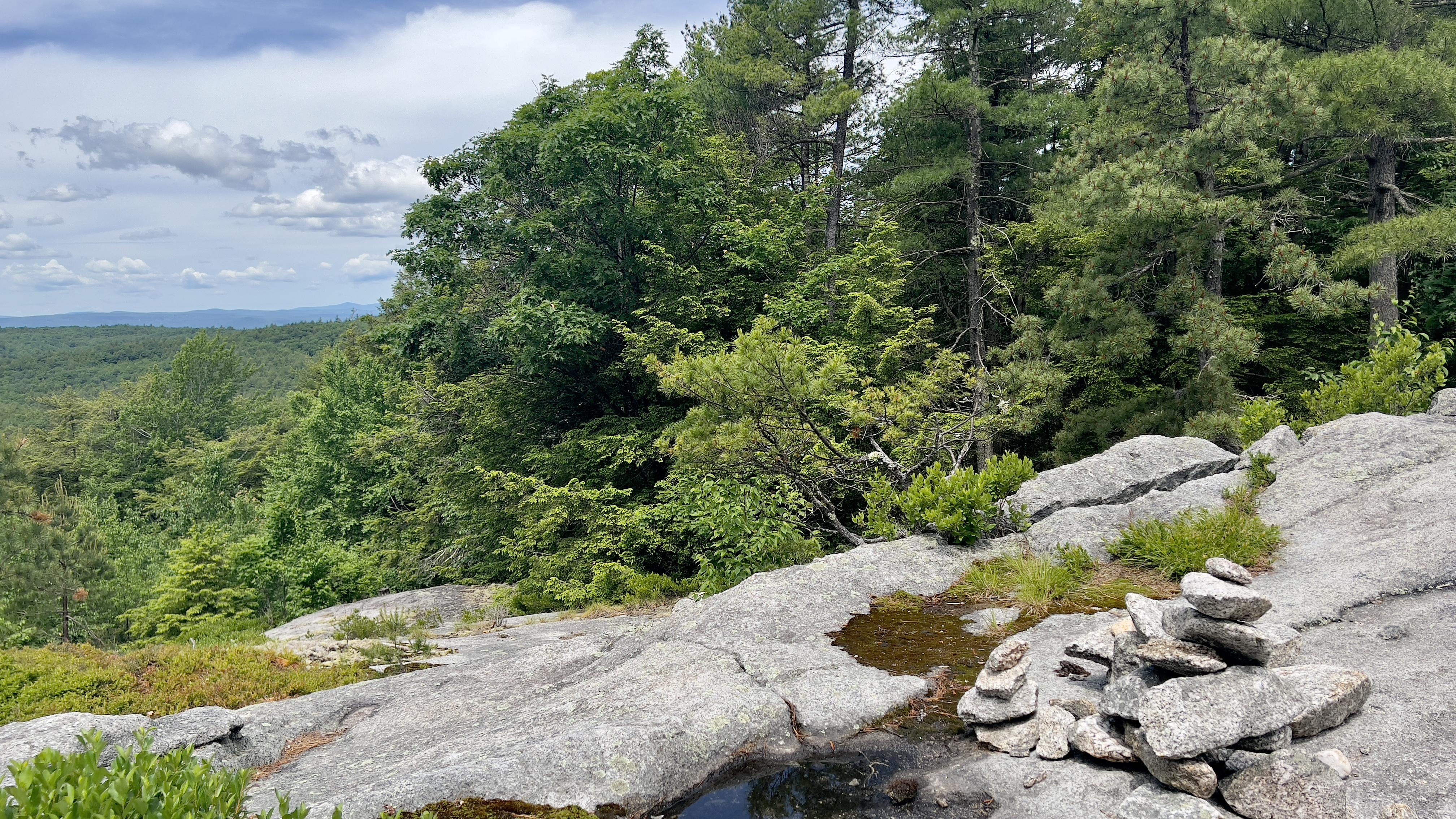
My schedule over the Summer this year is pretty full with family commitments. I'm super excited to do those activities, but bummed it means I won't be able to get out much. With one more day open before the madness begins, I wanted to go out big. I haven't done a "big" hike since December and that still wasn't even over 1000ft in elevation gain.. it had been since mid-Fall since I had done anything over 2000ft in gain.. I was ready. It was a bluebird day, so Vanessa and I headed for Middle Sister in Albany. The middle peak of the "Three Sisters" alongside Mt Chocorua. We opted for Champney Falls Trail off the Kancamagus Highway. Knowing this is a popular route, we headed up early and were the 5th car in the lot at 8am. The lot was full and overflowing on our return. We geared up, it had been unseasonably cool over the weekend, but was pleasant today. One of those "pack everything just in case" hikes. Champney Falls Trail is meticulously maintained and overall, the first 2 miles or so has easy footing. There are a couple of water crossings that were easily rock hopped today. At about 1.4 miles, we reached the intersection where you can take a left and head for the falls. We opted to do this on our way up as we knew we'd be tired on our descent. Turned out to be a great decision as we had the area to ourselves, whereas we passed lots of families and folks heading for the falls as we came down. There are 2 "bigger" falls, the first is right off the trail with some careful rock hopping to get a head on view. Continue carefully across the water and you end up in a gorge type cavern! It was stunning! I have seen pictures of people ice climbing here in Winter, today the flow was gentle, but with the lack of people around it was just beautiful. We could have stood there forever just enjoying the feeling of being in the middle of nowhere. Knowing we had all the climbing ahead of us, we continued on. Beyond the falls is where it starts to get much steeper, though the trail consists of lots and lots of rock steps (sometimes this is good, and sometimes for those of us vertically challenged, it's quad crushing!) As the trail continues to climb, the "easy footing" turns into boulder hopping and switchbacks up to the intersection that leads right to Chocorua and left to Middle Sister. We happily went left as most folks were heading right. Champney Falls Cutoff is a wonderful 0.3 or so miles that traverses the slopes of First Sister and about 3/4 of the way across the views open up and are incredible. Even though we knew there were 360 degree views on the summit, we couldn't help but stop for a long break and take alll the pictures! We also met David and Moose, a fan favourite on the many Facebook hiking pages for NH. I was super stoked to meet someone from FB that I actually recognized (well, Moose I recognized, David never shows himself in pictures! LOL). Energized we continued on. About 0.1 miles below the summit, we met up with Middle Sister Trail and made the final climb up to the fire tower remains and the most amazing views. I've been on Chocorua twice and while the views are mostly the same, the fact that this summit is so much quieter just makes it magical. We did encounter 3 groups while we took an extended lunch break, but they were all passing over on their way up or down from Chocorua. It was perfect. Initially we were going to head over First Sister on our way back down, but after seeing the climb up, and knowing the views wouldn't really be any different than where we had just been, we opted to do a straight out and back and headed back down Champney Falls Cutoff. We encountered lots of people heading up as were heading down. Some seemed unprepared for the type of hike this is, I think sometimes when you read something on paper, it doesn't always translate to reality if you're not used to hiking. We even turned a group of ladies around, that had been heading for the falls as they had no water with them and one was carrying a designer purse. Another family were all wearing flip flops and sandals. People see "1.4 miles to the falls" and think, oh that's easy.. and while yes, the trail is definitely on the easier side compared to other trails in the area, it's still a muddy, rooty, rocky trail! Overall, a truly amazing day!