With heat still ever present and my fitness not back to where it had been, I opted for 3 smaller hikes on my redlining spreadsheet, rather than 1 big one.. that way I could rest in between and enjoy the air conditioning in my car! I started with Honey Hill in Swanzey. There is a small parking area with signs. The hike begins by crossing a field behind the parking area, between 2 private residences and into the woods. The first section is blazed in very faded green blazes, but is obvious. A couple tenths in, it joins a blue blazed trail, which follows an old woods road. It's a steady but gentle incline on this section. The trail takes a left onto private land, which allows hiking and wanders through lovely open hemlock forest. About a mile in, a yellow blazed trail heads right. The sign is a bit hard to see if you're not looking for it, but once on the trail, it's well marked and easy to follow. I opted to take yellow up, as the guide book says it's the steeper of the 2 options. Call me crazy, even though I'm really slow on steep sections, I tend to prefer to go up steep and down gradual. My knees prefer it! The yellow trail meets back up with blue and after a couple long switchbacks reaches the summit, which has been cleared and has a view over to Monadnock. My weekend has consisted of looking over at Monadnock! I took blue back down.. the only thing to note on this hike, as the blue blazed section ends and you pick up the green.. there are no signs and it's difficult to tell as the old woods road continues straight ahead. Ultimately if you miss this turn, the old woods road ends in the field you cross back to parking anyway, but it looked wet and muddy.. whereas the green connector trail follows alongside on drier ground.
Strava Activity
 |
| where the trail enters the woods on the other side of the field |
 |
| trail turns left onto private land |
 |
| lower intersection of blue/yellow |
 |
| tired resting spot along the yellow trail |
 |
| Honey Hill summit |
 |
| zoomed in view of Monadnock from the summit |
 |
upper intersection of blue/yellow
|
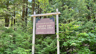
My next stop was Mt Caesar, which was literally about a mile down the road from Honey Hill. The trail network has been updated since the AMC South Trail guide was published, which I wasn't prepared for.. but was pleasantly surprised to find. There is a parking area in between Simeneau Lane and the Mt Caesar cemetery. The trail begins opposite the parking where a picnic table and kiosk are. Quickly you enter the cemetery and cross through a couple of rock walls, there is a blazed tree in the cemetery to guide the way. That was a first! Once through the cemetery is where I realized the trail network was more developed than I had thought. I saw a red blaze off to the right with a trail sign Tower Trail. Without knowing where the trails went, I just followed the pre-downloaded tracks I had, which continued straight on an old carriage road blazed with blue/yellow markers. Into the woods and the lower section was a little muddy very briefly before another trail went off to the right. Marked Quarry Trail with silver blazes. Had I known these trails are basically connector trails to Tower Trail, which also went to the summit, I'd have planned better and completed them all.. however I didn't, so I ended up doing a loop and will have to go back and grab those connectors another time. Continuing on the blue/yellow trail, the second connector trail.. where the blue and yellow split veered right and was named Theresa's Trail. I stayed on yellow which was named Elijah's Epic Summit Trail and headed straight up! It was a short but very steep climb just under half a mile to an overlook. The overlook had a view to Monadnock to the left and straight ahead over Honey Hill and some other surrounding bumps. The summit was a little further beyond the overlook and had the same view, though a little more restricted. There is also an FAA beacon on the summit for a nearby airport, plus a bench to sit and relax. There were a number of trails leading off the summit, but only red and yellow were blazed, so after consulting my trail download, I headed straight ahead from where I had come up and started down the red trail. Now realizing this was the Tower Trail, I just followed this all the way to the bottom. This trail was much more gradual, following what appeared to be an old jeep road. It was eroded in some sections but easy enough to get around the worst of it. I passed the other end of both Theresa's Way and Quarry Trail but stayed on Tower Trail to the bottom.


No comments:
Post a Comment