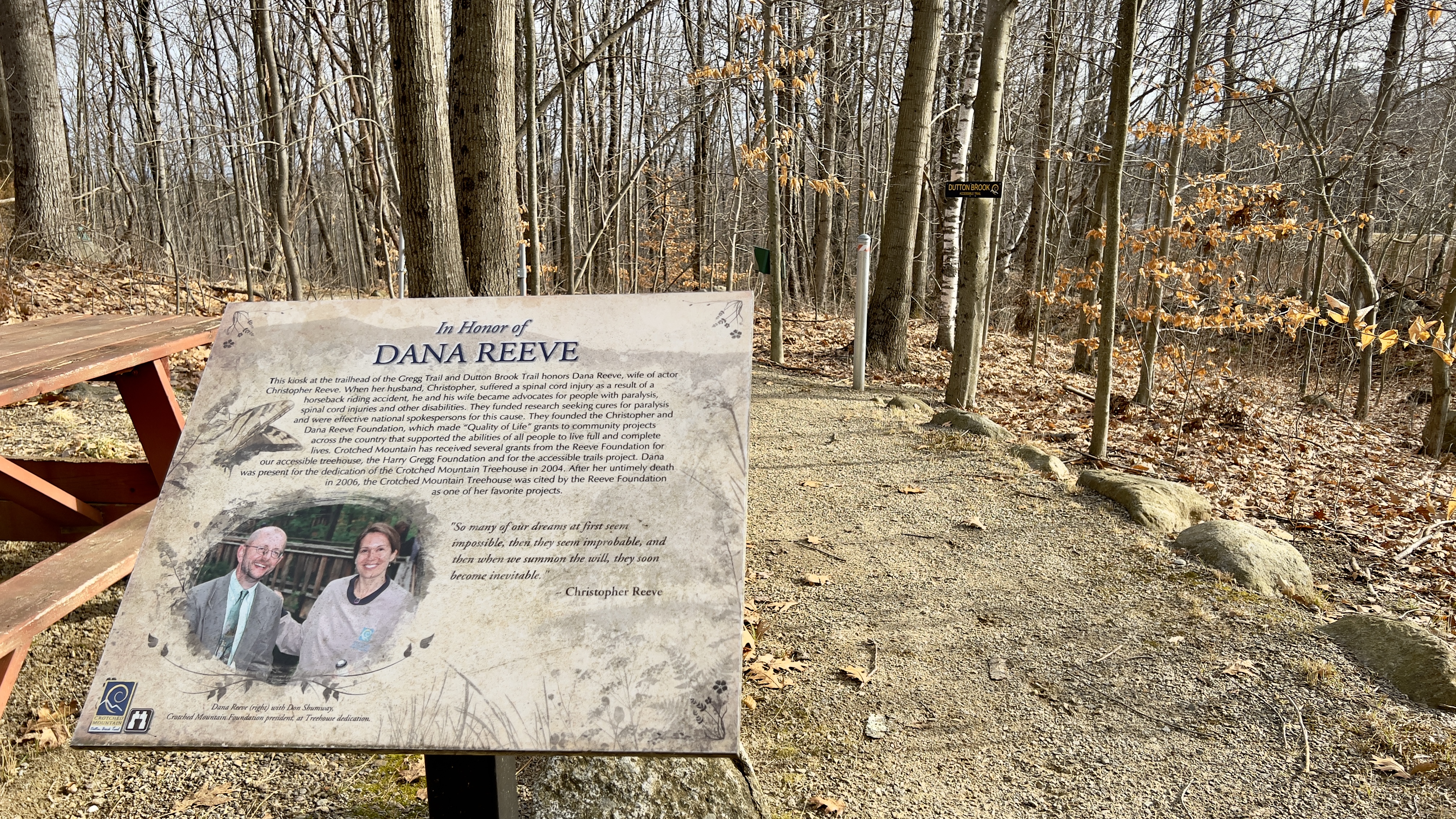
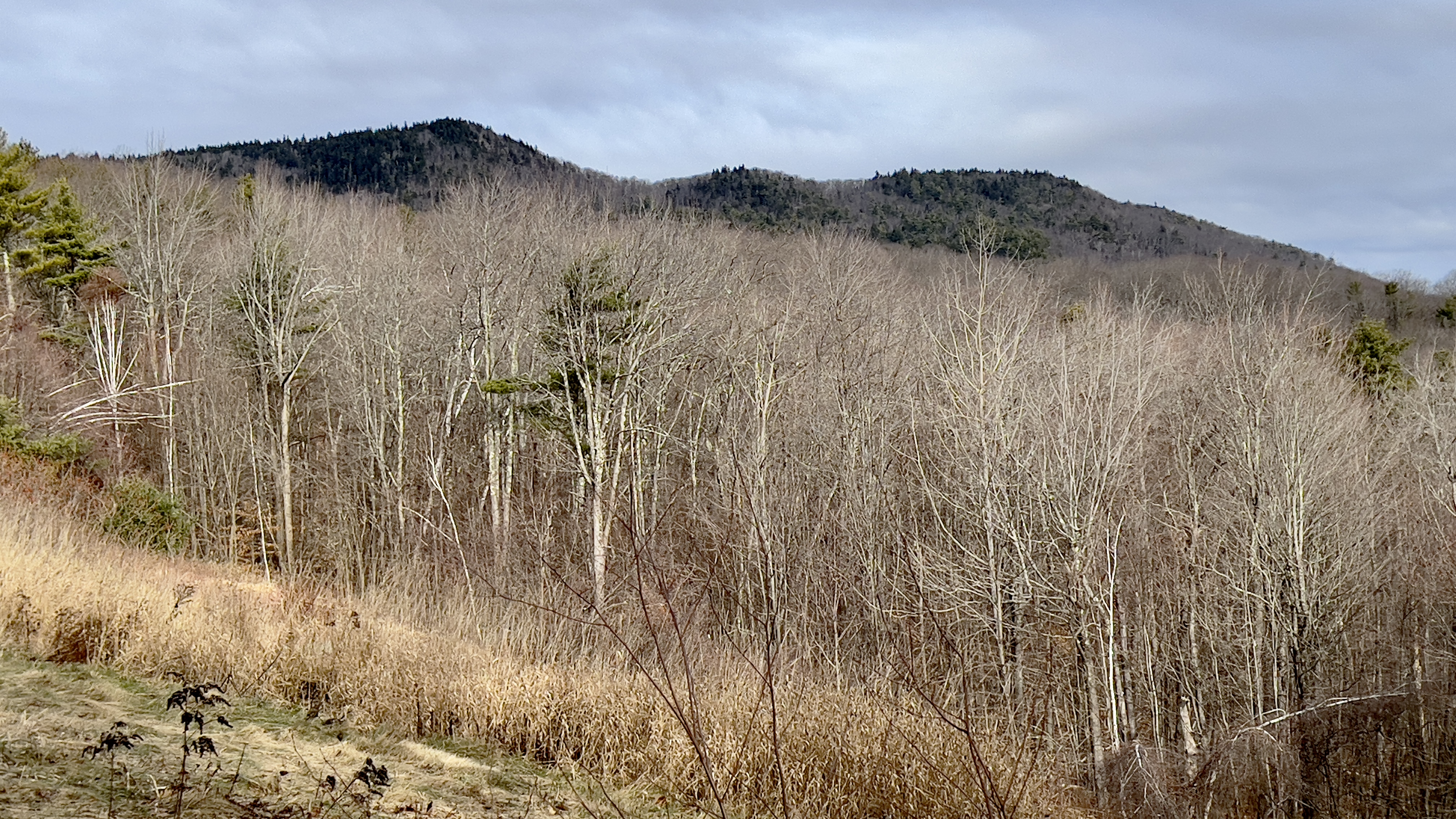
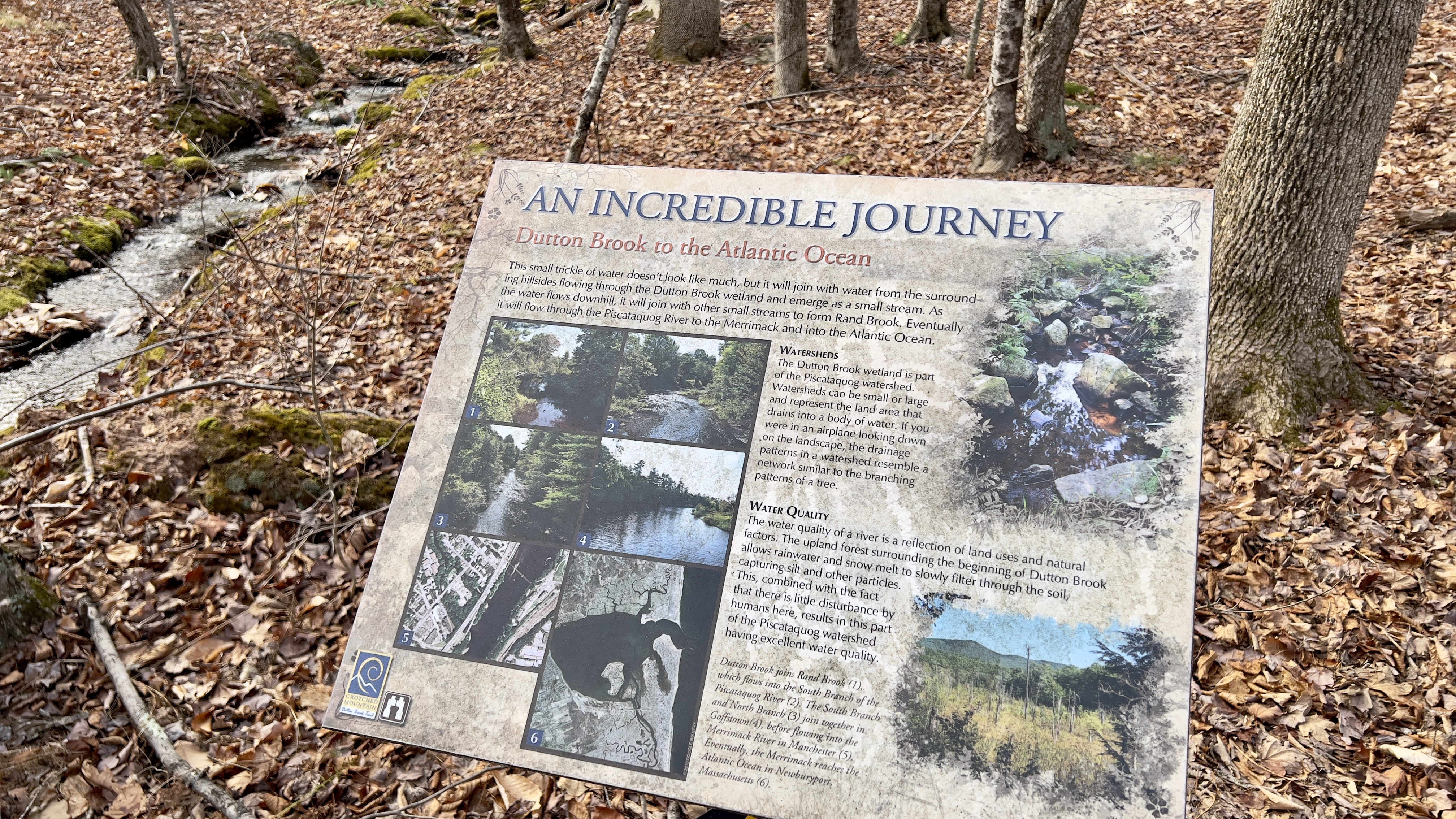
I headed over to the Crotched Mountain area after my hike in Antrim, just a 25 minute drive and parked at the parking area for the ADA Accessible Trails. There were a few cars there, with a large group just finishing up. My plan was to check out Dutton Brook and Gregg Trails, the 2 handicap accessible trails in this network. They both start at a picnic area next to the parking with signs explaining the trails, as both have information plaques along the way for points of interest. I chose Dutton Trail first, which is the longer of the 2, it is a lollipop loop. It descends gradually at first, but I kept thinking, if you were pushing a wheelchair, it would be a decent form of exertion on the return! The trail is a combination of graded gravel and raised wooden walkways. I found the graded gravel at this time of year was a bit soft, and I was "post holing" a little bit, so I tried to stay as far to the sides as possible, which seemed a bit firmer. I didn't stop to read all the points of interest, but it was good they are there! The one plaque I did read which I found interesting was as the trail crossed Dutton Brook itself, which is a small little trickle.. it talked about how it eventually joined larger streams and rivers and made its way to the ocean! The lollipop of Dutton Brook Trail was just over 2.5 miles total. Back at the picnic area, I started on Gregg Trail. Immediately you come out in an open area with expansive views across to the Uncananoonucs and Joe English Hill. Gregg Trail was all graded dirt, rather than gravel and wooden walkways. A good steady little descent that switchbacked up the slope to an observation platform. On one of the switchbacks I saw another trail paralleling for a moment. During the couple times I have been in this area before, I've noticed several old roads and unmarked trails, so I figured that was what this was, but then saw a sign where it joined with Shannon Trail and figured I'd check it on my descent, so I stayed on Gregg Trail up to the platform. The view here is lovely across to Monadnock, Skatutakee & Thumb, also Bald Mountain where I was earlier in the day. I started down Shannon Trail and quickly arrived at the sign I had seen earlier, and was surprised that it read Summit Trail. There are an East and West Summit Trail on the other side of this network, but I had never seen it come over this far on any maps. I could see on my digital map that it joined up with Shannon Trail above the observation platform and was only about 0.2 miles in length, so I figured I'd grab it just in case it ever formally appears on a map. That way I won't have to come back for that short piece. Back on Shannon Trail, I followed it back down to the car. All told about 3.5 miles on both trails.
Strava Activity
 |
| first point of interest is this lovely view of Crotched Mt |
 |
| combination of raised walkways like this |
 |
| and graded walkways like this |
 |
| really well maintained trails |
 |
| with several resting options along the way |
 |
| not marked on any maps, but I walked it anyway just in case |


No comments:
Post a Comment