Saturday, February 25, 2023

Burns Hill

 I hiked with Laura today, which was so much fun. We were on a time restriction and it was a chilly one, so I chose short and close (ish). Burns Hill in Milford was a perfect choice. As described in the Southern AMC Guide, the hike is only a mile long. There is a network of trails maintained by Beaver Brook Association connected to the Burns Hill trails, so we added a couple extra miles to make the drive worth it. We parked in a small lot on Burns Road in Milford and geared up in snowshoes, which ended up being a perfect choice. The snow cover was not deep, but enough that the shoes made it easy going. Most of the trail had been previously broken by bare boots except for our ascent, and we had no issues with our snowshoes on this section. The trail starts on Lower Trail before reaching an intersection. We chose to stay right on Lower Trail and then right again on Brook Trail. Everything was beautiful in the snow cover, the trail follows a brook and is well marked and well maintained. We picked up Loop Trail at the end of Brook Trail and followed this to the Mullen Road parking area for Hitchiner Town Forest and the Burns Hill trails. There is a large picnic pavilion here and I imagine a popular spot during Summer months with a large open field as well. Here we picked up what I've seen called Hitchiner White Trail, which followed an old woods road for a ways. A little ways down, a blue blazed trail went right, which we followed. I've heard this area can be very wet in Spring and following any rains, but today it was fine with the light snow cover. This trail ascended gently before rejoining the White Trail. Very shortly after this intersection, we chose to ascend via East Summit Trail, which is the shorter but steeper way up. This trail was definitely a good little climb, it appeared it might be a rocky climb in Summer, and I imagine in icy conditions it might not be the best choice, but again with the light snow cover and our snowshoes, we had no issues, even considering we were breaking trail. After a couple tenths, the steepness eased off, and while still climbing gently the going become much easier and was so beautiful. It was absolutely silent for our time out, not a single sound to be heard, and it was so peaceful and serene (except for our snowshoes crunching). The trail reaches the Burns Hill summit marked by a cairn. Continuing off trail a few hundred feet there is an open ledge with views across to the Wapack Range. Being that it was a chilly morning we didn't linger, and after taking some pictures, continued over the summit on what was now South Summit Trail for our descent. This side was much gentler and easy going. We reached the old woods road again, taking a hard left and retraced our steps staying on the White Trail all the way back to the Mullen Road parking area. Back on the Beaver Brook Trails, this time we took Hazels Trail back, which started with a fun little water crossing that had a rope assist! Hazels Trail meandered back to the first intersection we had passed on Lower Trail, which we rejoined for the short trip back to the car. A real hidden gem of a little trail network!

Strava Activity

Burns Road trailhead


Brook Trail's namesake

Mullen Road trailhead

this rock just seemed very regal


Laura heading up East Summit Trail

summit cairn

view from the open ledges

Laura on the summit

both of us at the summit

these bare trees always look like artwork to me


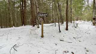
no sign at the top, this was the bottom of South Summit Trail


Sunday, February 19, 2023

SRKG Section 5

 Having completed half the Sunapee-Ragged-Kearsarge Greenway Section 5 already, I set out to complete the second half. It's the longest of the sections at 8.4 miles. Today my plan was to do an out and back of the remaining 3.7 miles I needed. I had hoped with the warm temperatures we have had that the snow may have almost melted. I parked in a plowed pullout along Rt 114 in Springfield, right next to where the trail crosses the road from Section 4 to Section 5 and was surprised to see another car there. I saw a decent amount of snow in the woods and peoples yards as I was driving in, so I geared up in snowshoes. The trail starts out on a snowmobile trail, which was just icy. It heads up a short hill and into an open field. Here I passed the owners of the other car on their return, and saw no one else the remainder of the day. A little further along I decided to change into spikes as this section was just ice or bare ground. Following the white trapezoids of the SRKG, the trail veered left into the woods and followed some single track up to Webster Pass. A gravel road rumored to have been used by Daniel Webster back in his day. This was bare gravel. Following that for just a couple tenths, the trail bears left off the road and up a pretty steep little hill (which is apparently an old mica mine, though snow covered any traces of that today). I was starting to sink into the snow cover at this point and maybe 3/4 of a mile into the climb I decided to change back into my snowshoes, which I ended up wearing for most of the remainder of the hike. At the top of the first climb was an open field with some peekaboo views across to the Grantham Mountain ridge, which was pretty. Back in the forest briefly and out into another cleared field. I then took a sharp right onto a straight section that follows a stone wall before turning left and back into the woods. A short distance in, I came across a sign on a tree that said "The Overalls", there was a very short spur to a restricted overlook of some nearby peaks. From here the trails goes up and down and up and down, the snow was anywhere from a couple inches to maybe 5 or 6 inches and was soft, which was exhausting! It had been broken out, but by bare boots, which wasn't always helpful except for guiding the way. The trail climbs up and over Royal Arch Hill, missing the summit which was off trail. In Summer I would probably have made the short trek to nab the true summit, but in the snow I wasn't interested in adding anything additional. Coming down the other side of Royal Arch Hill, I did lose the trail briefly as there were several trees down and lots of debris, which unknowingly hid the trail. I had my pre-downloaded tracks thankfully so never strayed too far. At the bottom of the descent was another overlook aptly named Royal Arch, which was a lovely view over to Mt Sunapee and surrounds. At this point, I was really tired and considered turning around, but I thought I only had 0.7 miles left so pushed on. The trail climbed back up, I lost it a couple more times as this section was completely unbroken, but with my downloaded tracks was able to get back on course. After yet another descent, and looking at my watch vs the map.. my watch said only 0.2 more miles but the map showed at least another 0.7 or so.. and I knew there were at least another couple of ups and downs, I made the decision to call it a day. It was the right decision, as I was really tired and starting to get sore, and knowing I had to backtrack, I couldn't imagine going any further. I'll get the last remaining "hanging chad" at some point! I literally turned around and retraced my steps all the way back to the car. Overall, it was a very pretty hike, as well maintained as it can be in Winter after a few snow dumps and wind. I look forward to exploring more of the greenway. 

Strava Activity

Start of Section 5 on Rt 114

Heading up the snowmobile trail

Turning off Webster Pass

first cleared section

varied terrain was so pretty

second cleared section

back into the woods - nice solid crust here

and the slog begins


view from the Overalls


view from Royal Arch

peekaboo view of Grantham Mountain ridge

looks solid!


Saturday, February 11, 2023

Fox State Forest - Part 4

 A glutton for punishment, I headed right back to Fox Forest, but this time on the East Side trails. We have had some more unseasonably warm weather and I figured it might be more traveled and easier going than last week. Partially true. I parked in the small parking area off Bog Road called Bog 4 Corners. It's not completely plowed out, but there is room for a few cars. Another car was just unloading as I arrived, but they took off before me and I never saw them again. I geared up and initially headed out in spikes on the Ridge Trail. This turned out to be a bad choice. The snow was very soft and while it had been traveled it was not packed at all. I slipped and slid and sunk into the snow for the first half mile or so before deciding to head back to my car and grab my snowshoes. Why I didn't bring them with me, I'll never know.. as I usually always carry them during Winter! Ridge Trail dips and climbs gently, through the woods.. that was the theme all day. Nothing of note to see, just more walking in the beautiful woods. When I reached Oak Lot Road, I turned onto it and headed back to Gould Pond Road, which would lead me back to the car. In all, I added a mile extra (half mile out and back) which was completely worth it for the snowshoes, that made life much easier. Back the way I came, I stayed on Gould Pond Road to Concord End Road. I turned right and did an out and back to the forest boundary. This was a steady climb up on the way out and I passed the only person I saw all day (besides the 2 in the parking lot) which was a local lady walking her 3 pups. I backtracked half way to where Ridge Trail crosses Concord End Road and turned right. This was the only section that was untouched. Of course it was the steepest section of the day also. A steep down, then steep back up, which was pretty exhausting in sometimes knee deep unbroken snow. When I reached Spring Road, I decided to cut my day short. The moral of my story is, always have bail out options.. particularly in the snow. I tend to bite off more than I can chew! So instead of turning right onto Spring Road and continuing around the forest, I turned left and headed back to Concord End Road, which was a nice descent. Back on Concord End Road, I did a quick out and back to the other end to complete that section. This area had been traveled but mainly by bare boots making it a bit post-holey.. thankfully it was softening quickly as the day warmed and I was able to just tromp through in my snowshoes. I followed Concord End Road back to Gould Pond Road and continued on Concord End Road back up to Ridge Trail. This time heading back towards my car. This side was much more pleasant than the other unbroken side. While not packed down, it had been traveled making it much easier going. The trail gently climbs up the side of Jones Hill with some peakaboo views through the leafless trees to the surrounding area, before descending back down to meet with Oak Lot Road. I repeated my steps from earlier in the day and turned onto Gould Pond Road back to the car. 6 miles total.

Strava Activity


Oak Lot Road


heading into the unbroken section

Spring Road


Sunday, February 5, 2023

Fox State Forest - Part 3

 I was planning on heading back to Pisgah today but at the last moment, changed my mind for Fox Forest. I should have stuck with my original plan, but oh well. I parked at Fox Forest HQ and had a roughly 8 mile route planned on the west side trails. There was a logging operation in that area on my last visit almost a year ago, and had I looked at the website for Fox Forest, I'd have seen that this logging operation has continued and just 3 days earlier moved to cover several of the trails temporarily closing them until the operation is complete. I did not have this intel, and as it turns out the physical sign indicating this closure, had blown over and was not visible as I started out. I would never intentionally break any rules by visiting closed trails. Not realizing this, I crossed the road and followed the logging path until I reached Hurricane Road. Hurricane Road had some old tracks, but was not packed in any way, so I wore snowshoes the entire duration. Snow cover ranged from frozen crust to several inches. I enjoyed the brief moments of frozen crust as I was able to float across easily, the softer several inches slowed me right down and I tired very quickly. I basically spent the whole hike negotiating with myself how far I could actually go and at each intersection I'd look at the map and contemplate if I could manage it or not. I did end up cutting my hike short by a couple of miles, but looking back.. any day on the trails is a great day. We had just come out of a record breaking polar vortex, so even temperatures in the 30s felt wonderful and refreshing. I followed Hurricane Road to Chestnut Corner Road and took that to White Tail Pass and onto Harvey Road. I took a right onto Harvey Road and followed to the intersection with Barred Owl Trail and White Cross Trail. Last time I was here, I got confused and relied on my digital download to figure out which way I needed to go.. and the same happened this time. The trails, while blazed, aren't signed with their trail name (at this end) and it has thrown me off both times I have visited. I took Barred Owl Trail to Ridge Trail and was happy to have some old snowshoe tracks to follow, at least to Molly J Swamp Trail. From here I was breaking trail while ascending (although gently in the grand scheme, it just felt like Everest at the time) the slopes of Bible Hill. I could see houses through the trees, and while it was a really pretty area, I was so cooked, I just wanted to be done. Just when I thought I couldn't go any further, magically the trail was broken out and my spirits were greatly lifted. Amazing how much difference that made and I continued around Ridge Trail to the intersection with Harvey Road again. Here is where I cut my route short, instead of continuing around Ridge Trail, I took a left onto Harvey Road and finished the section back to White Pass Trail. Retracing my steps on White Pass Trail to Chestnut Corner Road, this time I took a left onto Ridge Trail. I left a couple chads bypassing a small section of Swamp Trail I needed, as well as Ledges Trail.. I just had nothing left in the tank. I followed Ridge Trail all the way back to the logging swath and followed the tracks back to HQ and my car. I look forward to coming back once the trails are reopened and finishing the couple of miles I have left now on the west side. 

https://www.strava.com/activities/8511467255

this isn't much different than how it looked on my last visit, so I wasn't thinking the trail might be closed.