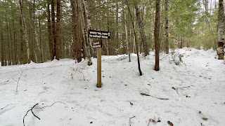
I was planning on heading back to Pisgah today but at the last moment, changed my mind for Fox Forest. I should have stuck with my original plan, but oh well. I parked at Fox Forest HQ and had a roughly 8 mile route planned on the west side trails. There was a logging operation in that area on my last visit almost a year ago, and had I looked at the website for Fox Forest, I'd have seen that this logging operation has continued and just 3 days earlier moved to cover several of the trails temporarily closing them until the operation is complete. I did not have this intel, and as it turns out the physical sign indicating this closure, had blown over and was not visible as I started out. I would never intentionally break any rules by visiting closed trails. Not realizing this, I crossed the road and followed the logging path until I reached Hurricane Road. Hurricane Road had some old tracks, but was not packed in any way, so I wore snowshoes the entire duration. Snow cover ranged from frozen crust to several inches. I enjoyed the brief moments of frozen crust as I was able to float across easily, the softer several inches slowed me right down and I tired very quickly. I basically spent the whole hike negotiating with myself how far I could actually go and at each intersection I'd look at the map and contemplate if I could manage it or not. I did end up cutting my hike short by a couple of miles, but looking back.. any day on the trails is a great day. We had just come out of a record breaking polar vortex, so even temperatures in the 30s felt wonderful and refreshing. I followed Hurricane Road to Chestnut Corner Road and took that to White Tail Pass and onto Harvey Road. I took a right onto Harvey Road and followed to the intersection with Barred Owl Trail and White Cross Trail. Last time I was here, I got confused and relied on my digital download to figure out which way I needed to go.. and the same happened this time. The trails, while blazed, aren't signed with their trail name (at this end) and it has thrown me off both times I have visited. I took Barred Owl Trail to Ridge Trail and was happy to have some old snowshoe tracks to follow, at least to Molly J Swamp Trail. From here I was breaking trail while ascending (although gently in the grand scheme, it just felt like Everest at the time) the slopes of Bible Hill. I could see houses through the trees, and while it was a really pretty area, I was so cooked, I just wanted to be done. Just when I thought I couldn't go any further, magically the trail was broken out and my spirits were greatly lifted. Amazing how much difference that made and I continued around Ridge Trail to the intersection with Harvey Road again. Here is where I cut my route short, instead of continuing around Ridge Trail, I took a left onto Harvey Road and finished the section back to White Pass Trail. Retracing my steps on White Pass Trail to Chestnut Corner Road, this time I took a left onto Ridge Trail. I left a couple chads bypassing a small section of Swamp Trail I needed, as well as Ledges Trail.. I just had nothing left in the tank. I followed Ridge Trail all the way back to the logging swath and followed the tracks back to HQ and my car. I look forward to coming back once the trails are reopened and finishing the couple of miles I have left now on the west side.
https://www.strava.com/activities/8511467255
 |
| this isn't much different than how it looked on my last visit, so I wasn't thinking the trail might be closed. |


No comments:
Post a Comment