Sunday, May 28, 2023

Pisgah State Park - Davis Hill

 Usually the goal is to get up and out on the trails as early as possible. Today being the middle day of a long weekend, and Laura having had morning commitments, we went for an afternoon hike. No worries about getting home later, we still have tomorrow to sleep in! We headed for Pisgah State Park and the Kilburn Trailhead for my last hike in the park from this location. The Davis Hill trail starts literally on the road at the entrance to the parking area. The parking lot was not surprisingly almost full with some cars lining the street. We lucked out with a spot from one of those early risers who had already been and gone. The trail climbs gently right away and continues to do so with a little reprieve about half a mile in before gently climbing again to near the summit of Davis Hill. Just before the height of land, Old Davis Hill Trail branches off to the right. This would be our return trail. The trail was in great shape and nice and wide which made for great meandering on this sweltering hot day. The only negative were all the bugs, even with multiple bug spray applications and long pants, I ended up with 18 bites! Continuing over Davis Hill (no views) the trail descended before reaching a sharp right hand turn. We got a bit confused in this area, even with pre-downloaded tracks but managed to stay on trail. We took a left at the sign for the FOP Shelter and descended down passing several unmarked trails until we reached the shelter. We did pass a trail on the left with a handwritten sign saying Dort Vista, but seeing as that was not on the map and we weren't sure how long it was to reach the view (plus there was not much in the way of views today as it was very hazy) we skipped it. We stopped for a quick break at the shelter. It looked really nice and clean. From here we climbed a short but really steep ascent up to Hubbard Hill trail and the outlook vista bench then descended just under half a mile to the three way intersection with the end of Davis Hill Trail and Baker Pond Trail. We headed up Davis Hill Trail which was a bit rockier but still wide, passing by the intersection with Old Davis Hill Trail which we would come back to, and filled in the blank back to the shelter spur. Backtracking to Old Davis Hill Trail, this was the original trail before they established Davis Hill Trail up and over, whereas the original trail skooches around the side of Davis Hill. This trail was much narrower and seemingly hadn't been swept yet after this past Winter as we encountered more debris and a really large blowdown that we had to go around. It started out level and then climbed back up to meet Davis Hill Trail. We turned onto Davis Hill Trail and returned to the car. Surprisingly the parking lot was still quite full and we saw several people return with towels and floating apparatus. I hadn't realized Kilburn Pond was a swimming hole! 

Strava Activity


peekaboo view along Davis Hill Tral

viewpoint along Davis Hil lTrail


from the shelter up to Hubbard Hill Trail

viewpoint on Hubbard Hill Trail

intersection of Hubbard Hill, Baker Pond and Davis Hill Trail


blowdown on Old Davis Hill Trail

Laura on Old Davis Hill Trail


Saturday, May 27, 2023

SRKG - Section 3

 I have plans for a double header hiking weekend this weekend, so today I wanted something quick and easy. I decided to go back and finish SRKG Section 3, that I did half of several weeks ago. I parked on Deer Hill Road in Springfield. As you turn onto Deer Hill Road there is a trail sign for the Protectworth Trail, and just beyond this on the left is space for a couple of cars. I geared up and headed out. Take a right on Stoney Brook Road, pass under I-89 then follow for about 1.2 miles. You'll pass a little pond on your right with I-89 behind it. The road ascends ever so gently, then descends to the intersection of Hogg Hill Road. I found that the majority of the SRKG blazes were in the opposite direction in this area, however it's not difficult to follow as long as you know which roads you need to turn onto. Take a left on Hogg Hill Road and go up. I wasn't expecting a big hill like that! Kept reminding myself I would be going down on my return ;) At about 2 miles from the car, I turned right onto West Road. I wasn't sure it was right, as I saw no SRKG blazes or a street sign even, but I had a digital download and that's where it went. This was a dirt road for about half a mile, then became a true Class VI road. The trail descends from here and in parts was rough and rocky and wet. After another half mile or a bit more, the Class VI portion ends and it turns back into hard packed dirt road, now North Road. The road descended, then ascended and I reached my turnaround point at Seven Springs Road, where I had reached previously. I about faced and retraced my steps to the car. Section 3 complete. 

Strava Activity

Deer Hill Road, end of Section 3, start of Section 4 of the SRKG

Along Stoney Brook Rd looking at I-89

Left on Hogg Hill Rd

Right on West Road

Continue on the Class VI - first SRKG blaze I'd seen in a while

my turnaround point at Seven Springs Rd

Along North Rd, it looked like an archway!

North Rd end of the Class VI section


Sunday, May 21, 2023

At Monadnock, just not up Monadnock

 Like Cardigan, Monadnock is another of those places that is a bit intimidating... there are a lot of trails, and just about everywhere you go is steep in some way, shape of form. I've done a few trails in the area before, and today decided to tackle a few more. I started at HQ and instead of heading up towards the summit, much like last week, I turned away from everyone else and headed for some of the lower lying trails. I actually walked down Poole Road a couple tenths from the entrance gate and started on Hinkley Trail. The trailhead sign for this trail is a few hundred feet in from the road, and not marked on the road at all. I wouldn't have even seen it if I wasn't watching a digital download so I could see where I was. When I reached the trail on my download, I was thinking "this can't be it" then I happened to catch sight of the sign a little ways in! In case you don't have a digital map, head down Poole Road and when you reach a chained off road on the right marked "No Parking", look left and the Hinkley Trail sign is hidden in the trees. The trail starts in the woods and then (again like last week) meets up with a brook and follows it for a while. More beautiful cascades were the order of the day. There were a few small blowdowns and it was very buggy. We had rain during the week prior so there was some standing water on the trail and it seemed whenever that was the case, the bugs were en masse. About halfway along the trail, there is an intersection with Harling Trail, which would be my return and one of the prettiest intersections I think I've seen yet with a bridge over the brook and more cascades! I stayed on Hinkley Trail and followed to the end meeting Birchtoft Trail. I turned right and headed towards the campground. This trail was clear of debris and was really nice and flowy following a stone wall much of the way. Next to the campground is Gilson Pond and the area around (on this side of the pond) was beautiful and open with views over the pond. I followed Birchtoft Trail to the road and turned left, crossed a field and joined Pond Loop Trail, which as the name suggests follows the pond all the way around. There were a couple nice open viewpoints looking up over the surrounding bumps around Monadnock. The far side of the pond was a little more rustic and buggier, but still easy to follow. Back on Birchtoft Trail, I retraced my steps, this time going past Hinkley Trail and continuing on and up... and up and up and up to Cascade Link Trail. I took this section slow as it was some of the steepest trail I'd done in a while, which made the bugs pretty unbearable, so I broke out the bug net for the first time this year. I made it to Cascade Link Trail and turned left following the brook.. the trail itself was pretty wet too so care was needed to not slip on the rocks. Just before Cascade Link Trail meets up with White Dot Trail, Harling Trail heads left. There were some more blowdowns on this trail, some step overs, some skooch arounds.. but overall this trail was so soft and flowy. I was really pleasantly surprised how nice it was. Back at that beautiful intersection, I picked up Hinkley Trail again and returned to Poole Road and the car. No major scenic spots, except Gilson Pond on this hike.. but it was really nice to be in a super crowded area (parking lot was beyond full upon my return) and only have seen a handful of people all day!

Strava Activity

where Hinkley Trail starts on Poole Road

sign is a few hundred feet in


Saturday, May 13, 2023

Welton Falls - Cardigan Back Country

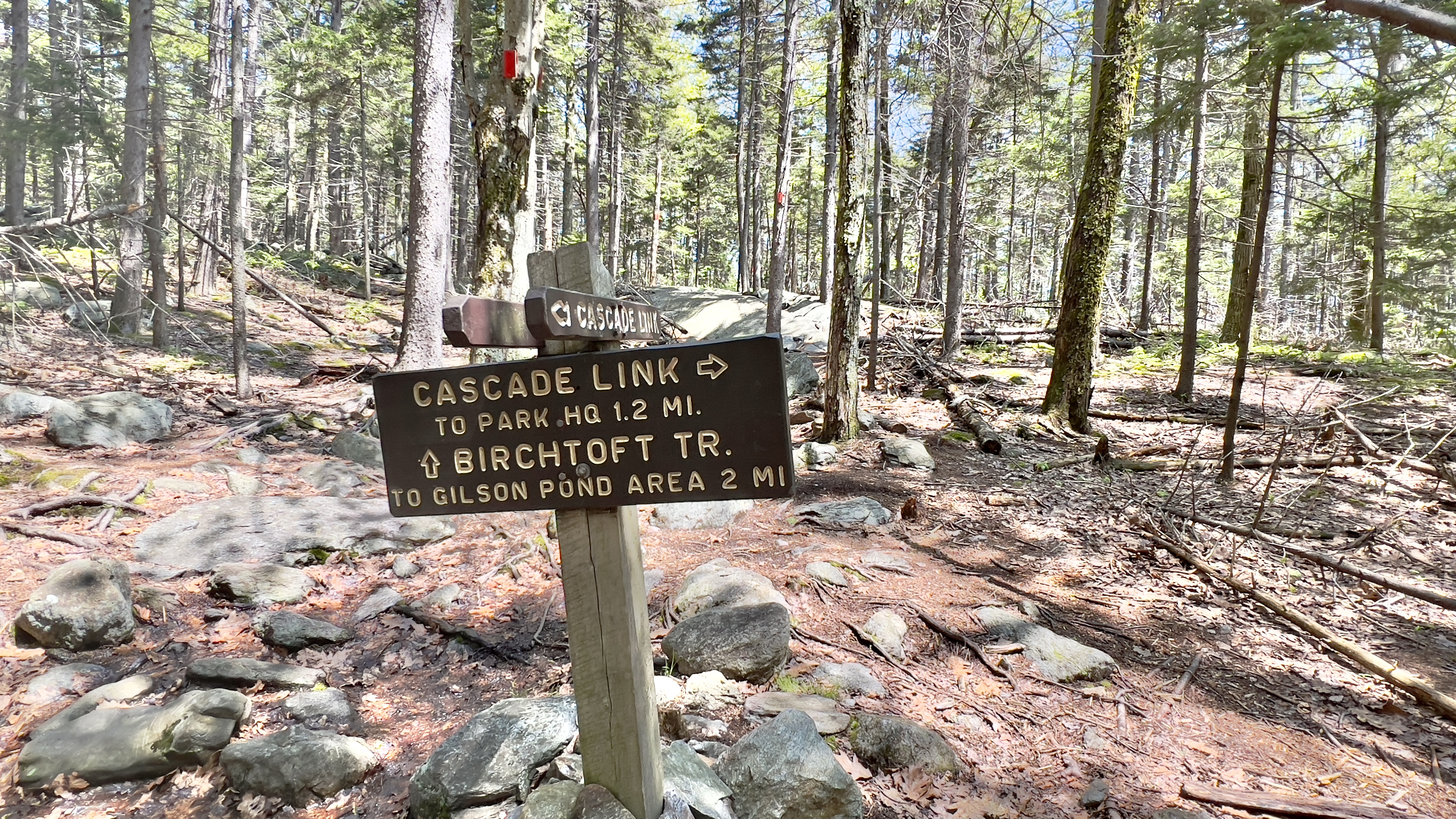
 I've been hesitant but curious to explore the back country trails of Cardigan Mountain. They intimidate me with their seeming remoteness, lack of maps showing exactly where they are with trailheads/parking etc.. and lack of trailheads in general! My pre-planned hikes of the area are longer and more technical than a lot of the other hikes I have planned for the Southern AMC Trail Guide because of this.. and that intimidates me! I'd heard the area was finally snow free, so I decided to tackle a few trails. I headed for the AMC Cardigan Lodge and hoped that this time I'd find available parking. The one other time I tried to park here, it was full by the time I arrived. With that in mind I scrambled to think of alternatives before arriving so I wouldn't be disappointed if that ended up being the case again. Thankfully when I got there I found abundant parking (it would be full upon my return though). While everyone else headed up towards Holt/Manning Trails to climb the mountain, I headed in the opposite direction on Lower Manning Trail, which starts right opposite the porta-potty in the parking lot. The trail starts through some camp sites then wanders into the woods. Soon you reach a brook, which was flowing significantly with all the recent rains we've had and it was so incredibly beautiful. I stopped and admired the cascades several times. The trail descends with one significant water crossing that was easily doable today and after just over a mile reaches the highlight of this trip, Welton Falls. At the sign for Welton Falls you can take a side path to the left which goes alongside a big drop off into a cave like rock formation over the top of the falls. There is a fence, but it was still really scary for someone like me afraid of heights! I was determined to make it into the cave though. Back around on the trail, it continues to follow a big drop off before reaching the view point in front of the falls. Again with the rains we've had, the falls were definitely in full flow! The whole area is really beautiful. The trail now follows the brook right alongside it. At one point, I didn't realize the trail actually crosses the water and I kept going before shortly realizing I wasn't seeing blazes any longer. I backtracked and found the water crossing, but it was too high for me to get across, so I kept backtracking looking for a spot that was safe to cross. There were plenty of rocks, but always one that was just too far apart for my vertically challenged legs, and the water was rather deep (like above the knee deep, not over my head deep) and I didn't want to take the chance of falling in. A couple tenths from the true crossing I found an area that looked doable. My feet still got wet, but it didn't go above my shoes thankfully. I made it across and bushwhacked back down the trail and continued. The trail was now an old road until it joined with Old Dicey Road (named Welton Falls Road on some maps). I took a left and followed Old Dicey Road for about a mile, which was uphill gravel, a lot of the time without shade. Nothing exciting on this stretch except at one point I passed a parked car, which ordinarily wouldn't have concerned me, except it had FL license plates.. so all these visions of too many Dateline episodes started going through my head about a solo female hiker in the remote back country of Cardigan Mountain. I quickened my pace as much as I could and tried to be fully alert for any sounds around me. Thankfully no bad guys emerged from the woods. I turned onto Back 80 Loop Trail and immediately crossed back over the brook (this time on a bridge) and re-entered the woods to come up on another water crossing, across some pretty cascades. The trail crosses one more set of cascades (here I saw a couple sitting enjoying lunch, probably the FL car and thus wiping out my concerns!) and then climbs back up to meet Back 80 Trail. This section was my least favorite. It was messy with debris and blowdowns, it was quite steep and the mosquitoes were out in FULL force. I was not upset to meet up with Back 80 Trail and start my descent to the lodge. This trail was the complete opposite, lovely and clear. Wet in some places, but overall much nicer. Once back at the Holt Trail intersection, I headed a short ways down Holt to pick up the Nature Trail, which is a short interpretive trail basically alongside the campsites. This trail is currently under construction and halfway in I encountered a trail closed sign as they are working on improving erosion and making it an accessible trail. I just backtracked to the car and called it a day!

Strava Activity


view from the parking area up to Cardigan & Firescrew


first major water crossing


2nd water crossing where I decided to cross, trail was a couple tenths further down


3rd water crossing