Today I continued my mission of no snow.. still not ready. I went as far south as I possibly could with my remaining hikes for redlining. The Metacomet-Monadnock Trail is part of a really long thru-trail that actually starts in Connecticut and ends at the summit of Mt Monadnock. I'm only completing the NH section that is about 18 miles long, beginning at the MA/NH border in Richmond, NH. I have been enjoying the longer thru trails as they give me some good Winter options. This was no exception as I saw no snow at all. I parked at the end of Section 2 on Old County Road at Dean Farm Road, where there is room for a couple cars to park and not block either road. It had started lightly raining as I drove in, so I started in a rain jacket and covered up my pack.. thankfully it was a relatively warm day, so no freezing or icy conditions. I walked down Old County Road to the end, which was roughly 0.4 miles on hard packed dirt. Turned left onto Rt 119 and followed that for about 0.2 miles, then carefully crossed and turned onto Monument Road, another hard packed dirt road. I followed that to the end of the maintained section and residential area. From here the road becomes a bit more of a Class VI road, but was still easy footing. At about 2.2 miles, the road takes a sharp right with a cleared section on the left. It looked like maybe there were some views of the surrounding area here, but I was in complete whiteout conditions at this point, so nothing for me to see. In roughly a tenth of a mile, the road met up with a recent logging operation and a very large clearing. Due to some heavy rain last night, this area was very wet and muddy. I turned left, staying on Monument Road and from here it was a true Class VI road. Over the past Summer, this area was logged and thru hikers had to bypass a section of the trail that was closed by following the road. The actual trail has very recently been reopened but the logged section is still very fresh and messy. The route has been marked with blazes and flagging tape, and I didn't find it difficult to follow, but did find it challenging to cross the logging slash in some places as there was some serious mud and wet areas from recent rain. It was very slippery and it was a mental game to keep moving forward. I kept telling myself, it's not forever, it's not forever.. and sure enough, just about 0.6 miles later, the logged section was behind me and I was in the woods! For this I was grateful and while there was nothing scenic or special about this section, I just bounced along ecstatic to be out of the yuck! The trail descends down to meet Greenwoods Road. Here, there was a truck parked that belonged to the only 2 people I saw all day that were returning on the next section. Crossing Greenwood Road, the trail re-enters the woods and so begins the most magical, mystical, mountain laurelly section of trail! I may have felt that way after the last 3.5 miles of road/mess, or it may have been the foggy, dreary day that contributed to my emotions along this 0.6 miles to the MA border.. either way, it was amazing. The trail starts out alongside a beaver pond then meets up with Falls Brook with some cascades and lots of mountain laurel before entering a mini-gorge area that was just amazing with so much moss and some amazing rock formations! It truly felt magical! I must have stopped every 5 feet to take pictures and videos or just soak it in. I reached the MA/NH border which was my turnaround point, but I could see on the map just past this area a landmark named "Stone Bridge". I continued on and just a few hundred feet down I could see what I believed to be the stone bridge. It was slightly off trail and covered in moss, so I had no intentions of trying to cross with how slippery it had been so far. I took a couple pictures, then retraced my steps back to Greenwoods Road. This time, instead of backtracking over the logging slash, I opted for the "bypass" from the Summer, which followed Greenwoods Road back to Monument Road (about half a mile). Turned right on Monument Road, which was rocky, wet and muddy in places and followed that back about 0.7 miles to where I had turned off into the woods and the logged area earlier. The one bonus in taking this route back (besides it being quicker due to being a road walk) was finding a marker for the birthplace of the mother of James Garfield, President of the United States! From here, I just retraced my steps back to the car.
Strava Activity
 |
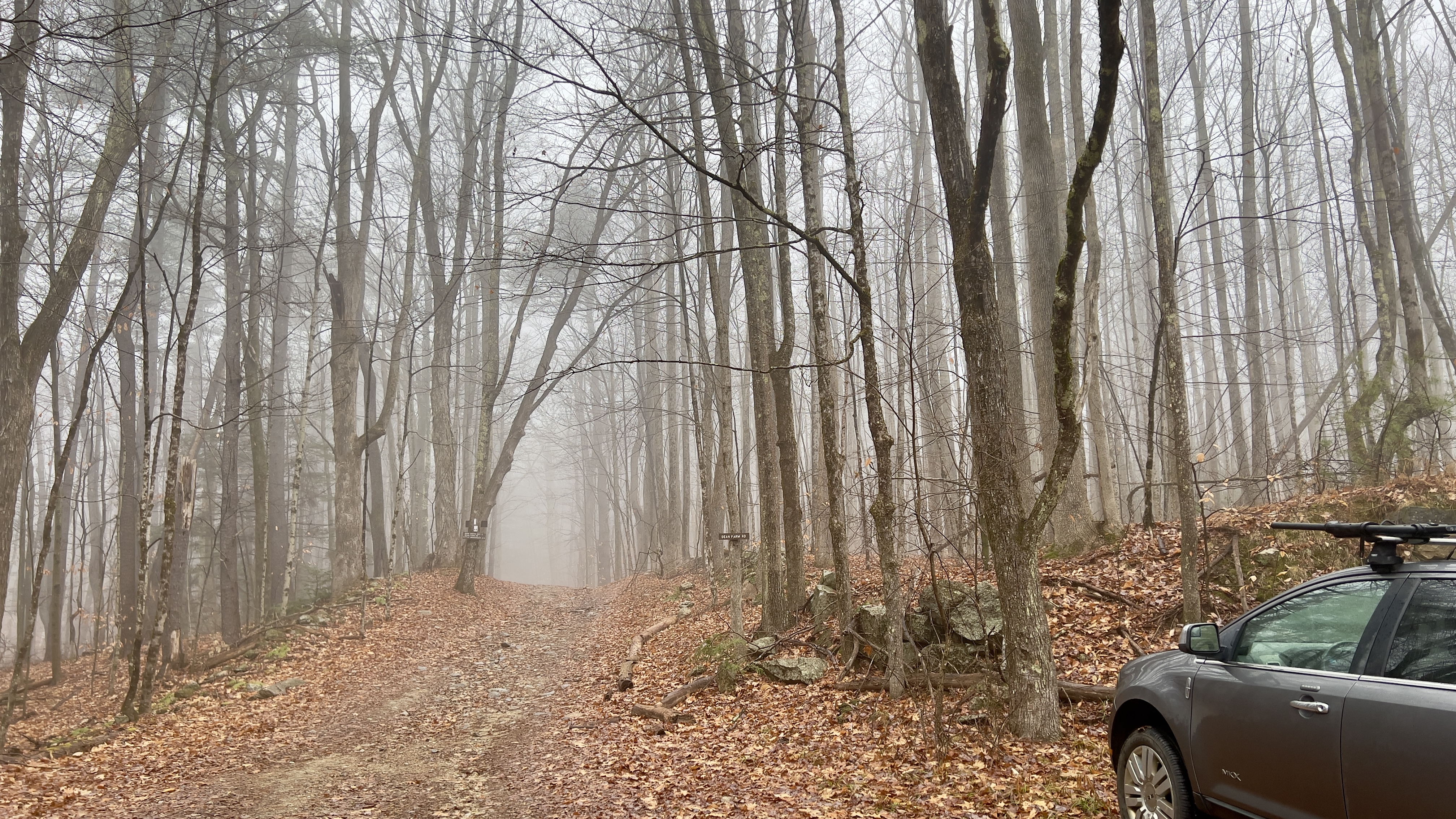
| Foggy start at Dean Farm Rd |
 |
| walking along Monument Rd |
 |
| left at the logged clearing |
 |
| the newly reopened trail through the logging operation |
 |
| some of it looked like this |
 |
| and some of it looked like this |
 |
| and finally back into the woods |
 |
| magical mountain laurel |
 |
| luckily I had a raincoat on, as this was wet! |
 |
| Falls Brook |
 |
| some of the gorge formation |
 |
| the Stone Bridge |
 |
| another view of the Stone Bridge |
 |
| more of the gorge formations |
 |
| along the bypass on Monument Road |
 |
| a bit rougher but still easy going |
 |
| bonus finds! |


No comments:
Post a Comment