Saturday, July 27, 2024

Spellman Trail/Cascade Link - Mt Monadnock

 Today's weather was absolutely perfect hiking weather. Temps in the 70s with no humidity and a perfect breeze. There were a few bugs, only enough to complain about, not enough to actually take action. The biggest downfall was the haze, we suspect from California/Canadian wildfires, which unfortunately has become the norm each Summer. Laura and I set out early for Monadnock State Park in an effort to beat the majority of the crowds. We hit the trail around 730am and it was already starting to pick up.  I had planned on doing this hike several weeks ago, but the weather had deterred me then. I had been very anxious at that time and done all my research then. This time I made somewhat last minute plans based on the forecast and just went out and did it. I think that helped as I hadn't taken any time to stress over what this hike may be like. We started at Headquarters on White Dot Trail and at roughly 0.8 miles turned onto Cascade Link. This trail, the past 2 times I have been on it, is somewhat wet and muddy with gorgeous cascades along much of the way. Today it was bone dry. There were a couple patches of residual mud, but the cascades were nada. Not even a trickle. Good and bad. The cascades are super pretty, but dry rocks/roots made for quicker walking. We passed the junctions for Harling Trail, Birchtoft Trail and Red Spot Trail, which was as far as I'd been on Cascade Link previously and continued another 0.2 miles to Spellman Trail. Known as the steepest trail on Monadnock, this was where my anxiety had been. It is only 0.6 miles long, but is pretty much a vertical scramble up the side of the mountain. The trail starts with boulders and eventually transitions to a more ledge type surface, with a little pine needle path in between. I honestly don't mind a good boulder scramble, even if it's steep, as long as there are plenty of things to hold on to along the way.. which in this case there were. Even on the ledge portions, there were still plenty of large rocks and trees to assist with pulling yourself up. It's definitely steep, really steep, but there wasn't really anything hairy about it. I had it hyped up in my head as way scarier. One spot I had read about was crossing the top of a waterfall, which was early on in the trail and due to the dry conditions today, was a mere trickle. I could see how that might be a bit sketchy if the water was really flowing as it's a straight drop down on one side, but today was no issue. I really loved Spellman Trail. We stopped for a snack break about halfway up, which was a perfect refuel. The views started as we neared Pumpelly Trail, but with today's haze there was really nothing to see. Once at Pumpelly Trail, we turned right heading back towards Dublin Pond and followed for just under a mile to the top end of Cascade Link. Pumpelly has a lot of up and down, but along this section we had views over to the summit and beyond for most of the way. We found a little side path to a rock with a perfect outlook and stopped for another extended snack break/rest. We took Cascade Link back down, which finished off that trail for me on my redlining quest. Cascade Link started off rather steeply with a couple of butt slide descents, but then mellowed out and honestly I think was one of the more gentle trails on the entire mountain that I've done to date. I loved it. Spellman and Cascade Link are definitely top contenders for my favorite trails on this mountain by far. We followed Cascade Link back to White Dot and down to the car. I highly, highly recommend this route for anyone wanting to explore Monadnock beyond the summit. You will see enough people, particularly on Pumpelly Trail, but you avoid the hordes of people on White Dot for the most part and get just as fantastic views. I now have 15 trails left on my Southern AMC Trail Guide redlining quest!

Strava Activity


normally a decent water crossing


crossing the mostly dry waterfall on Spellman


Saturday, July 20, 2024

Woodland Trail/Vistamont Trail - Cardigan Mountain

 I had hyped this hike up in my head to be rather difficult. A lot of it was unknown. Woodland Trail is often described as very rustic, wet and hard to follow in places.. I wasn't as concerned about Vistamont Trail as I think that's a little more traveled/maintained, it was Woodland Trail I was more concerned about. I started on Clark Trail and headed up to the Woodland Trail intersection. Temperatures were perfect today and initially bugs weren't too bad. Once at the intersection, stay straight onto Woodland Trail. It was very overgrown in places, but the path itself wasn't too difficult to follow. I knew about the abandoned caravan along the trail, so when I reached it, while it was definitely somewhat unnerving to pass so closely to, I wasn't too worried about it. The first half of the trail was seemingly on an old road and the worst of it was definitely the mud in places. I think I lucked out though as we've had some really hot, and somewhat dry weather, so it wasn't terrible. Annoying, but not terrible. I reached a point where you crossed a small brook, and the trail took a sharp left. This was really the only place I fully relied on the track I had downloaded to figure out where to go, otherwise navigation wasn't as bad as I had expected. The blazes are definitely very faded in spots and the trail is very lightly, if at all maintained.. but I found the path was mostly discernible, and in the areas where it was very overgrown, it seemed to luck out that the blazes were visible. The trail relatively gently climbs for just over 2 miles popping out on Skyland Trail just below the summit of Church Mountain. Here I turned right and followed Skyland Trail in the reverse direction than I had previously done it, climbing up and down over Grafton Knob, Crane Mountain and a couple of unnamed knobs until just below the summit of Gilman Mountain (or Orange Mountain as I've seen it called both). Skyland Trail has some really stunning viewpoints over to Cardigan Mountain and the surrounding areas. I like it much more than actual Cardigan Mountain because it's not so commonly traveled and you get much of the same view without the crowds. The ups and downs to the summits of each of the peaks you pass over are somewhat steep in places and the peaks get higher as you go in this direction, but it's really a lovely trail, one of the best hidden gems in all the Southern AMC Trail Guide I think. My downfall today was I developed a really bad blister on my left heel, which made it really painful to walk and took away from the beauty of the day unfortunately. My toes also got so smushed for some reason so my feet from one end to the other were in horrific pain. I spent most of the hike just wanting to be done and take my boots off. I'm disappointed because this hike really is a great one. I didn't do anything extra on the hike today, so I didn't go up to the actual summit of Gilman Mountain, having been there before a couple years ago. The views from the start of Vistamont Trail though are completely stunning, so not going to the actual summit was no great loss. Vistamont Trail from here is a really steep descent for just under a mile. Much steeper than I had anticipated. There are quite a lot of switchbacks in places which helped, but it was a pretty relentless down. Starts off with amazing views, then heads back into the woods and just goes down and down and down. About a quarter mile before the Clark Trail intersection, you hit the low point on the trail and climb a little back up. Once on Clark Trail, it's a mostly gentle descent all the way back. While the temperatures and breeze were amazing the entire day, as it warmed up the bugs came out. I had to relent and put on the bug net part way down Vistamont Trail as they were beyond annoying and I was too tired to keep swatting them away. Aside from the painful feet, it was a great day and I was happy to check off 2 more trails on my spreadsheet. 17 left to go. 

Strava Activity

Lower intersection of Woodland Trail/Clark Trail

Upper intersection of Woodland Trail/Clark Trail

Woodland Trail

overgrown in places

muddy in places


Skyland Trail at Woodland Trail


Vistamont Trail at Skyland Trail


Saturday, July 13, 2024

Welton Falls Trail South

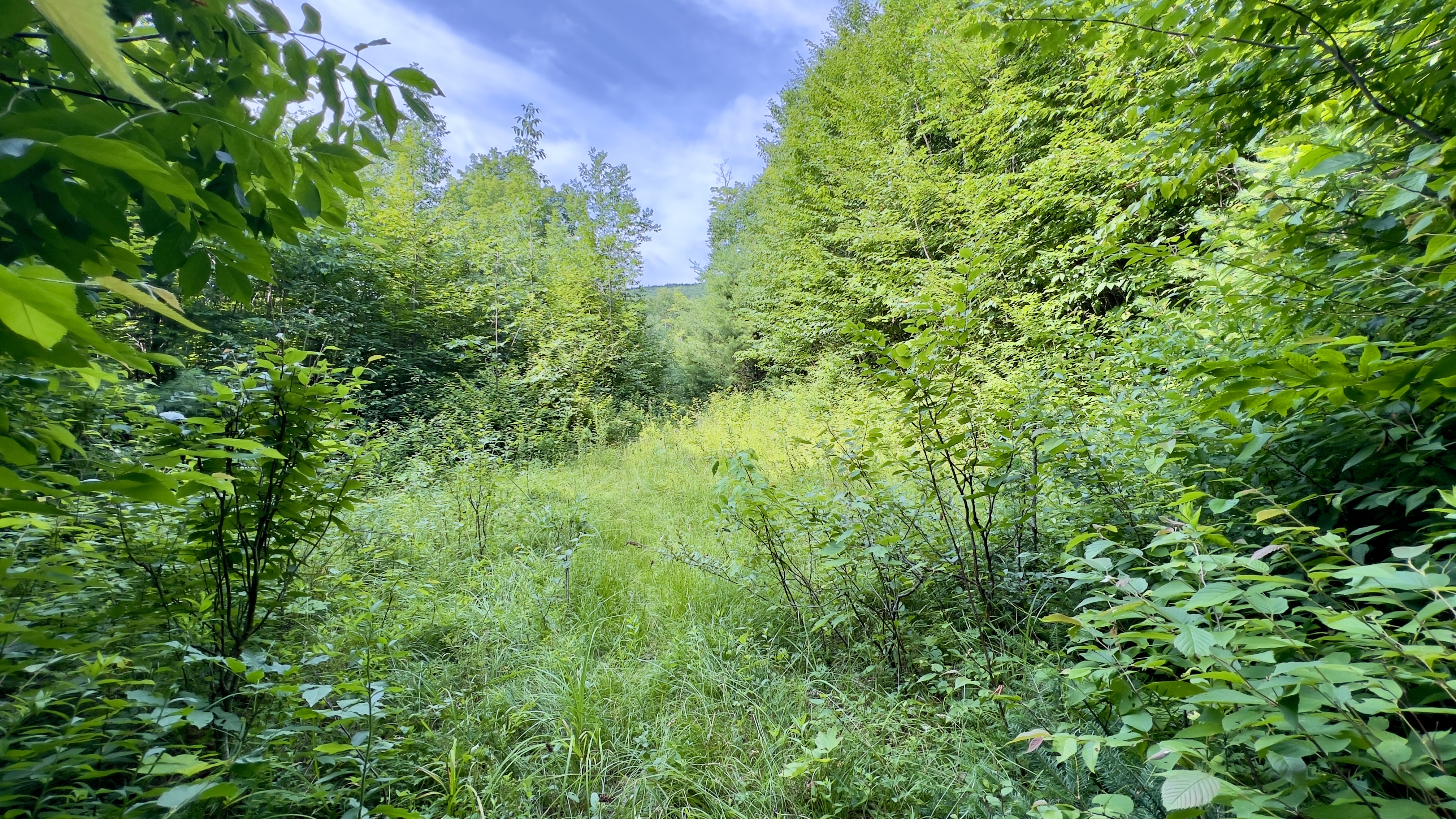
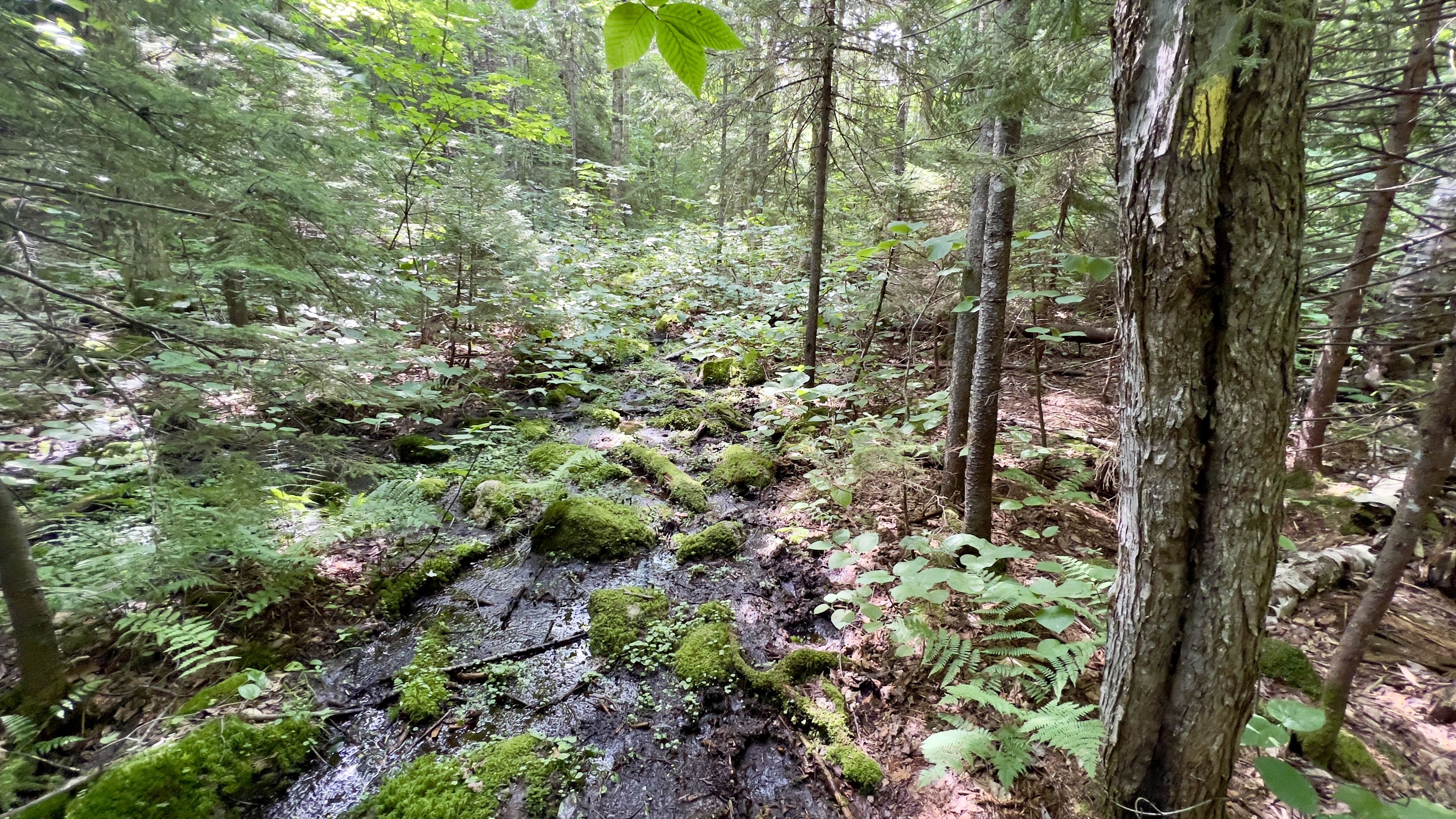
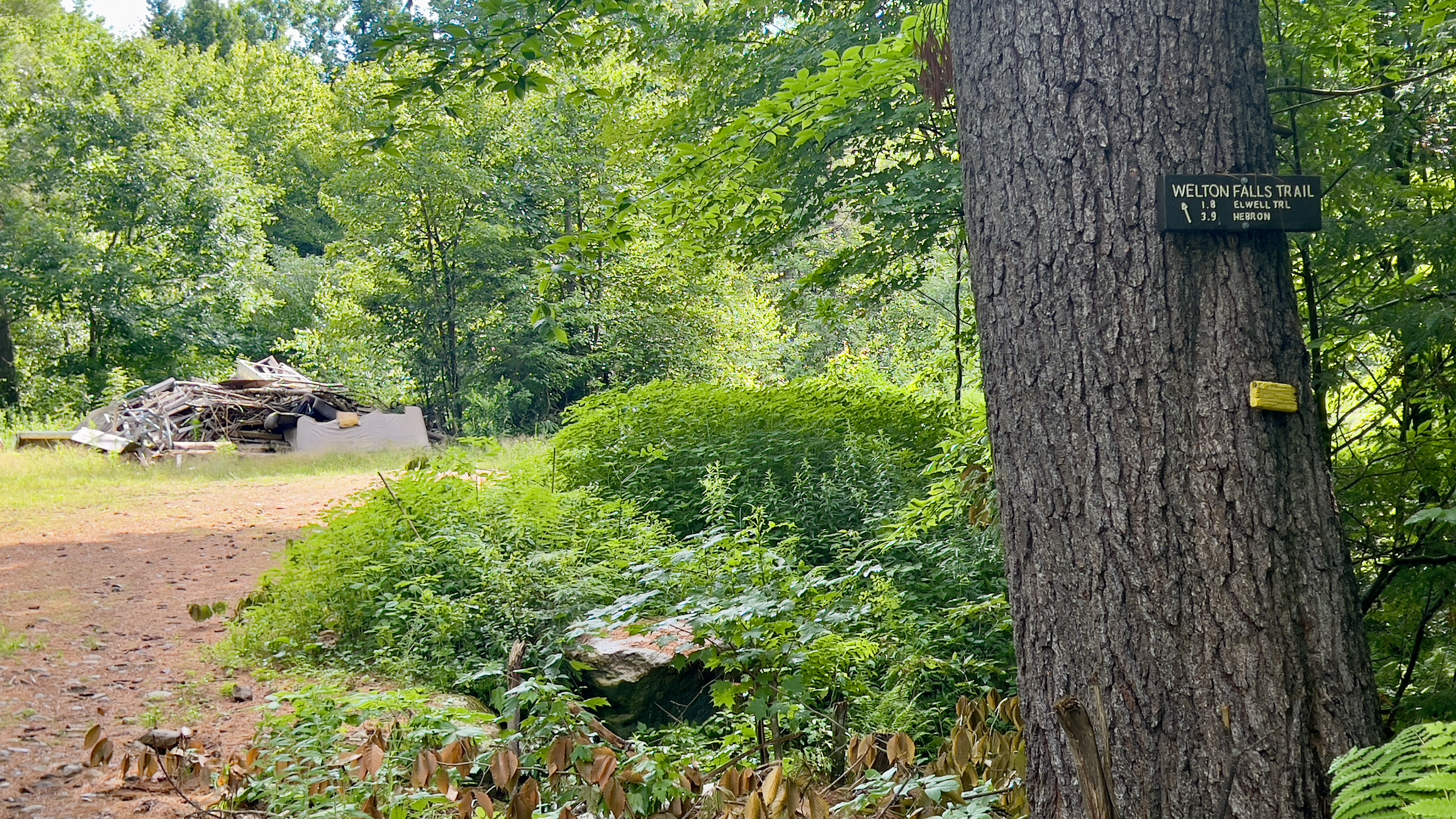
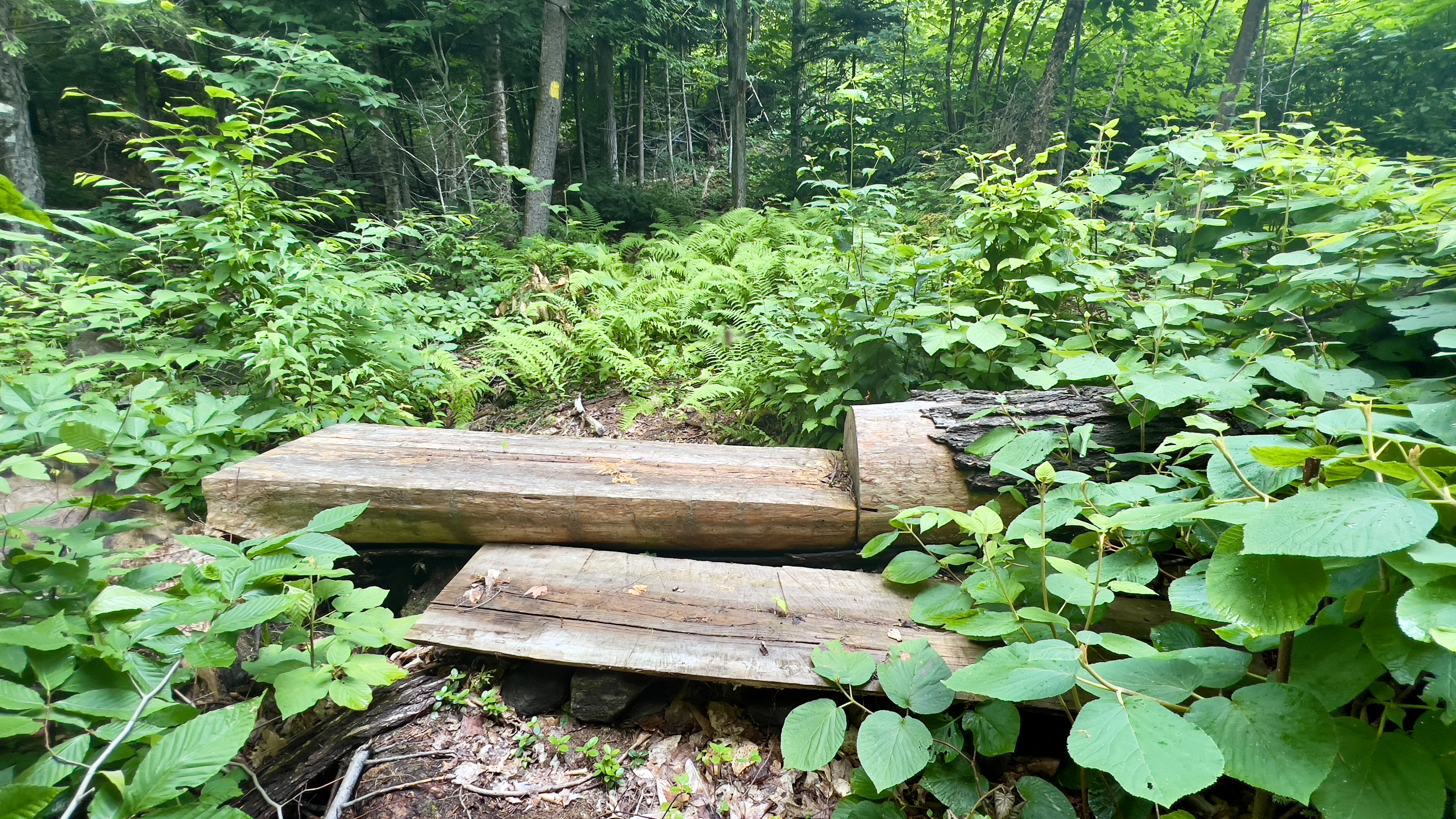
 Welton Falls Trail in the Cardigan Backcountry had been closed due to a change in land ownership, however a group of trail maintainers in the area have reconstructed the trail on new land and broken it effectively into a Welton Falls Trail North and South, connected by a merge with the Elwell Trail. I decided to explore the new South Trail today. We're still in a heat wave and the bugs are still insufferable. Both of these factors unfortunately made the overall experience less than ideal, but I still got it done and was grateful to be outdoors. Identifying the trail is the biggest hurdle at the moment. There are no signs on the street, so without prior knowledge you'd never even know the trail is there. The trailhead is on private land at 420 Welton Falls Road. Parking is on their right of way/driveway. There is room for a couple of cars without blocking the road. Continue down the right of way staying straight when their driveway goes left. Cross a little bridge and there is a sign for Welton Falls Trail South and an arrow pointing diagonally left. I had a pre-downloaded track just in case, and I was happy about that at this point, otherwise I likely wouldn't have found the trail. The road heads around to the right. The description I had said cross a clearing on the left here. There was an area with no trees, a trailer and a pigpen with several large and loud pigs. The grass here was also very tall, waist high for me at least, and there did not appear to be any sign of a path across. Per the track I had though, this was the trail, so I sort of just went for it. Luckily, at the point at which I started to cross, once in the grass, a very, very faint path could be identified, so I followed that and about halfway across I looked up and saw a yellow blaze on a tree on the far side. Confident I was heading in the right direction now, I continued.. let me say, crossing that "clearing" was a real pain. The ground was uneven but you couldn't see through the grass to be sure on what you were stepping.. I couldn't tell if the ground was wet or muddy, which it was a couple times.. it was also thorny and had long strands that kept tripping me up like they were grabbing at my ankles! At the trees, an old road opened up, and the trail followed this for the first 0.7 miles. It was much nicer being on a wide road, though this is where the bugs kicked in, so the bug net came out. At 0.7 miles, cross a road and continue on trail into the woods. The trail was really well marked, and was easy to follow. It climbed, rather steeply at times through a variety of terrain. Sometimes it was rocky and rooty, sometimes lovely pine needle path and there was even one very short bouldery section. The trail crossed several old roads/maybe snowmobile trails, so keep an eye on the blazes. If you stop seeing the yellow markings, back up and figure where you went wrong. This happened to me once. I got caught up following a road section and didn't catch that the trail veered off into the woods. So keep an eye on those blazes, and you'll be fine. It felt steeper than the 700ft of gain or so sounds. And I found in some places, the steepness was sideways, rather than front/back which my ankles didn't really like at all. I imagine as the trail becomes more traveled this sort of thing may wear in some and be a little less severe like that. At about 1.2 miles, the trail briefly merges with Gove Road, which was nice and open and surprisingly had a lovely view across to Cardigan and Firescrew. Back into the woods, the trail continues to climb before popping out again on another old road/snowmobile trail, which I was not expecting and stays on this until the intersection with Elwell Trail. This section was also rather uneven and I lost count of the times I rolled my ankles! What seemed to take a long time to climb up to my turnaround point, although only 1.8 miles was much quicker/easier to descend and I was down in no time. 

Strava Activity

Trail access at 420 Welton Falls Rd

Trailhead sign down the right of way

Cross the field to the left of the sign

Spotted a blaze on the tree on the right

Blaze on the far side of the clearing

Immediately opens up to an old road

at 0.7 miles cross and continue on trail

little boulder section

almost missed this one as the path appeared to go straight

almost got caught on this road too, but cross straight over

approaching Gove Rd clearing

well marked across Gove Road


surprise!

turn right here


do not cross the bridge, go left into the woods

signs of trail maintenance

this guy looked like he was the doorman


approaching the intersection with Elwell Trail

Elwell Trail intersection

Elwell Trail intersection

looking back down Welton Falls Trail South

nice open road at the start/end of the trail