Saturday, September 12, 2020

Mt Cube

 Another perfect weather forecast, another opportunity for big views. I opted for Mt Cube, I was on a time restriction today and this fit the bill. I knew it would be busy, Mt Cube is one of the more popular summits in the area. When I arrived on Baker Road, I was the 3rd car. 4 and a bit hours later, there were 20 cars. Thankfully I think I passed most of those people as I was descending, so the summit wasn't too bad when I arrived. I chose the Cross Rivendell Trail for my ascent. There are 3 trail options for Mt Cube, the other 2 being the Appalachian Trail from the North and South (otherwise known as the Mt Cube Trail and Kodak Trail). Parking on Baker Road, there is a pull off area 0.1 miles from the trailhead. This trail ended up being a contender for one of my most favourite trails to date. It started off super smooth and very gradual in ascent. At about 0.7 miles you encounter a large boulder and the trail starts to steepen just a little and get a little more technical with rocks and roots. Just as your quads start to warm up with that terrain it gets a little steeper again and the rocks become a little larger, but nothing overly crazy or sketchy at all. You hit an area of spruce forest with beautiful tall trees. There is one little area cleared which provides an early peek at what is to come. Due to my earlier departure, there was a beautiful undercast still hanging around the area. A little further on, you hit the first of the ledge slabs and the view opens right up, which provides a great place to catch your breath. The trail then descends just a little before making the final climb which is rocky and rooty again. About 0.2 miles from the summit the trail climbs a rather steep slab, which I imagine would be rather treacherous in Winter or if it was wet. The summit is beautiful, lots of space for everyone to spread out and enjoy the views. I particularly liked looking over at Smarts Mountain where the fire tower appears as a tiny speck above the trees and thought back a few weeks to being up that tower myself! I didn't really linger on the South summit as I was going to head over to the North Peak, where I had read the views are equally beautiful but much less crowded. I continued over to the Mt Cube trail and descended about 0.1 miles before reaching the intersection with the North Peak Side Trail. From here it is not marked, but easily followed. Once you reach the ledges, look out for little cairns that mark the way to the views. The ledges are all quartzite, which was sparkly in the gorgeous sunshine. I highly recommend taking the time to visit. It was 0.5 miles each way from the South summit and well worth it. I relaxed and enjoyed a snack before heading back down the way I came up. The trail maintenance on the Cross Rivendell trail is definitely worth noting. The CRT is a 36 mile trail, which begins/ends depending on your direction of travel at the Mt Cube summit. The trail was one of the best maintained trails I have been on. Mt Cube is definitely a peak worth visiting!

Strava Activity

My pictures uploaded backwards for some reason?!

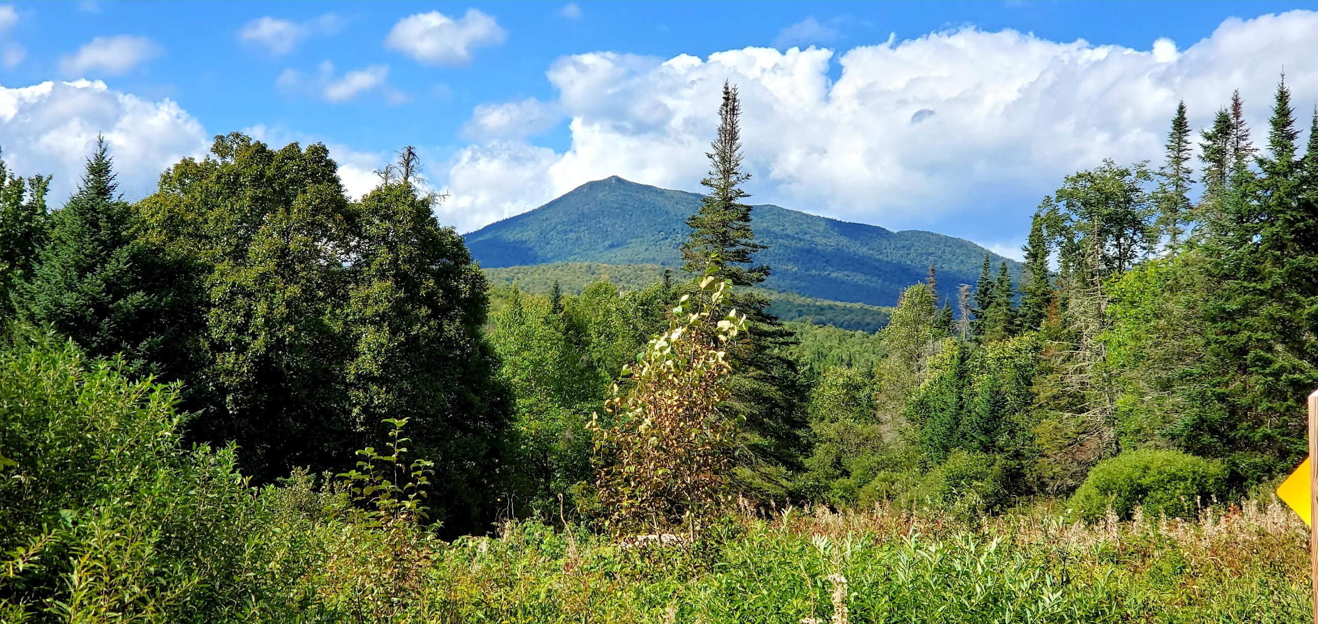
looking up at Mt Cube from Rt 25A

Smarts Mountain from Mt Cube

Quartzite on North Peak

Views from North Peak


Intersection of North Peak Side Trail and Mt Cube Trail


Views from the South summit


Final slab climb to the South summit

From a viewpoint below the summit


Peakaboo view on the way up


About 0.7 miles from the trailhead is this huge boulder


Saturday, September 5, 2020

Sugarloaf

The forecast for today called for perfection. So I wanted to go big on views. I also was going to have my 14 year old son with me (reluctantly). Don't get me wrong, I love my kids, but they're not enthusiastic hikers. Mr 14 is fine once he gets going, it usually takes some sort of negotiation (ie bribe) to keep him moving and once he reaches the top he seems happy, then he crushes the descent in order to get back to the car. This was a last minute call on where to actually go. Everything I was looking at had recent reports of being super crowded, or had sections of trail that I was somewhat nervous about with Mr 14. He is a phenomenal hiker, which means he can often get a little ways ahead of me on the trail, and me being the helicopter parent that I am, I like to have them in my line of vision if there are going to be sketchy sections. Thus we ended up on Sugarloaf in Groveton. Double whammy as it's on the NH Fire Tower list and the 52 With a View list. It was a little more elevation gain than I had been looking to tackle, but the trail descriptions (aside from the steepness) were all reading super non-technical. It ended up being perfect. The trail head is 8.3 miles down a dirt road/ATV road in Groveton, NH. I thought this would be a quiet road as far as cars go, maybe ATVs.. however we saw zero ATVs and the road was actually quite busy with cars! I guess not surprisingly it's Labor Day weekend with perfect weather. The Sugarloaf Mountain Trail starts on a private driveway for a camp called "Finally Inn". There are enough spaces for 2 cars at the end of the driveway, which unfortunately were already occupied when we arrived. I was able to park off the road at the very end of the driveway without blocking the parked cars/road or driveway thankfully. Head up the driveway, around a closed gate preventing ATV traffic (this is a snowmobile trail in Winter) and 0.1 miles to the first intersection. For that 0.1 miles you are also on the Cohos Trail, which continues straight at the junction. We took a right on the Sugarloaf Mountain Trail. Another 0.3 miles is an unmarked fork. Yellow arrows point left for the snowmobiles, Sugarloaf Mountain Trail continues straight. At this point the trail starts to get a little steeper and a little rougher in some places, however overall the trail has great footing and is never technical. Any moderate or hard rating it may get is purely for the grade. There are no views or anything exciting on this trail, it's just a good hard slog up the side of a mountain in the middle of nowhere! Around 1.7 miles from the road is a cleared area with the remains of the old fire wardens cabin alongside the trail on the right. Past this, the trail heads through some waist high grass (at this time of year) and appears rather overgrown, however the path is still fairly easy to follow. Keep right at the fork with cement blocks and head up the final 0.5, which does not let up with grades until the very top. Just remember it's all worth the work! At 2.2 miles you reach the ledgey summit with views for miles. So spectacular. I was so glad to have chosen this mountain on this perfect day. There is an old cast iron stove and some artifacts from the old fire tower. My son and I enjoyed a snack while taking in the views before heading back down. This is a hidden gem not to be missed. 


Remains of the fire wardens cabin


Sunday, August 30, 2020

North & South Doublehead Mountains

 I had a buddy today! We basically talked the entire time, so even though I kept my average snail's pace, it didn't feel so bad. We parked in the lot on Dundee Road and headed up the Doublehead Ski Trail for 0.6 miles until the intersection with the Old Path. We decided to ascend Old Path and descend the Ski Trail. Old Path is consistently steep, but the footing is great the entire way and the trail to the intersection in the col is only another 0.6 miles. I find I can tolerate steep sections when I know it's not very long. Hiking for me is definitely a mental game (as well as physical naturally). We reached the col and headed to the right towards South Doublehead. The incline to South Doublehead really isn't that bad, and you reach the ledges with the views in roughly 0.3 miles. We could hear the wind whipping around the trees as we ascended but hadn't really felt the wrath as we were protected on the trail. Once on the ledges, we got the brunt of it. Later on the news I saw them report upwards of 40+ mph wind gusts in that area. It was quite exhilarating and thankfully was blowing us towards the safety of trees behind us and not out towards the ledge drop off! We enjoyed the gorgeous views until it started to get a bit chilly standing there, so we headed up towards the true summit and out to the end of the spur with some more amazing views. After a snack break and plenty of picture taking, we back tracked to the col and up to North Doublehead. Again, about 0.3 miles (from the col, so 0.6 from the summit of South) but this time much steeper than we had just come down. We made it to the cabin, which was unoccupied at this time, however there were several groups on this summit spread out enjoying the lovely cooler (and bug free) weather. Vanessa and I found an empty little spot in the sun and enjoyed another small snack. The views from North Doublehead (as we had read about) are definitely not as grand as from the South summit, but the little peekaboo views you get are still beautiful. We descended via the Doublehead Ski Trail which is wider than an average trail with it being a back country ski trail and definitely less steep than the other options. Longer and still a steady down, but easier on the knees! We passed a couple groups heading up and before we knew it were back at the car. My Suunto battery died on this hike, so I don't have a complete picture of what we did, but it was roughly 4.1 miles and we think between 1700-2000ft of elevation gain. Definitely a good bang for your buck hike!

Strava Activity


Intersection of Doublehead Ski Trail (to the left) and Old Path (to the right)


The col between the North & South summits

Views from the South summit ledges


South Doublehead Summit


End of the South summit spur path

Looking over at North Doublehead from South Doublehead


Looking towards Kearsarge North


The intersection of Old Path and New Path on the South summit

The cabin on the North Doublehead summit


Intersection between Old Path and Doublehead Ski Trail on the North summit