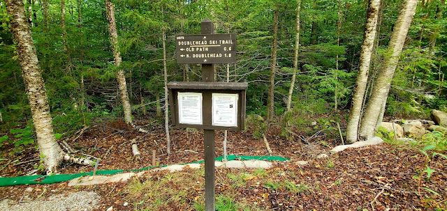
I had a buddy today! We basically talked the entire time, so even though I kept my average snail's pace, it didn't feel so bad. We parked in the lot on Dundee Road and headed up the Doublehead Ski Trail for 0.6 miles until the intersection with the Old Path. We decided to ascend Old Path and descend the Ski Trail. Old Path is consistently steep, but the footing is great the entire way and the trail to the intersection in the col is only another 0.6 miles. I find I can tolerate steep sections when I know it's not very long. Hiking for me is definitely a mental game (as well as physical naturally). We reached the col and headed to the right towards South Doublehead. The incline to South Doublehead really isn't that bad, and you reach the ledges with the views in roughly 0.3 miles. We could hear the wind whipping around the trees as we ascended but hadn't really felt the wrath as we were protected on the trail. Once on the ledges, we got the brunt of it. Later on the news I saw them report upwards of 40+ mph wind gusts in that area. It was quite exhilarating and thankfully was blowing us towards the safety of trees behind us and not out towards the ledge drop off! We enjoyed the gorgeous views until it started to get a bit chilly standing there, so we headed up towards the true summit and out to the end of the spur with some more amazing views. After a snack break and plenty of picture taking, we back tracked to the col and up to North Doublehead. Again, about 0.3 miles (from the col, so 0.6 from the summit of South) but this time much steeper than we had just come down. We made it to the cabin, which was unoccupied at this time, however there were several groups on this summit spread out enjoying the lovely cooler (and bug free) weather. Vanessa and I found an empty little spot in the sun and enjoyed another small snack. The views from North Doublehead (as we had read about) are definitely not as grand as from the South summit, but the little peekaboo views you get are still beautiful. We descended via the Doublehead Ski Trail which is wider than an average trail with it being a back country ski trail and definitely less steep than the other options. Longer and still a steady down, but easier on the knees! We passed a couple groups heading up and before we knew it were back at the car. My Suunto battery died on this hike, so I don't have a complete picture of what we did, but it was roughly 4.1 miles and we think between 1700-2000ft of elevation gain. Definitely a good bang for your buck hike!
Strava Activity
 |
Intersection of Doublehead Ski Trail (to the left) and Old Path (to the right)
|
 |
| The col between the North & South summits |
 |
Views from the South summit ledges
|
 |
| South Doublehead Summit |
 |
End of the South summit spur path
|
 |
Looking over at North Doublehead from South Doublehead
|
 |
| Looking towards Kearsarge North |
 |
The intersection of Old Path and New Path on the South summit
|
 |
The cabin on the North Doublehead summit
|
 |
Intersection between Old Path and Doublehead Ski Trail on the North summit
|


No comments:
Post a Comment