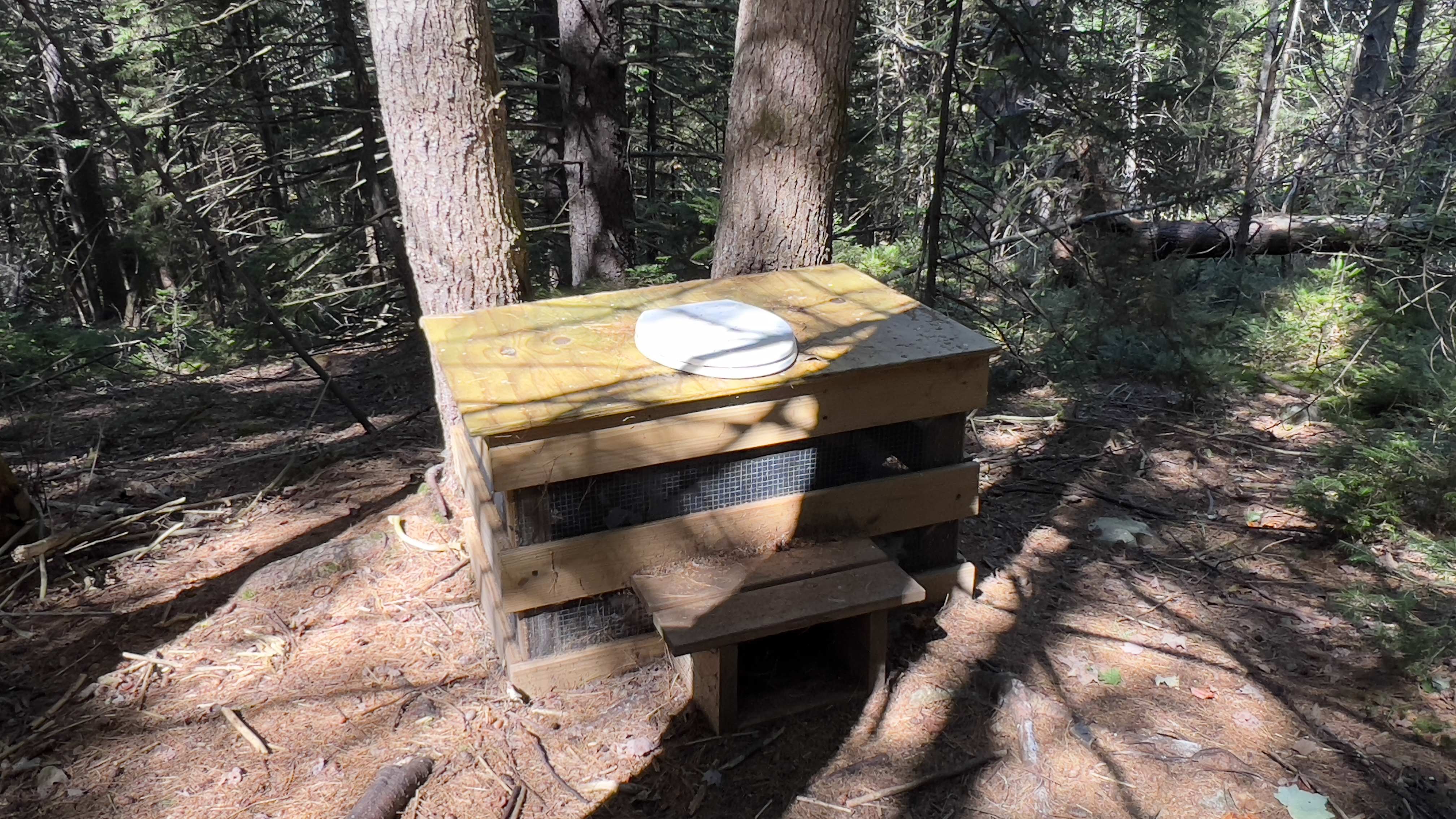
Having previously ascended Lovewell Mountain from Lovell Mountain Road, I needed to complete the trail from the other side. Lovewell Mountain Trail is a section of the Monadnock Sunapee Greenway and I needed to complete the section from Half Moon Pond Road to the summit. Having just been at this trailhead a few weeks ago when I hiked into Pillsbury State Park, I knew it needed to be accessed before Winter as the road is not maintained during that season. The last half mile of Half Moon Pond Road after Martin Road is very rough and should only be attempted by high clearance vehicles. As was the case last time, when I arrived there was already a vehicle parked, though I never saw the occupants. Today was absolutely perfect hiking weather, crisp temperatures without being cold, delicious light making everything glow and no bugs! I headed into the Max Israel State Forest where the trail immediately begins a gentle ascent. It is roughly 2.3 miles from Half Moon Pond Road to the summit and the trail goes over 3 knobs before the final ascent to Lovewell Mountain. The trail is impeccably maintained and just gorgeous meandering through the forest with a variety of up, down and flat to give you the ability to soak it all in without being too out of breath! I kept stopping to look around, it was so pretty. Roughly 0.8 miles from Half Moon Pond Road and atop the 2nd knob is Max Israel Shelter, which I visited on my descent. The shelter even has a not so private privy! The final ascent is more technical with rocks and roots, but made a little gentler with switchbacks. It was here I was passed by the only people I saw on the hike, 2 ladies and a pup named Norm. Along this final push you also enter Lovewell Mountain State Forest. The summit was bigger and more open than I had remembered from my previous visit and a bench has been added at the viewpoint, which was a pleasant surprise! Trees do restrict the view ever so slightly, but still a gorgeous view over towards Kearsarge and surrounding bumps is an added bonus. I remembering being pleasantly surprised on my first visit, and I was again this time around. Definite hidden gem of NH hiking! As I arrived back at my car, another car was just parking with a lady removing a bike. She had been planning on riding 7 miles back into Washington township to leave her bike and hike back to her car. She asked if I would mind driving her instead, which of course I was happy to do.. so if Carol from Grantham somehow ends up stumbling onto this page *waves hello*
Saturday, September 17, 2022
Sunday, September 4, 2022
Monadnock-Sunapee Greenway - Section Hiking
The Monadnock-Sunapee Greenway is a roughly 50 mile trail stretching from the summit of Mt Sunapee to the summit of Mt Monadnock. I'm tackling this trail in small bits and pieces, although many do make it a multi-day thru hike. This was my 5th hike on the MSG and my adoration of the trail continues. It is impeccably maintained (in fact on my hike today, I passed a trail adopter making sure his section was clear) and very well marked. Today I started at Brown Road in Harrisville, where there was space for a few cars where the trail turned off the road and headed into the woods. Just as I was feeling a bit remote, a young family passed by that must live locally and were out for a stroll. That made me feel a bit better and I geared up and headed out. I was doing a 4 mile out and back section, with nothing really scenic along the way, just a pleasant walk in the woods. Within a half mile or so of starting I reached an area called Eliza Adams Gorge. There was some construction equipment parked and it looks like they must be doing some repair work on the Howe Reservoir Dam which is adjacent. Unfortunately at this time, the reservoir is practically dry and there was barely a trickle coming over the dam, thus the "Gorge" wasn't the spectacular sight I have seen in pictures on Google. Continuing on, I soon reached the Spiltoir Shelter. Amazingly, there was a large stockpile of water bottles, which the trail adopter I later passed said had been donated by the Monadnock-Sunapee Greenway Trail Club due to the drought conditions right now and lack of water supply. Continuing on, the trail was a rolling up and down, but nothing too strenuous. The highlight was a town line sign for the Harrisville/Dublin town line! At about 1.5 miles from where I started, I crossed over Rt 101, which thankfully on my way out was relatively quiet so I didn't have to wait too long to cross. On my way back it was a bit busier, but I made sure to wait till it was completely clear before attempting to cross. On the other side was a pull off with room for parking if needed and a gate. A lot of this section was old road, so wide with relatively good footing. Somewhere around a mile from Rt 101, the trail actually veered off the old road and became an actual trail, descending down until it met with Old Marlborough Road in Dublin. Turning right here, it was roughly a 0.5 mile road walk (dirt road) before heading back into the woods and the final (for me) 1.1 miles to the Dublin Trailhead for Mt Monadnock. Once I reached that point, I turned around and retraced my steps to the car. Highlight of the return trip was passing 4 horses and their humans on the trail. I love seeing horses on the trail, they are so beautiful.. but I don't love what they leave behind, always right in the middle of the trail meaning I have to pay extra attention to where I'm stepping! Just as I arrived back at my car, a lady riding an E-Bike mountain bike headed into the woods.. just going to show this trail is a great resource for all sorts of activity!
![]() |
| sign on a tree where I parked off Brown Road |
![]() |
| crossing Eliza Adams Gorge |
![]() |
| Howe Reservoir Dam |
![]() |
| Spiltoir Shelter |
![]() |
| town line sign |
![]() |
| crossing Rt 101 |
![]() |
| entering the trail at Rt 101 |
![]() |
| where the trail turns off the old road onto actual trail |
![]() |
| Old Marlborough Road walk |
![]() |
| re-entering the woods off Old Marlborough Road |
![]() |
| Dublin trailhead |
![]() |
| hiker register near Dublin Trailhead |
![]() |
| entering trail heading north from Rt 101 |
Saturday, August 27, 2022
Mount Monadnock
There are 39 active trails on Mount Monadnock plus several abandoned. I've previously done 3 1/2. I've been eager to get back and do some more exploring on this beast of a mountain, but I've always found an excuse.. the weather wasn't right, I didn't have enough time, my fitness wasn't good enough.. well 2 out of 3 ain't bad.. the weather was perfect, and I had all the time.. so I headed back over to the State Park headquarters with my reserved parking spot and a plan. I arrived around 830am to plenty of cars already (not surprisingly), geared up and headed out for the Parker Trail. Immediately I missed the entrance, but luckily a kind ranger was parking his car and pointed me in the right direction. I was only off by a few hundred feet. Parker Trail was a nice gentle start, skirting around the Poole Reservoir and following along a slope at relatively easy grades for about a mile and a half. I followed all the way to the Halfway House Toll Road and then backtracked to the intersection with Cliff Walk. This was where my ascending began, but honestly it wasn't as bad as I had thought. There were definitely some technical areas, but there was a lot of level areas too. Great to catch your breath! I knew there was a ladder on this trail, but I had been anticipating it being like some of the other "ladders" I have experienced, which are more like stairs.. this was an actual ladder! Just before the intersection with Hello Rock Trail, is a viewpoint named Hello Rock. The first real views of my day. I spent the rest of the day enjoying the same views from time to time just from slightly different angles!. I turned onto Hello Rock Trail and followed that back over to the Halfway House site. I saw the most people of the day in the brief moments I was on the Toll Road. I figured the summit was busy, but I had no intentions of going up that far, instead enjoyed the solitude of exploring the smaller trails that criss cross the slopes of Monadnock. From the Halfway House site, I took Do Drop Trail. There is no sign right at this intersection, but it creates a triangle point with Hello Rock Trail off the Toll Road. A few hundred yards in are signs for the Side Foot Trail and Do Drop Trail. I headed up Do Drop Trail. This trail is short at only 0.2 miles, but packs a mighty punch going up 300ft in those 0.2 miles. I rejoined Cliff Walk just above the view point named Thoreaus Seat. This spot took me by surprise as it was rather precipitous. A rather tall rock with narrow spine and decent drop off on either side. Not down a cliff drop, but you'd hurt yourself if you fell drop. Being vertically challenged, I had to pull out some old gymnastics moves to get myself up and over this rock, briefly stopping on top amid my fears of slipping to take a couple pictures. Just before this spot, Thoreau Trail branched off, only marked with a white arrow painted on the rock (as far as I saw). None of these small trails were blazed, but were mostly easy enough to follow with a well established footbed. Thoreau Trail descended gently back to Hello Rock Trail and a junction with Point Surprise Trail, which I took back up to Cliff Walk. Up and down was the name of the game. I was amazed at the variety in terrain, from technical rock puzzle, to mossy/ferny trail to lovely woods.. it kept the day interesting. Point Surprise Trail met up with Cliff Walk at another view point called.. you guessed it, Point Surprise. From here I descended back down Cliff Walk to where I had turned onto Hello Rock Trail, to fill in that piece, then ascended again to Point Surprise, this time continuing on Cliff Walk back to Thoreaus Seat and the junction with Lost Farm Trail. By now I was getting tired but was happy to be on the final stretch. Lost Farm Trail was a slightly gently descent back to Parker Trail. Although on tired legs, the sometimes neverending feeling of navigating rocks and roots wore thin. I started tripping on anything and everything, but thankfully never actually fell. Back on Parker, I was very grateful for the easy going back to the car. In total 6.7 miles and 6 1/2 trails checked off the Monadnock tab of the AMC South spreadsheet.
![]() |
| As I got near the mountain it was shrouded in cloud! |
![]() |
| Poole Reservoir |
![]() |
| cool glacial erratic that seemingly stopped to avoid ruining the wall |
![]() |
| Parker Trail off Halfway House Toll Road |
![]() |
| Cliff Walk was marked in White Diamonds and White Cs |
![]() |
| view from Hello Rock |
![]() |
| straight up |
![]() |
| variety of terrain |
![]() |
| I see a frog |
![]() |
| view from Point Surprise |


.jpg)


.jpg)


