Saturday, December 9, 2023

Bear Mountain

 There are probably a lot of Bear Mountains in New Hampshire. This one is in Hinsdale and is part of the Wantastiquet-Monadnock Trail. In my efforts to still avoid snow, I again headed far south. Parking for this trail is at the Kilburn Trailhead across the street in Pisgah State Park. Carefully cross Rt 63 and walk maybe a tenth of a mile down to a gate. Here you will see a map for the W-M Trail. Pass through the gate and follow the blazed stakes around the abandoned vehicles and up the road. Today it was frozen mud and a little bit of ice, and I wondered if it would be like this the entire way. I had my spikes in my bag, but for now I could avoid the slippery bits easily enough. Another abandoned truck is in the woods halfway up the road, and then you come upon a cabin. I always find this a bit disconcerting, but there were no signs of life and I continued on my way. The road got a bit muddier/icier but soon came to a sharp left turn. The mud/ice ended here thankfully and the next couple tenths was through some overgrown grasses, but continued to be well marked. At about half a mile from the car, the trail enters the Bear Mountain State Forest and everything changes. The trail became pine needle bed and the forest became enchanting. I passed a bench at a small cleared area, but there were no views this morning with low hanging clouds. The trail continues to climb gently before reaching a sign on a tree stating Bear Mountain Peak.. this is in fact not the true summit of Bear Mountain, which is about 75 yards off trail ( I did not visit the true summit). There are no views, so I just continued over the mountain and started down the other side. The descent started moderately at first, then became rather steep and even though there was no snow or ice, it was very leafy, which made it slippery going at times. There were a couple areas that could use a little maintenance, but the trail is very well marked and nothing impeded progress. Once down the other side, I crossed Plain Road and started up the Bear Mountain Connector Trail.. which was renamed the Tom Duston Trail this past September. I had read this trail was rather steep and that description rang true. Only 0.7 miles up to the Moon Ledge vista, but that 0.7 miles packs a lot of punch, particularly after having come up and over one mountain already. My legs were burning by the time I reached Moon Ledge. I had been up here a couple years ago when doing the Daniels Mountain Loop, so reaching it from this direction completed all the trails in the Madame Sherri Forest/Wantastiquet Mountain immediate area for me. I stopped for a snack and enjoyed the views.. and even contemplated if there was another way back to the car via roads instead of having to go down and up and down all those steep climbs.. alas, there wasn't anything miles and miles long, so I began the steep descent back down the Tom Duston Trail. As is always the case, it wasn't as bad as I had imagined while climbing up. I saw my first 2 people of the day (who commented that they do this trail almost every weekend and I was one of the first people they'd ever seen on it!) and then I encountered a hunter a little further down. Back at Plain Road, I crossed back over and took a deep breath before having to do the steep climb back up Bear Mountain. Although there is absolutely nothing to scenic to see along this trail (with the exception of the bench and small lookout) it was a pleasant walk nonetheless.

Strava Activity

Where the trail enters from Rt 63

left turn off the driveway/road

into the overgrown grass

and then it becomes lovely forest trail

not the true summit of Bear Mountain

heading down the backside of Bear Mountain

some areas need some clean up, but it's well marked

end/start of the trail on Plain Road

Heading up what used to be known as Bear Mountain Connector

remnants of the old trail name


Moon Ledge


Saturday, December 2, 2023

Metacomet-Monadnock NH Sections 1 & 2

 Today I continued my mission of no snow.. still not ready. I went as far south as I possibly could with my remaining hikes for redlining. The Metacomet-Monadnock Trail is part of a really long thru-trail that actually starts in Connecticut and ends at the summit of Mt Monadnock. I'm only completing the NH section that is about 18 miles long, beginning at the MA/NH border in Richmond, NH. I have been enjoying the longer thru trails as they give me some good Winter options. This was no exception as I saw no snow at all. I parked at the end of Section 2 on Old County Road at Dean Farm Road, where there is room for a couple cars to park and not block either road. It had started lightly raining as I drove in, so I started in a rain jacket and covered up my pack.. thankfully it was a relatively warm day, so no freezing or icy conditions. I walked down Old County Road to the end, which was roughly 0.4 miles on hard packed dirt. Turned left onto Rt 119 and followed that for about 0.2 miles, then carefully crossed and turned onto Monument Road, another hard packed dirt road. I followed that to the end of the maintained section and residential area. From here the road becomes a bit more of a Class VI road, but was still easy footing. At about 2.2 miles, the road takes a sharp right with a cleared section on the left. It looked like maybe there were some views of the surrounding area here, but I was in complete whiteout conditions at this point, so nothing for me to see. In roughly a tenth of a mile, the road met up with a recent logging operation and a very large clearing. Due to some heavy rain last night, this area was very wet and muddy. I turned left, staying on Monument Road and from here it was a true Class VI road. Over the past Summer, this area was logged and thru hikers had to bypass a section of the trail that was closed by following the road. The actual trail has very recently been reopened but the logged section is still very fresh and messy. The route has been marked with blazes and flagging tape, and I didn't find it difficult to follow, but did find it challenging to cross the logging slash in some places as there was some serious mud and wet areas from recent rain. It was very slippery and it was a mental game to keep moving forward. I kept telling myself, it's not forever, it's not forever.. and sure enough, just about 0.6 miles later, the logged section was behind me and I was in the woods! For this I was grateful and while there was nothing scenic or special about this section, I just bounced along ecstatic to be out of the yuck! The trail descends down to meet Greenwoods Road. Here, there was a truck parked that belonged to the only 2 people I saw all day that were returning on the next section. Crossing Greenwood Road, the trail re-enters the woods and so begins the most magical, mystical, mountain laurelly section of trail! I may have felt that way after the last 3.5 miles of road/mess, or it may have been the foggy, dreary day that contributed to my emotions along this 0.6 miles to the MA border.. either way, it was amazing. The trail starts out alongside a beaver pond then meets up with Falls Brook with some cascades and lots of mountain laurel before entering a mini-gorge area that was just amazing with so much moss and some amazing rock formations! It truly felt magical! I must have stopped every 5 feet to take pictures and videos or just soak it in. I reached the MA/NH border which was my turnaround point, but I could see on the map just past this area a landmark named "Stone Bridge". I continued on and just a few hundred feet down I could see what I believed to be the stone bridge. It was slightly off trail and covered in moss, so I had no intentions of trying to cross with how slippery it had been so far. I took a couple pictures, then retraced my steps back to Greenwoods Road. This time, instead of backtracking over the logging slash, I opted for the "bypass" from the Summer, which followed Greenwoods Road back to Monument Road (about half a mile). Turned right on Monument Road, which was rocky, wet and muddy in places and followed that back about 0.7 miles to where I had turned off into the woods and the logged area earlier. The one bonus in taking this route back (besides it being quicker due to being a road walk) was finding a marker for the birthplace of the mother of James Garfield, President of the United States! From here, I just retraced my steps back to the car. 

Strava Activity

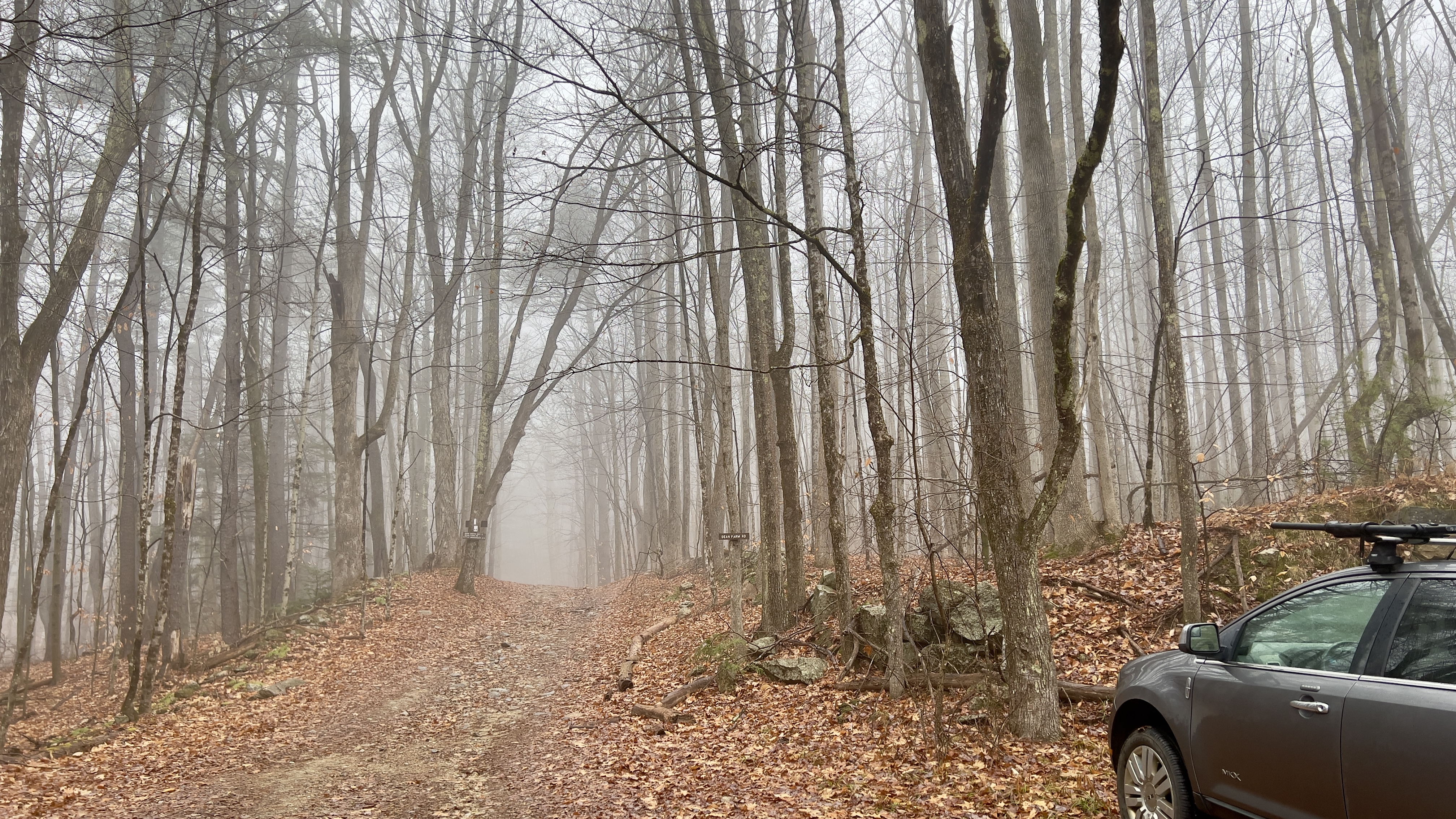
Foggy start at Dean Farm Rd

walking along Monument Rd

left at the logged clearing

the newly reopened trail through the logging operation


some of it looked like this

and some of it looked like this

and finally back into the woods


magical mountain laurel

luckily I had a raincoat on, as this was wet!

Falls Brook


some of the gorge formation


the Stone Bridge

another view of the Stone Bridge


more of the gorge formations

along the bypass on Monument Road

a bit rougher but still easy going

bonus finds!


Saturday, November 25, 2023

Pisgah State Park - Habitat Loop Trail

 When I did my first hike at Pisgah State Park, I was thinking it would take forever to complete all the trails and all the miles.. I hiked in Winter, Spring, Summer and Fall.. there were some amazing days, and some not so amazing days (it gets reeeeeallly buggy there in Spring/Summer).. but looking back, I can say this place is special. There is nothing specific to see, no high summits or must see places.. just miles and miles of peaceful trails. Some lovely ponds.. an overlook here and there. If you don't want to see many people, this is the place to go. Today I tackled my last 2 trails to complete the park. I had a half mile on South Woods Trail and the newly built Habitat Loop Trail. I spent almost as much time driving out there than I did on the hike, and it was bittersweet after all this time to be done.. I  lingered a little longer than normal today. I parked at the Horseshoe Road parking lot, where there were already a few cars.. but I only ever saw folks while in the parking lot, none out on the trails. I was looking for no snow, as I'm not mentally ready for Winter hiking yet.. there were small traces of snow and ice, but nothing that caused any issues and I needed no traction. I continued down Horseshoe Road. Just a couple tenths down this road, the first of the Habitat Loop Trail markers can be seen. There are 26 markers along a roughly 2.5 mile loop pointing out places of interest.. being almost Winter, most of them today were not really visible, but I took a peek each time I passed one. A guide to what each marker represents can be found on the Friends of Pisgah website, along with a map. I continued past South Woods Trail, which also coincides with Habitat Loop Trail as this would be my return. At the fork where Winchester Road meets Horsehoe Road, Habitat Loop Trail veers right, but having done that section on my very first hike in the park, I opted to head towards Old Chesterfield Road and cut off that corner of the Habitat Loop Trail. Continuing onto Old Chesterfield Road, just about a tenth of a mile down, Habitat Loop branches off to the left. This whole section is snowmobile trail/gravel road so the footing is easy going. After 0.3 miles, Habitat Loop rejoins Old Chesterfield Road for 0.2 miles before taking a left hand turn at a cleared section which is clearly marked with blazed stakes and crosses into the woods. The next half mile or so was a lovely ramble through the woods before reaching an intersection with a spur path to a marsh overlook. I followed the spur, which is only about a tenth of a mile long reaching a nice spot to stop for a snack with 2 lovely long new wooden benches overlooking said marsh and surrounds. Back on the main trail, it continues for another tenth of a mile before reaching the intersection with South Woods Trail, which was my turnaround point a couple months ago. I did take a right and head back down to the scenic overlook where I had visited previously. Along my final half mile South Woods Trail and Habitat Loop Trail follow the same route, which is more lovely trail before reaching back to Horseshoe Road and my completion of every mile in Pisgah State Park. It took me 15 trips and roughly 100 miles of hiking total!

Strava Activity


looking down Horseshoe Road


marker 1 was remnants of an original house

where Habitat Loop branches of Old Chesterfield Road

a pond created by beaver

Habitat Loop off Old Chesterfield Road again

new and old bridges


this marker was for the hemlock trees, but I liked the fungus!


new benches at the marsh overlook


South Woods Trail/Habitat Loop intersection

but first the scenic overlook on South Woods Trail


Eastern White Pine

and that's a wrap on Pisgah State Park!