Sunday, August 30, 2020

North & South Doublehead Mountains

 I had a buddy today! We basically talked the entire time, so even though I kept my average snail's pace, it didn't feel so bad. We parked in the lot on Dundee Road and headed up the Doublehead Ski Trail for 0.6 miles until the intersection with the Old Path. We decided to ascend Old Path and descend the Ski Trail. Old Path is consistently steep, but the footing is great the entire way and the trail to the intersection in the col is only another 0.6 miles. I find I can tolerate steep sections when I know it's not very long. Hiking for me is definitely a mental game (as well as physical naturally). We reached the col and headed to the right towards South Doublehead. The incline to South Doublehead really isn't that bad, and you reach the ledges with the views in roughly 0.3 miles. We could hear the wind whipping around the trees as we ascended but hadn't really felt the wrath as we were protected on the trail. Once on the ledges, we got the brunt of it. Later on the news I saw them report upwards of 40+ mph wind gusts in that area. It was quite exhilarating and thankfully was blowing us towards the safety of trees behind us and not out towards the ledge drop off! We enjoyed the gorgeous views until it started to get a bit chilly standing there, so we headed up towards the true summit and out to the end of the spur with some more amazing views. After a snack break and plenty of picture taking, we back tracked to the col and up to North Doublehead. Again, about 0.3 miles (from the col, so 0.6 from the summit of South) but this time much steeper than we had just come down. We made it to the cabin, which was unoccupied at this time, however there were several groups on this summit spread out enjoying the lovely cooler (and bug free) weather. Vanessa and I found an empty little spot in the sun and enjoyed another small snack. The views from North Doublehead (as we had read about) are definitely not as grand as from the South summit, but the little peekaboo views you get are still beautiful. We descended via the Doublehead Ski Trail which is wider than an average trail with it being a back country ski trail and definitely less steep than the other options. Longer and still a steady down, but easier on the knees! We passed a couple groups heading up and before we knew it were back at the car. My Suunto battery died on this hike, so I don't have a complete picture of what we did, but it was roughly 4.1 miles and we think between 1700-2000ft of elevation gain. Definitely a good bang for your buck hike!

Strava Activity


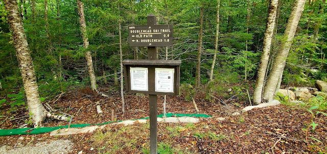
Intersection of Doublehead Ski Trail (to the left) and Old Path (to the right)


The col between the North & South summits

Views from the South summit ledges


South Doublehead Summit


End of the South summit spur path

Looking over at North Doublehead from South Doublehead


Looking towards Kearsarge North


The intersection of Old Path and New Path on the South summit

The cabin on the North Doublehead summit


Intersection between Old Path and Doublehead Ski Trail on the North summit


Saturday, August 22, 2020

Mt Martha & Owls Head (Cherry Mountain)

 After a 2 week hiatus from hiking due to other commitments, my sore muscles from Smarts Mountain were ready to take on another challenge. That came on Mt Martha and Owls Head, 2 sub peaks of Cherry Mountain in Carroll, NH. Mt Martha is on the NH Fire Tower list and 52 With a View, so double whammy. There are several ways of reaching Mt Martha, I opted for the shortest, which was from Rt 115 at a gravel parking lot opposite Lennon Road. There is a kiosk here and a trail sign just a short way in from the parking area. The Cherry Mountain Trail leads 1.7 miles to a junction with a spur to the Mt Martha summit (and then continues another 3.6 miles down the other side to Old Cherry Mountain Road). I had read this was a steady climb for most of the way, and that it was. The first half of this was mostly smooth footing with a pine needle footbed, paralleling a brook for part of the way. It gradually gets steeper and steeper eventually becoming an incline of rocks. I knew this was a more popular hike than I had been doing and there were several parties on the trail, however we all managed to stay at a good pace apart from each other and everyone was very polite when passing. I came up behind a group of 3 girls who were slightly slower than I would normally do, mostly because they stopped to rest quite a lot more. I knew I wasn't fast enough to get up and in front of them and hold pace, so I stayed behind them, stopping to rest when they did. This slowed me right down, but honestly I was glad for it as the incline and humidity of the day was having its way with me. I just accepted this was going to be a slow day and enjoy it for what it was. I ended up stopping for an extended period of time to have a (safely distanced) conversation with a lovely couple from Newport, VT which put the girls quite a ways ahead for the last half mile. At the junction for the spur, take a left and head the final 0.2 miles up a snowmobile trail, which improved footing, but the incline was still steady. At the summit, I met up with the girls and another couple plus their dog relaxing and taking a break. Although Mt Martha is on the 52 With a View list, the views are actually quite minimal. A couple of cleared patches give a peekaboo view out. Unfortunately today, the clouds were really low so there wasn't much to see. The remains of the fire tower are just past the summit and quickly becoming overgrown with some lovely wildflowers. Beyond the remains is a short spur to a slightly larger clearing and views (when the clouds aren't obstructing!). I was pretty tired by this point and debated whether to continue to Owls Head, but ended up deciding to give it a go. The views are reportedly much better from there, I just wasn't sure I was up for the 400ft climb back to Mt Martha on the return! Martha's Mile is a 0.8 mile trail between Mt Martha and Owl's Head. It climbs steadily down for about half the way, evens out for just a short while in the col, then climbs really steeply for the final 0.1 miles to Owls Head summit. It started to sprinkle as I was heading down, but I kept going. I had come this far. The final 0.1 mile climb stopped me in my tracks for a moment as the initial rock slab to climb up was taller than my waist, and I honestly wasn't quite sure how I'd get up (and I'm always thinking ahead to how would I get back down!!). Luckily there are just enough trees and roots that I prayed were stable enough to hold me (I always test them first before just throwing all my weight onto it) and went for it. It was a hands and knees, climb in a couple of spots, but I managed to get up and put the thought of getting down out of my mind for a moment to hopefully enjoy the view. The true summit is wooded with no views, but I went up to bag it anyway, then carefully made my way down the now wet and slippery slabs to the ledges with a view. The clouds were still low enough that the true beauty of the view wasn't visible, but I could see enough to imagine what it must be like! What was clear was looking back at Mt Martha and that climb back up! After a snack break it was time to take on that slab down... turns out it was actually much easier than climbing up, not easy... but easier! I didn't stop at the summit of Martha this time, just kept on going. The descent down the rock area did a number on my quads and they were exhausted by the time I reached the area of pine needle footing. I was going really slowly at this point. About half a mile from the parking area, the heavens opened up and it just poured! The rain cooled the air and I was just thankful to be off the rocks and almost finished. Of course when I got back to the car, I started thinking about where to go next week!

Strava Activity


Pictures never do an incline justice

Junction with Mt Martha spur

Firetower remains


Partial views from a summit spur path

Mt Martha summit


Martha's Mile was a little messy with blowdowns


Looking back down the 1st rock slab climb

Owls Head summit


Looking back at Mt Martha


Looking back down the second rock slab climb


Sunday, August 9, 2020

Smarts Mountain

 I pushed myself today with my biggest hike in several years. While my hike to Faraway Mountain several weeks ago was longer, this one had more elevation gain, so I'm calling this one my biggest. I was actually terrified going into this, because the Faraway Mountain hike left me completely spent for the last few miles, so I was nervous about how my body would handle this. I wasn't completely sure what to expect as I chose a lesser traveled route to reach the summit and hadn't really found any trip reports to help me. The most commonly hiked route to Smarts Mountain is the Lambert Ridge Trail/Ranger Trail loop. I chose to approach from the north on the J Trail, as it appeared to be a gentler approach looking at the topo maps online. Judging from the trip reports and videos I had seen of the Lambert Ridge Trail I do think I made the right choice for me. I parked at the gate on Quinttown Road in Orford and walked 0.5 miles up the gravel road to the trailhead for the J Trail. This is also the Appalachian Trail between Smarts Mountain and Mt Cube. The J Trail left off to the right, the Kodak Trail to Mt Cube left off from the left. There was 1 other car at the parking area when I arrived, so I also hoped it would be the quieter option. According to the trailhead sign, the summit of Smarts Mountain is 4.2 miles from the junction. The trail itself is in great shape, only 1 water crossing which is 0.1 miles from the start across Jacobs Brook. A bridge is there making that an easy crossing. The remainder of the trail has zero views and is just a long, consistent climb up. Nothing crazy in the way of inclines and several flat areas make this a really awesome day in the woods. Several areas of the trail seem to be consistently damp, but those small mud patches were easy to skirt around. In the larger areas of mud, bog bridges have been placed and recently renovated. The 4 miles was long (for me) but in terms of the trail itself, it really is a great trail. I imagine for a northbound thru hiker it's a little piece of respite before the gnarly reality of the White Mountains ahead. I reached the summit a little earlier than expected per my watch and found it much smaller than I had anticipated. The fire tower is surrounded by trees but is much taller than them, so all the views can be found from the top. I believe there are open ledges if coming from the Lamberts Ridge Trail, but I was too tired to go any further and explore. I enjoyed the views from the tower and called that a successful summit. The former fire warden's cabin is a little ways from the tower and is now an AT shelter. There was a thru hiker enjoying her lunch in front of the cabin, so I didn't go look inside leaving her in peace. There is also a privy on the summit, which although I didn't actually see it, I could sure smell it. A couple were leaving as I arrived, and another couple arrived as I was leaving, so I was able to enjoy the views to myself. It was a bit hazy, but definitely another beautiful mountaintop. The hike back was also long, but again relatively easy as far as grades and footing are concerned. I completed 8.6 miles in 6 hours. The one benefit to solo hiking is I am accountable to no one but myself, no need to feel guilty that I'm holding anyone up!

Strava Activity


Gate on Quinttown Road

J Trail head off Quinttown Road

crossing Jacobs Brook


Fire Warden's cabin shelter


Sunday, August 2, 2020

Chapel Rock & Pine Mountain

Today I set out for Pine Mountain in Gorham for 54/100 on the NH Fire Tower list, which also turned out to be 14/52 on the 52 With a View list for me. I hadn't realized at the time that Pine Mountain was one of the recent additions to the 52 With a View after several were removed for their views becoming overgrown. I parked on Pinkham B Road at the Pine Link Trailhead for Mt Madison. The access for Pine Mountain from this side is up the access road for the Horton Center, a Christian children's Summer camp. Hikers are welcome as long as they stay on trail and away from the camp buildings. I later learned that access to Chapel Rock is restricted from June-August, which I had absolutely no idea about. There are plenty of signs indicating access to the camp is restricted, but the trail to Chapel Rock has no indication. I felt bad once I learned this, as I would never intentionally visit somewhere off limits. So, if you happen to trip across this blog looking for information on Chapel Rock, the Horton Center has asked that hikers visit off-season only.

The road walk is approximately 1.4 miles. Alternatively there is a trail that branches off at 0.9 miles from the parking area called the Ledges Trail. Everything I had read described this as, although short, quite steep and tough, so I opted for the "easy way". I was happy with my choice as the road walk was definitely relatively easy. At 1.4 miles, the road continues straight into the camp which is Private. The Pine Mountain Loop Trail heads off into the woods to the right and parallels the road for approximately 0.2 miles before coming to an intersection with the Pine Mountain Trail. This little section appears as though it is relatively damp year round, but there are many log bridges over dicey areas making this a fun little section. At the intersection I chose to do Chapel Rock first, so I went straight on the Pine Mountain Trail for 0.3 miles at which point the trail swings left on bog bridges and follows the power line cut to the Chapel Rock entrance. Chapel Rock has gorgeous views over to Pine Mountain and Mt Madison behind. Being a Sunday morning, I savored the view for a moment and reflected on the beauty of the surrounds before heading back down and over to Pine Mountain. Back at the intersection for the Pine Mountain Loop Trail, this time I headed left for the summit. There are 3 viewpoints along the way, the first being Chapel View which also has a shelter available for rent and a lovely wooden bench at the outlook. Gorham View is second and Angel View is third (although the sign has been destroyed, the spur path was very obvious). Not far beyond the Angel View spur is the summit of Pine Mountain. Viewless, there are remains of the fire tower with the 4 cement footings. I had read about beautiful open ledges at the top of the Ledges Trail with a memorial bench carved into the rock, which according to 1 trip report was only 0.1 miles from the summit.. so I decided to go and check these out without having to actually traverse the steepest part of that trail. Definitely worth the short walk. The views are absolutely spectacular, and I can see why this mountain was added to the 52 With a View. I found the memorial bench and sat and enjoyed the view for quite a while. I could feel weather starting to come in, so after my break, I headed back to the summit and down the way I came up. I didn't encounter anyone else until the final 0.1 of the road walk, so overall a really wonderful day.

Strava Activity

the start of the access road to the Horton Center


Ledges Trail intersection

Pine Mountain Loop Trail intersection


Pine Mountain Trail intersection


Left to the summit of Pine Mountain


shelter at Chapel View outlook

Chapel View outlook

Chapel View outlook

Chapel View outlook


Gorham View outlook

Angel View outlook

Pine Mountain summit


views at the top of the Ledges Trail


Pine Mountain summit

back to Pine Mountain Loop Trail