Saturday, March 27, 2021

Joe English Reservation Part II

 My plans changed for this weekend and I felt like taking a big long walk in the woods.. so I headed back to Joe English Reservation to try and finish up as much as possible in this park. We had a pretty decent rainstorm yesterday so I was concerned many other places would be super wet and muddy. Based on my experience at Joe English last weekend, I felt confident the trails would be in decent shape today. I wasn't wrong. There was a little mud, but it was all avoidable and I was thrilled to be able to wear my sneakers without any sort of traction, for the first time in a while! It felt so light, like I was floating on the trails. I parked at the Peabody Environmental Center on Brook Road and headed out on Hammond Brook Trail. This trail followed Hammond Brook for much of the way with informational plaques. It was very pretty and the rain yesterday had the brook flowing strongly with several areas of small cascades. I followed it all the way to the end, then turned onto Eagle Trail, then Timber Trail which had a continuation of the informational plaques and was basically a big wide, flat pine corridor. It was so pretty. I took Old Brook Road to the end alongside a big pond with a bench, then back to the Peabody Environmental Center and the "other" side of the trails. These trails were a little more rugged, but still quite gentle and always easy to follow. These are definitely the most well marked trails I've been on in a while with plenty of blazes and interactive maps at each intersection. I started out on Highland Trail which crosses a tiny gorge with pretty views in both directions. On the other side are more plaques, this time a Girl Scout project of storybook pages! So creative. I turned onto Ledges Trail, which is the only trail on their guide described as "Hard".. it wasn't really, just had a couple of brief steep sections. This crossed the outlet to the pond I had passed earlier, where a new bridge has been constructed. From here I turned on Bacon Trail which skirts the border of the New Boston Air Station (plenty of signs warning you of where the private property begins). This was probably the "hardest" trail for me, a decent incline at this point in my hike slowed my pace a little. This was probably the least traveled trail as well, though still easy to follow. Oak Trail which connects between Bacon Trail was also a little less traveled with a little more up than the rest. From here I did the Harding Loop Trail. I actually picked up a second wind here. The day was gorgeous out, perfect temps, no bugs.. couldn't ask for better. I finished Highland Trail back to where Cam and I were last week and doubled back to Pine Trail.. the final trail of the day. I popped out at a pond where some kids were finishing up a camp day of some sort and a full parking lot. It's a very popular place for dog walkers, and while I passed a few groups during my time out, it was never busy or overcrowded. I definitely recommend these trails for anyone looking for some moderate walks with some pretty nature to enjoy along the way. 

Strava Activity


along Timber Trail

Old Brook Road Trail


the view from the bridge

Girl Scout storybook project.. so cute!

you never know what you'll find along the trail

Ledges Trail


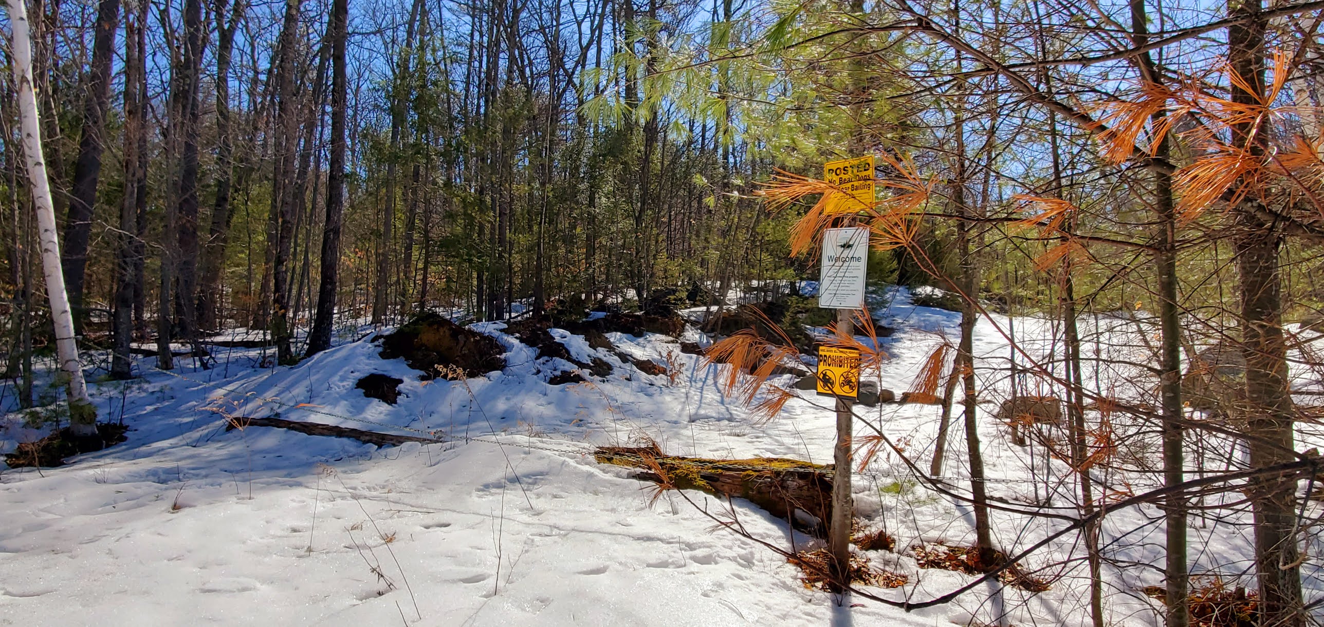
reminder on Bacon Trail


It is 1 year since my father-in-law passed. He was a proud (BC) Eagle <3


Sunday, March 21, 2021

Joe English Reservation Part 1

 Another spectacular day. Today my son and I headed to Amherst and began redlining the Joe English Reservation. I am finding that I really enjoy these expansive parks with trails just wandering through the woods, no real landmarks or scenic views, just beautiful nature. We parked on Chestnut Hill Road and headed out on the Plumb Trail. We quickly reached the intersection with P-H Trail and then Highland Trail. This reservation is multi-use, however you can tell the design of the trails themselves are geared towards mountain bikes, winding and meandering around. They are fun to hike as well though. We were really lucky with dry trails, no mud/ice/snow to contend with and no bugs yet! We had worn Winter boots in case it was muddy and carried our spikes, but neither were needed. From Highland Trail we turned onto Rocky, then Bullwinkle. Every trail is super well marked and every intersection has additional blazes and a map with a "You Are Here" marker. Bullwinkle wound back around meeting back up with Highland Trail, which we backtracked and continued on until it met back up with Bullwinkle at the other end. We did a quick out and back to complete the Bullwinkle trail and another quick out and back on Tree House Trail. We then headed up Plumb Trail, did the lollipop that is Bobtail Loop and back on Plumb to the car. It didn't feel like much and doesn't sound like much writing it down, but we ended up with just over 6 miles. It was one of those days I could have just kept walking. While there were rolling ups and downs, nothing that used up too much energy, the temperatures were perfect and the sunlight streaming through the still leafless trees was just magical. I look forward to going back and exploring more of this park.

Strava Activity


Saturday, March 20, 2021

Wapack Wandering

 Today didn't quite end up the way I had envisioned.. but the weather was amazing and I was in good company! Laura and I headed west to wander some more on the Wapack Trail. My original plan was to start where I had previously started at the Windblown XC Ski Center at the Wapack parking area and head  up Kidder Mountain, over to Burton Peak and down the Berry Pasture trail to a car spot at the trailhead. As we were heading to spot the car, we discovered Mountain Road that the Berry Pasture trail is on is closed for Winter. Luckily there was an alternate parking area on Temple Rd for the Wapack Trail itself that would only cut off  a couple of miles from our original route. We dropped my car there and headed to Windblown to get ready and head out. The weather really was amazing after the colder days we've had and I quickly had to stop and layer down as I was getting hot just moments into the hike. There are a few intersections along the Wapack Trail, most are signed so as long as you pay attention to where the Wapack Trail goes, it shouldn't be an issue to follow. We came up to a powerline swath and saw the sign for Kidder Mountain Trail. At first I thought it was going to be straight up the powerlines, but after a couple tenths, the trail turned into the woods and very gradually ascended, joining with a snowmobile trail and up to a really pretty view towards Massachusetts. I hadn't expected such an open clear view! The trail was a mixture of bare ground, hard packed snow and ice. We wore our microspikes and ended up taking them off and on as the terrain changed. They were definitely beneficial on the icy/snowy sections. We enjoyed the view for a few moments before heading back down and continuing on the Wapack Trail. The next section of trail was blah. We ended up on a really muddy road for a while passing a fairly new house and some other private land before it turned back into the woods and followed a brook. Thankfully this section was a little more pretty. One final stream crossing and we were on Temple Road. Another boring road walk and we were back at the car. We contemplated doing an out and back to Burton Peak, but both of us had some minor chronic pain issues surfacing and we had started a little later in the morning than usual, so we decided to call it. Despite the underwhelming hike itself, it's always good to be outdoors on a beautiful day. 

Strava Activity


we did a little bushwhack from the view to the true summit


the section of Wapack Trail I hiked a few weeks ago over on the ridge

you never know what you'll find on the trails


Saturday, March 13, 2021

Fogg Hill Conservation Area

 Today I went out with Cameron. I really do enjoy spending time with him, even if it's not his favorite thing to do. After yesterday's adventure with microspikes, today we wore snowshoes.. and probably would have done better in microspikes.. oh well. We headed for the Fogg Hill Conservation Area in Center Harbor. A series of 3 trails maintained by the Lakes Region Conservation Trust. There is a nice kiosk and map at the parking area on Piper Hill Road. The trails are blazed, but there are no signs at the intersections, so watch for the different colors on the trees. We started on the Fogg Hill Trail blazed in yellow which weaves easily to moderately up Fogg Hill. About a tenth of a mile from the summit, the orange blazed Bog Trail leaves to the right. We found the terrain to be either bare ground, ice, or a very hard packed crusty snow. Fogg Hill Trail had been broken out, but Bog Trail had not. Some older footprints from time to time, but we were breaking trail for the most part, which was a little tricky in the hard, crusty conditions. Bog Trail descends moderately at first, which was interesting in the ice. I opted to butt slide down the steepest section and inadvertently cut my hands in several places on the sharp edges on the way down. Nothing major, just a little blood. The trail doesn't really go past anything interesting or to anything interesting, just out to a road where no parking is allowed, a basic out and back. The trail does turn a couple of times, so be careful to watch for the orange blazes. We did the out and back and once back on Fogg Hill Trail went up to the summit. The summit is a nice sort of open area with a big split rock. With it being Winter still and no leaves on the trees, we had some peekaboo views over the Lakes region which was nice. We sat and had a snack before heading back down. The Bear Pond Trail leaves a couple tenths from the parking area and is blazed in blue. It leads a little way down to Bear Pond. Short and sweet. These past 2 days have really shown me that I am not a fan of "Spring hiking". Either be snow packed and good coverage for spikes/snowshoes or be bare! Alas, this is New England. Several more weeks of "Spring hiking" ahead!

Strava Activity


Kiosk at Piper Hill Road trailhead


the end of Bog Trail

waiting for Mum to catch up

approaching the summit

peakaboo views


Fogg Hill summit

Fogg hill summit

end of Bear Pond Trail