Saturday, April 29, 2023

Beebe Trail

 For my second hike of the day, I drove about 10 minutes to Beebe Trail, another side trail off Wapack Trail. Beebe Trail has a large parking area, just across the street and down a couple tenths from the Miller State Park entrance on Route 101. Beebe Trail heads up the side of Temple Mountain through the old ski area. A kiosk and orange gate mark the start of the trail, then just a little ways up, the trail heads right and then left. This trail was really well marked, especially at some of the intersections with old ski trails, where it may be confusing which was the actual hiking trail. Down low it was quite wet and muddy, and some of those areas that must be permanently so were bridged or had rocks placed for stepping through the worst of it. The trail moderately climbs up to meet the Wapack Trail just north of a communications tower. For most of the Beebe Trail if heading up, you can look behind you and see Pack Monadnock just across the street. I passed a couple of trail runners while on this trail which were the only folks I saw all day. Wapack Trail from Rt 101 to this point follows the gravel service road to the tower (Laura and I hiked this on a long 10 mile traverse a couple years ago). At the intersection with Beebe Trail, Wapack heads into the woods. I took a left onto the service road and continued up to the tower to see if there were any views. It was here Mother Nature beat me to the punch and the rain started. I actually didn't mind as it felt nice and cool. I put my Osprey pack raincoat over my pack and wasn't too worried about myself getting wet. I was surprised as I passed the tower to hear voices. At first I thought there must have been workers there, but there was no one. Must have just been some sort of transmission that was audible. Just past the tower I came across a tiny little memorial bench. It looked like it must have been the couple who founded the ski area. There was also a great unobstructed view across to Pack Monadnock that would be a great lunch spot (had it not been pouring rain!) next to the tower. I decided to make a loop and stayed on the Wapack Trail heading down the service road. Currier Outlook is marked on the trail map, and I saw the directional painted on a rock. I got a bit confused as I thought it was pointing into the woods, but I quickly saw that went nowhere, then I saw a herd path just to the right of the arrow that led a little ways down an old ski trail to another great view across to Pack Monadnock. It was really pouring by now, so I took a quick picture and continued on down. I decided to take a shortcut down one of the ski trails that was marked on my digital map. Initially I had concerns it would be overgrown. Turns out that wasn't the case, but it was very wet and muddy which I hadn't thought about. Thankfully it was only a couple tenths and I was back on Beebe Trail not too far from the parking area. Just because I'm a stickler on trail tracing, I also grabbed the short connector from Beebe Trail over to the Wapack Trail at the bottom as well. This completed everything south of Route 101 connected to the Wapack for me. 

Strava Activity

Kiosk in parking lot - also not the right gate for the trail


looking at Pack Monadnock


this actually freaked me out a bit.. too much Dateline watching


Beebe Trail off Wapack Trail

where Beebe Trail and Wapack Trail intersect


views from Currier Outlook


Berry Pasture Trail

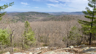
 Having completed the Wapack Trail a few weeks ago, it was time to explore some of the side trails that lead up to the Wapack. Rain was forecast for today, so I picked a couple of the shorter ones, to try and beat Mother Nature. Laura and I had attempted to car spot at Berry Pasture Trail a couple years ago, but when we got there we discovered the road it is on is closed over Winter. I couldn't remember the exact date I had seen on the sign, but I knew it was April something, and today being April 29 I felt safe it would be open. The Summer opening date is April 10, so I was good. The trailhead is just under a mile up the dirt road, marked by a very tiny sign high up in a tree. This area was cleared back in 2007 with a tree harvest project so the trail starts in a wide open area. A blaze on a rock points the way. I could see a cleared section heading straight up the hill and thought that was the trail, however that must be the old logging road, the trail heads into the woods and just skirts the edge of the cleared section. It starts wide like an old road and immediately starts climbing. I recorded just over 800ft of elevation gain in a pinch under a mile. We have had a lot of rain recently, and this area was hit hard over the Winter with storms. There were a few blowdowns but not near as much mess as I had anticipated, especially after Fox Forest last weekend. There was some mud down low, but that was easily avoidable. Thankfully it was climb the entire length, there were stretches of flat to catch your breath. The trail weaves up the side of Burton Peak and when you hit the area that must have been part of the previous logging, the trail narrows. I had read reports it was overgrown. I definitely didn't think that was the case, but I can imagine in Summer when everything is filled in with greenery it may seem that way. Looking behind you (on the way up) there are wonderful views over to Monadnock. The trail re-enters the woods and has one last short, steep climb before reaching the Wapack Trail just south of Burton Peak summit. I wasn't going to hit the actual summit, but once there, I decided to just do it. I'm glad I did, because I forgot there is a wonderful cleared view. I didn't linger as I could feel the rain approaching and wanted to get my second hike in for the day, so retraced my steps back to the car. 

Strava Activity

Trailhead on Mountain Road, Sharon

Start of trail from parking area

Berry Pasture Trail and Wapack Trail intersection

for the record, my watch record 0.95 miles

looking along the Wapack Trail

cleared view near Burton Peak summit


heading back down Berry Pasture Trail

views from Berry Pasture Trail


Saturday, April 22, 2023

Fox State Forest/ Monroe Hill Tower - Part 6

 I had my Laura with me today, and as she is still rehabbing after some medical issues, we decided to keep it shorter and simpler today.. back to Fox Forest to grab the last section I needed. We parked at the headquarters and headed down Ridge Trail on the East Side trails. We noticed a large group of trailwrights assembled that were preparing to head out. After my last trip there, I wasn't surprised. As we headed down Ridge Trail, we quickly realized they have a large job ahead of them. Ridge Trail was a mess from the Winter storms that hit this area. Whole trees, limbs and lots of mud. Once on Concord End Road, it was better. Ridge Trail turns off Concord End Road after a short distance and climbs moderately up to meet Spring Road. More trees down in this short section. It was here I also discovered my pre-planned route was missing a section of Ridge Trail I would need to complete the forest. Some quick scrambling and planning and we had a slightly different route in place. We turned left onto Spring Road and did an out and back to the property boundary. The trail was drier, but still had lots of debris to step over, under or around. Thankfully nothing impassable and we tried to move as much as we could off the trail. Back at Ridge Trail and we headed up the side of the South Peak of Monroe Hill. This was all new trail for me now and I was enjoying the snow free trails. Every other hike I've done in Fox Forest has had snow cover of some type. It was amazing how different it all looked with that gone. I think I must have said that at least 1000 times. At the intersection of Ridge Trail and Monroe Hill Trail is a very small outlook tower, that appears on the 100+ Standing, Former and Proposed Fire Towers list, so I was able to check that off as well. Peakaboo views from the tower as the trees have grown and restricted much of anything else. We started a figure 8 lap of Monroe Hill Trail, then left onto Molly Jackson Road (also Ridge Trail), which gently descended down the side of the hill. A very short out and back to the end of Molly Jackson Road before getting back on Ridge Trail and climbing back up to the tower. This was a short, but really quite steep climb! Back on Monroe Hill Trail, and this time right onto Ridge Trail. This was the section I had originally forgotten to include, so I was very grateful to have realized. It would have been so frustrating to get home and discover I still had this little piece left. This whole area was much nicer as far as debris. At the intersection with Spring Road, I completed my quest to hike every trail in Fox State Forest! We took Spring Road back to the short section of Ridge Trail to Concord End Road. This time instead of taking messy Ridge Trail back to the car, we stayed on Concord End Road, which leaves the forest boundary, but has a gate right at the end that connects to the parking lot at headquarters. This was dirt road and a much better option that all the mud and debris on Ridge Trail. 

Strava Activity


some of the mess along Ridge Trail


more mud and mess on Ridge Trail


Ridge Trail off Concord End Rd

forest boundary on Spring Road.. those cars sketched us out to go any further


Monroe Hill Tower

peakaboo view from the platform


intersection of Molly Jackson Rd and Ridge Trail

at Center Road looking down Molly Jackson Road

back at the tower from the opposite direction


this spot marked my completion of all the trails in Fox Forest

Spring Road


Saturday, April 15, 2023

Madame Sherri's Forest

 I've had this area on my radar for a while, but the long drive is always a negative when selecting my destination. Today I decided to go for it. We have had some unseasonably hot days and I just wanted no snow/ice. I got a late start, and by the time I arrived at the trailhead on Gulf Road, the lot was almost full. I chatted with a couple ladies who I would encounter several more times throughout the day, and geared up, excitedly leaving all traction in the back of my car! What I should have had with me was bug spray. Note to self to repack that for next time. Starting out by crossing a marsh, a spur to the old ruins of Madame Sherri's castle is almost immediately on the right. I headed up and took some pictures. I would have loved to have seen the ruins before the staircase collapse, but it's still a neat area to explore. I headed back to the main trail and continued on the Ann Stokes Loop. At the intersection for the loop, I took a right towards Indian Pond wanting to get the steeper side out of the way first. Immediately it started a moderate climb up towards the pond. The leafless trees made the entire forest so light and bright. At the next intersection, I stayed right again onto Mine Ledge Trail. Very shortly after this intersection is a short spur to an overlook of Indian Pond. After this the climbing started in earnest. Thankfully alternating between quite steep and some flatter sections, the trail climbed up and through lots of mountain laurel, which must be spectacular when in bloom. The trail was well marked and really well maintained, I was loving it. Again, with the leafless trees, I could see all the surrounding views. I reached the Mine Ledge spur, which was my turnaround point. The guide says to use caution on this spur as it traverses the top of a cliff, so I was a bit worried it would be rather scary.. but I actually found it quite safe (but yes, I can see the need for concern especially with little ones or dogs) as it does drop right off. This was a great view over to Wantastiquet Mountain and beyond into Vermont. I encountered a couple here thinking they were on a loop back to the parking area. I let them know that in fact they were heading for Brattleboro and got them back on track before doubling back myself to Indian Pond. I continued around Ann Stokes Loop, which climbed up and over East Hill before meeting up with Daniels Mountain Loop Trail. I stayed on Ann Stokes Loop which took me back to the trailhead. Once over East Hill in the lower part of the trail was the only area where I really encountered any water or mud, but this seems to be a permanent fixture on the trail as there were plenty of well placed rocks for hopping across these areas. Maybe it was the bright sunshine, maybe it was the no snow.. but I found myself really enjoying this area. 

Strava Activity