Saturday, September 23, 2023

Skyland Trail

 I've had this trail on my radar for a while ever since reading about the gorgeous views and tranquil setting. I wanted a good weather day though, and while today wasn't sunny and glorious, it was crisp and clear and most importantly bug free. Laura and I did a car spot on this one, which I'm so very grateful for. We parked my car at Alexandria Four Corners per direction in the AMC Guide. We were a little confused when we arrived as the intersection is really small and tight, and there didn't seem to be anywhere to park, so I pulled down the side that looked the least traveled and as it turned out a local was out walking her pups. I asked her about parking.. and she confirmed to just pull off the road as far as possible and lots of people do it! So I did, just a few feet in from the intersection on Orange Road. We drove to the Cardigan State Park main lot and started from there on West Ridge Trail. As I found a couple weeks ago, this trail is a good, moderate climb up from the get-go. I was mentally prepared for it this time, but it still took the wind from my sails regardless! At just about a mile, a lovely big sign marks the start of Skyland Trail. Only 4.6 miles long, but it goes up and over many named and unnamed bumps that make it feel much longer than 4.6 miles! The start was gorgeous and mossy and a relatively gentle climb up to Rimrock. Much different views than my last visit. We could see all around, and Cardigan looked like you could reach out and touch it! Continuing down Skyland Trail it makes a very steep descent down slab for just about a quarter mile, that had us on our butts a couple times doing some skooching. The views take some of the sting out of how steep it is because you're constantly looking up at the beauty around you. Once into that first col, the terrain changed back to the lovely moss before taking on the personality of what I call a "real bushwalk" (growing up in Australia, I can say that as that's what we call a hike!) This trail kept us guessing the entire length as it seemed to take on the personality of about 12 different trails between rock slab, mossy pine ridge walking, and full "bushwalk" and kept changing back and forth. The views were grandest in the first half of the trail particularly from just beyond the summit of Mt Gilman (Orange Mountain) where the views over to Cardigan and Firescrew match some of the best I've seen from any mountain! The other side of the summit had more views as far as the eye could see, though as the trend seems to be of late, those were hazy but still beautiful. The trail goes over 5 named peaks plus a couple smaller bumps, and near the summit while not actually reaching it on one more. We started at West Ridge Trail which had the biggest climb first up to Rimrock. From there, the summits were smaller, so we wanted the biggest out of the way first.. but don't be fooled. The ups to even those smaller summits, then the downs on the other side were all super steep! Thankfully short, but they packed so much punch. By the time I reached Church Mountain and then traversed the slopes of Brown Mountain, I was cooking without much gas. The trail is well marked up to the Crane Mountain summit. After that, it did become a lot more rustic (which is described in the AMC Guide) and we did have to stop a few times to look around and see which direction the trail went. The trail is a lot more overgrown on this end and not as well swept, but we had no real issues and really only got stumped once at a clearing with lots of ferns. I finally saw a very faint herd path and then a cairn hidden by all those ferns. From that point until the end the blazes seemed to be freshly painted, and we had no issues wayfinding. The end of the trail pops out on Church Hill Road which is gated and private, though you can obviously walk down to Knowles Hill Road where you take a right and soon reach the Alexandria Four Corners intersection. I've never been so grateful for a car spot in my life! An amazing trail though, highly recommend!

Strava Activity  


views from Rimrock


starting the steep descent from Rimrock


starting the steep climb to Mt Gilman


pictures don't do steepness justice, this was a little steep section.. with lovely colors!

looking out over where we are headed


starting to get more rustic, trails in there somewhere


this was the one place we got stumped for a moment


popping out on Church Hill Road


Sunday, September 17, 2023

Pisgah State Park - Dogwood Swamp Trail

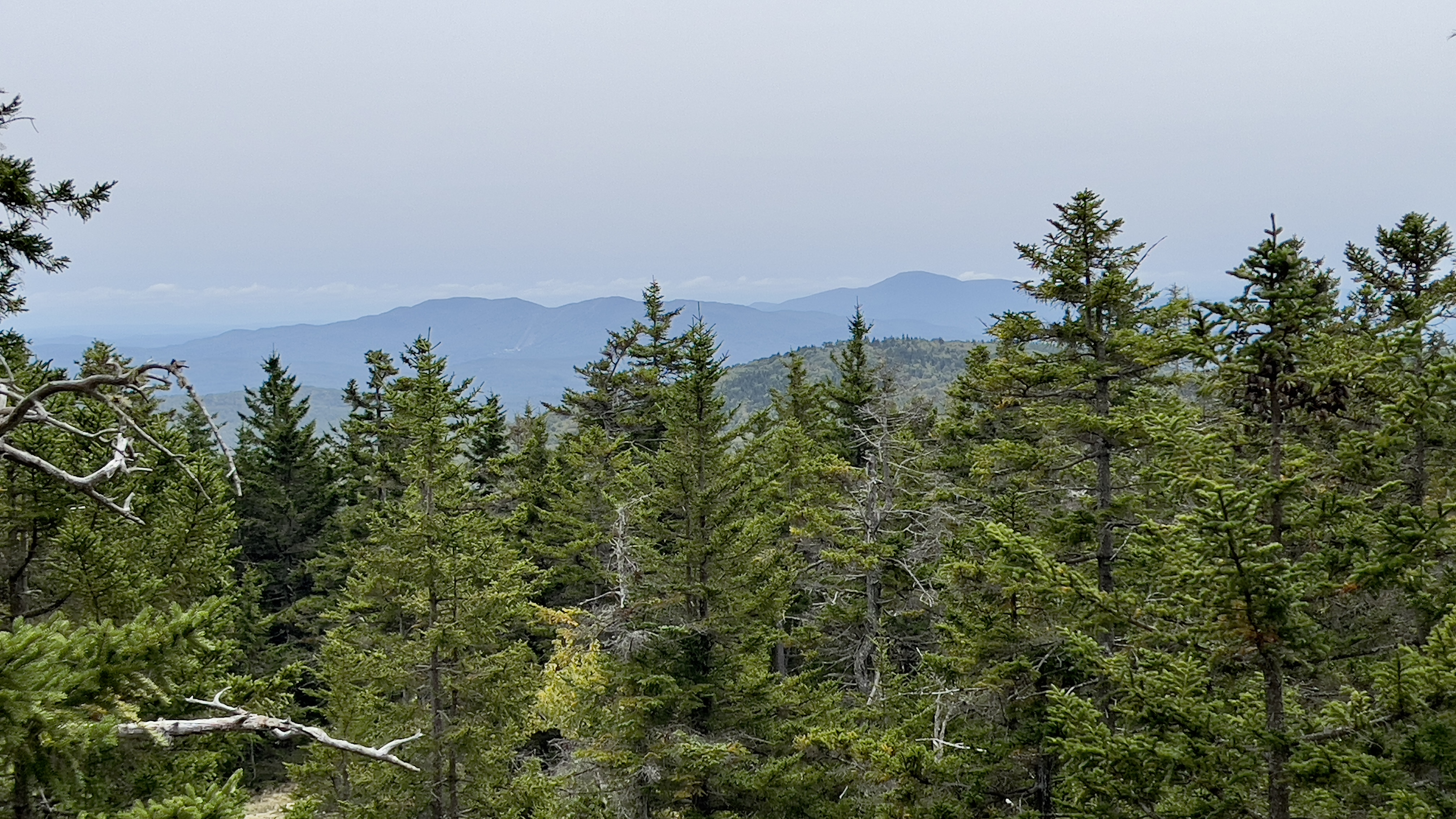
 I'm getting close to finishing Pisgah. I've enjoyed (and not enjoyed) my hikes here... the not enjoyed has primarily been because of mud and bugs, not the parks fault! I was in the mood for a long walk without anything technical. I drove in the couple of miles on Reservoir Road to park at the interior lot and was first car there. There was one upon my return that was a very low clearance vehicle. That must have been an interesting drive. The road isn't bad by any stretch, but there are some rocky sections that might have been hairy in a low clearance car. As I geared up, 2 ATVs came past. I was expecting to see a lot of ATV traffic today as it was gorgeous out.. finally! I started on Dogwood Swamp Trail, which despite the "Closed" signs at either end, is open to hikers, per a conversation I had with Park Manager Kim a couple months ago. The closed signs are for motorized vehicles as the trail needs a lot of maintenance before it will be safe enough for any of that type of traffic and they've had too many other projects happening to tackle it at the moment. So he said to me, by all means hikers can hike, just with the understanding it hasn't been swept or brushed in a year! I wasn't sure what to expect with that intel. The trail immediately begins a gentle climb that lasts about a mile. There was definitely a lot of small debris, which I was expecting.. as well as a lot of blowdowns. All but 2 were easy stepover, duck under or skooch arounds. There were 2 that were trickier as they were large and right near water/mud which made the skooch around a little more difficult. Both of those I just went for it and climbed through. After roughly a mile, the trail descends a little then has some rolling ups and downs for roughly another mile before descending down to meet up with Old Chesterfield Road. The trail itself is not technical in anyway, as is most of the park where the trail doubles as a snowmobile trail in Winter (when open) and isn't particularly scenic. In the middle you pass a marsh that can be seen through the trees and it skirts the end of a pond, otherwise it's just walking in the woods. I did find the first half of the trail to be particularly peaceful. The trees are starting to lose their leaves, there was some lush light filtering through and I saw no one the entire length of the trail. The second half was wetter, muddier and the bugs started to find me, so I enjoyed that part a lot less. Turning onto Old Chesterfield Road and for the remainder of the hike, was gravel road that allows ATV and dirt bike traffic in Summer. Old Chesterfield Road also allows cars as far as the Chestnut Hill Trailhead. I saw none on my walk today. I was able to make quicker time on the gravel roads which helped trying to keep the bugs at bay. They weren't horrendous based on my last few trips here, but just annoying enough that it made you not want to stop. I was on Old Chesterfield Road for about a mile passing a few trail junctions, and amazingly not seeing a single ATV. I turned onto Broad Brook Road and repeated the section to Doolittle Trail I had done over the Winter before continuing to the gate at the park boundary. The signs at the start of Broad Brook have conflicting mileage, my watch clocked it at 3.2 miles of long, relatively boring gravel road. You do pass a couple ponds and several historic markers which are interesting.. otherwise, I was just doing it as a check mark on my spreadsheet. I did pass several ATVs and dirt bikes on this section.. those dirt bikes sure do go fast, so be sure to step off the road when you hear them coming. Once I reached the gate, I backtracked a couple tenths to South Link Trail, which is a connector road between Broad Brook and Reservoir Road. It starts up a steep, short little climb then just continues a couple tenths over to Reservoir Road. There were a couple really muddy sections here, which a hiker can easily go around, but the ATVs and bikes were splashing right through them. Back on Reservoir Road, I had just over a mile back to the car. More of the same.. gravel road, bugs and a pond.. plus a couple more ATVs and dirt bikes. So overall, not the most exciting of hikes, but today I was able to check off 5 trails and nearly 10 miles off my spreadsheet! That sure felt good. 

Strava Activity

Dogwood Swamp Trail off Reservoir Road


one of the large blowdowns I had to climb through

the trees made the cave seem like a house entrance!


the second half of the trail was less open, but still pretty

the second large blowdown I climbed through

Dogwood Swamp Trail off Old Chesterfield Road

Old Chesterfield Road

start of Broad Brook off Old Chesterfield Road

one of the historic markers along Broad Brook Rd

Broad Brook at the park boundary

South Link off Broad Brook

low clearance car at the parking area.. that must have been a bumpy ride!


Sunday, September 10, 2023

Cardigan Mountain - South Ridge Trail

 We had a mixed forecast this weekend, and more inclement weather was forecast this afternoon. I wanted to get out and do something so I headed back to the Cardigan area to grab a 3ish mile loop I've had planned that would cover South Ridge Trail over Rimrock and Cardigan's South Peak. I arrived to find the parking lot about half full. Not surprising, hikers don't seem to be deterred by much. I have hiked Cardigan 3 times previously, all on West Ridge Trail which begins at the back of the parking lot. Despite this being a State Park, there is no fee and no ranger at the gate. There is however some porta potties, which is always a bonus, particularly when they're clean as these were today! My memory of West Ridge Trail was it being on the relatively mild side and one of the "easier" 52 With A View/Firetower mountains.. my memories seem to have faded over the years, as although not insanely hard, it was steeper than I had remembered! The trail immediately begins climbing, though does use long switchbacks at first to make the ascent. The trail was damp today from recent rains (a recurrent theme this year) but the biggest plus of the entire day was no bugs! About half a mile up West Ridge trail is a giant cairn marking the intersection with South Ridge Trail. I had read some reports that it was better to ascend via South Ridge due to some steep scrambles near the top, so this was the way I headed. The trail continues to climb though there were some level sections to help catch your breath. I could see from the map I was following that the trail ascended a small knob, leveled out then came the steep scramble I had read about. At first, I was thinking it wasn't too bad, steep yes.. but not overly technical. Then I turned a corner and all that changed. For about a quarter mile, the trail was very steep with a mixture of slab and technical rock scrambles. I was actually quite nervous the entire time being alone and on the shorter side.. some of the scrambles were precarious. I was also cognizant that the ground was very saturated, and since I was using trees a lot of the time for balance and to pull myself up, I just prayed none gave out under the wet ground. I took my time and tried to enjoy the surroundings. I couldn't see much through the trees as the clouds were way low. Maybe this was good, I couldn't see how high up I was! I've never been so glad to reach the top of a scramble and even though it continued to be a steep climb, it was far less nerve-wracking than going up those rocks. The climb was now more slab and I imagine on a clear day there would have been some wonderful peekaboo views of the surrounding area. I reached Rimrock and was completely socked in. I wasn't overly concerned as I know I need to revisit this area when I hike Skyland Trail which intersects on the summit of Rimrock. I actually enjoyed the total quiet and peacefulness of the whiteout. The trail continues a couple tenths over to Cardigan's South Peak marked with a giant cairn.. and typically great views up to Cardigan's actual summit. It then descends slightly and up a little again to meet up with Ranger Cabin Trail. South Ridge Trail turns right here and follows over some more slab with a gentle incline to its end at Clark Trail at the old Fire Wardens cabin. I looked up Clark Trail and could even barely see with the fog. I could see how steep it was though and thought about Holt Trail further over and how that's even steeper! I backtracked to Ranger Cabin Trail and continued the couple tenths to West Ridge Trail. This area seems to be lightly used as there were lots of spiderwebs. It also started to very lightly rain at this point. I reached West Ridge Trail, there is no sign, but a large cairn in the middle of the trail. I did notice a small sign up in a tree pointing up Ranger Cabin Trail that said to South Ridge Trail. Descending West Ridge Trail was rocky and wet. I was amazed at the amount of people still heading up, despite obvious white out conditions, rain starting to fall and heavier rain in the forecast! I passed the intersection with Skyland Trail, thinking about being back to do that trail at some point in the future and continued on back to the car just as the rain started to get a bit heavier. 

Strava Activity


looking up South Ridge Trail as it starts to get really steep

one of the more sketchy sections I found on South Ridge

more technical scramble

Rimrock

trail between Rimrock and South Peak

South Peak


spider webs on Ranger Cabin Trail

intersection of Ranger Cabin and West Ridge trails

heading down West Ridge Trail