The Summer is flying by ever so quickly. I had read how Mt Hale was one of the "easier" 4000'ers, plus it was on the NH Fire Tower list as well. Bonus. We were up and on the road early and about halfway up it turned very overcast and some raindrops started to fall. This hadn't been in the forecast I had read. I quickly looked again and sure enough, "7% chance of rain".. We drove in and out of some relatively heavy downpours, but I was determined to keep going. You never know what the weather might be like on the other side of Franconia Notch, plus I felt that if it wasn't raining when we arrived at the trail head, we would take a chance and head up anyway.. the trail was only 2.2 miles long, I had not read about any rock slabs or ledges that might be treacherous in wet conditions, plus this was a viewless summit, so if we were in cloud it wouldn't matter. We arrived at the Hale Brook trail head on Zealand Road around 8:30am and geared up. I had driven past Zealand Road so many times on our way to Bretton Woods for skiing or various races over the years, I have been chomping at the bit to do this hike and cross it off the various lists it sits on. The trail was damp, but never really wet. The climb is moderate (per my definition) but nothing crazy. There were no real flat sections, it was (or at least it felt like) climbing the entire way.. but I never stopped at any point thinking "I can't do this anymore".. naturally I had to take breather breaks and normal rests, but I was never thinking "make it stop".. which I have done before. I could tell we were hiking up into cloud, which had the boys rather fascinated. It was slow going for a 2.2 mile trail, but we eventually made it to the summit, which is basically a small field with a large cairn in the middle. There are some of the former fire tower artifacts. But no views to speak of. After a quick snack and a couple of summit pictures, we headed back down. It sprinkled on us a little as we headed down, but soon we were under thick cover and didn't get wet at all. We passed a few parties on our way down. I think the viewless summit on an overcast day is a draw for anyone who needs this on their NH48, just like us! Back at the trail head and another successful hike for our little trio. I know the boys would never voluntarily say "hey, let's go for a hike".. but afterwards when I always ask "did you have fun?".. hearing "oh, it was good".. is success enough for me. I'm so glad we got at least one 4K in this Summer.
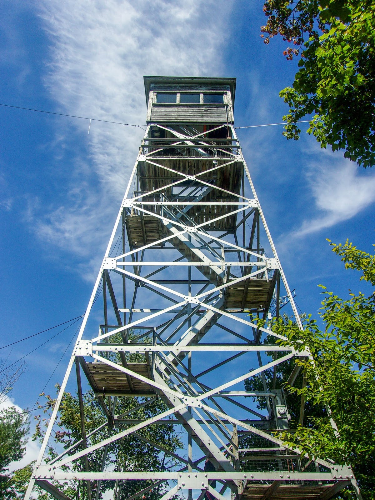
I'll combine two in one for this report. After leaving Mt Prospect, we headed for Carter Tower which is situated right alongside Route 2 in Jefferson. I checked out Google street view before heading out, so I had a rough idea of where to look for the tower. Of course, we drove right past it the first time, back tracked and there it was. Quick park alongside the road and a couple of pictures to "tag" this tower. The tower is locked, so you cannot go in. However, that is another fire tower marked off the list!
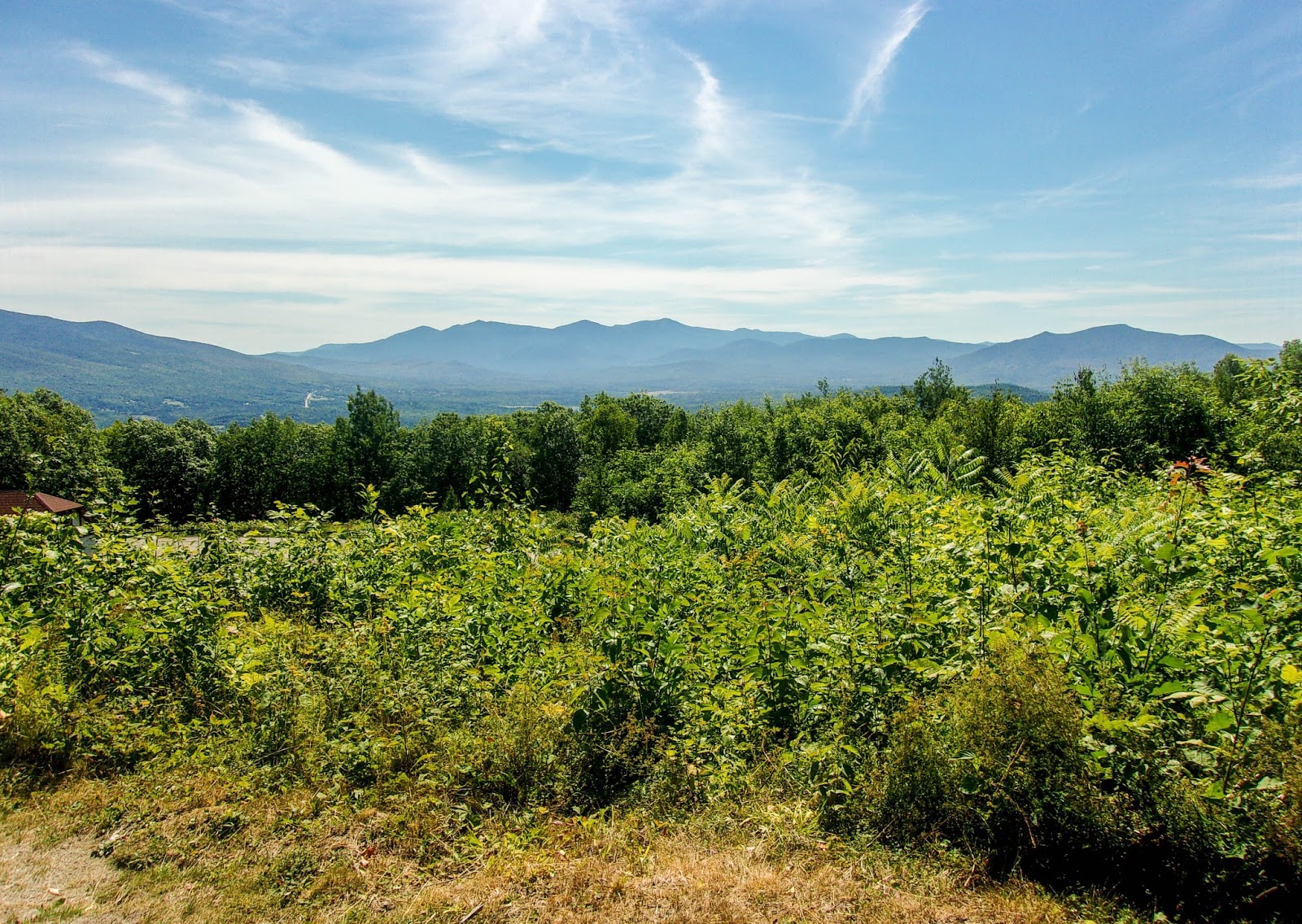
Onto Milan and Milan Hill State Park. Driving into Gorham on Route 2 is one of the prettiest drives I have done in a while. I've gone up Route 16 so many times, but the views of the Presidentials from Route 2 are maybe my favorite. We arrived at Milan Hill State Park and stopped at the Ranger cabin on the way in. I had anticipated having to pay a State Park fee, and after being ribbed a little by the Park Ranger (he told me it would be $52, he was just having a laugh) he said there were no day use fees and to enjoy our time exploring the park. We didn't have a whole lot of time having to get back to football practice that evening, so we didn't spend a whole lot of time in the park. But what we saw was really, really pretty. Aidan even said "this is one of the nicest places we've been".. they have yurts you can camp in, or open campsites you can rent. The yurts looked like fun! The tower was just up the road from the ranger cabin with some picnic tables, swings and a covered pavilion you can rent out for larger parties. We climbed the tower and were rewarded with some amazing views. Again, viewing the Presidentials from this angle was spectacular. We were blessed with an absolute bluebird day as well. The tower looks like it could be a bit shaky, but it was sturdy enough. Cameron wasn't interested in making it all the way to the top of this one, he stopped about halfway. So 3 more towers marked off the list. Even if we never complete this list, it has been so much fun touring around and exploring places we would never ordinarily visit. New Hampshire is a very beautiful state, we are so lucky to live here!
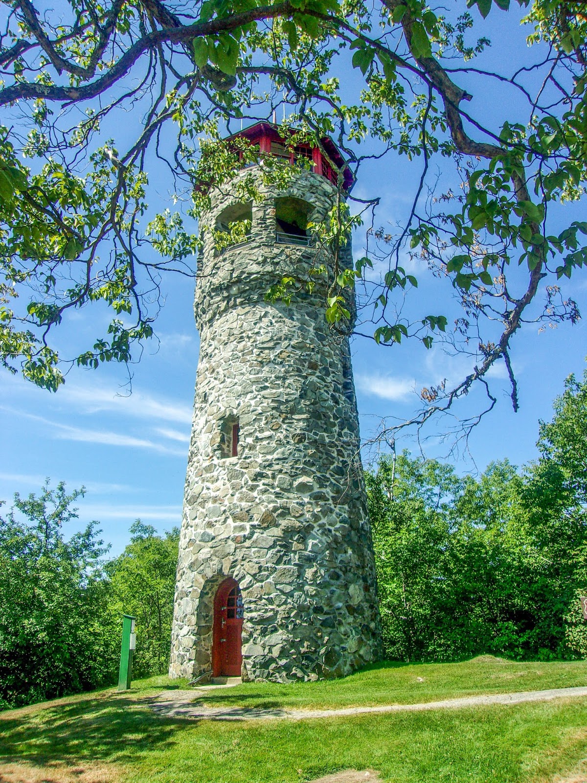
I had made grand plans to hit up some of the fire towers in the northern part of the state. The day started in glorious fashion and I got everything ready. These were towers we could drive up to, but the commute was going to take a while, so I figured while we had a day with no commitments till later that evening, let's cross these off the list. Plus the boys had not been this "far north" in New Hampshire. New places to explore. One last check on addresses and I see that our first stop is actually closed on Tuesday's.. what?! I panicked for a moment, but resolved we would go ahead with the plan anyway. After some quick research, I saw the auto road was open to hikers on any day and it was 1.5 miles from parking to the tower. I was sort of hoping I had misread the hours.. or that the tower wasn't actually in the State Park itself, but had in the back of my mind to be prepared for a little road hike. Almost 3 hours later we arrived at Weeks State Park in Lancaster, NH and yes.. the road was gated shut. Road hike it was. Thankfully the hike was mostly under tree cover and there was a delicious breeze most of the way. While naturally ascending, it didn't feel so steep and was actually a rather pleasant walk. The tower came into view and we took the last turn. A small 0.2 mile nature trail (Ken Jordan Nature Trail) veered off the road and we took this up to the tower itself. There was some landscaping maintenance going on, so it wasn't necessarily a quiet, peaceful stop.. but the weather was perfect and the views incredible. The tower was like a castle turret and unfortunately locked, so we couldn't go up. There are some picnic tables below however, so we stopped and had a snack while enjoying the surrounds. Quick dash back down the road, stopping at an over look of the Presidential Range and surrounding mountains (which is probably one of the best I have ever seen) and we were back at the car.
After a couple of days of driving around and exploring Fire Towers with my boys, I felt we needed to do a "real hike" but continue our goal of checking off those towers. So, I reviewed the list and Stinson Mountain stood out to me. I had seen my friend Ruth post pictures from a hike there in the past and it was on my radar as one to do with the boys. This hike would serve dual purpose, it is on the Fire Tower list, but also the NH 52 With A View. We had a late start as Aidan has been at Vacation Bible School in the mornings. We arrived at the trailhead in Rumney, NH just after 2pm. After gearing up and taking the obligatory trailhead picture we headed out. There was only 1 other car in the small parking area, and we quickly passed them on their way out, so from that point on we had the mountain to ourselves. The trail is straightforward.. and almost a straight line. Part of the trail is a snowmobile trail in the Winter, so it is relatively wide. The grade is moderate, you know you're climbing but there aren't any crazy steep sections. At 1.1 miles you hit an intersection where the snowmobile trail heads left, and the "hiking trail" heads straight ahead. I had read from this point, the trail became a little more technical. There are quite a few rock slabs to navigate with quite a bit of moss on them. The trail was damp today, but we've had a very dry Summer, so we did OK.. I have to imagine with normal rainfall, this is a pretty wet trail at all times. We made our way up the final 0.7 on the "hiking trail" and came up and over to see the beautiful view. Cameron climbs like he's on flat ground, so he was several minutes ahead of me. He had stopped at the top and both of them were saying "wow, that was worth it"! I love that. The Fire Tower no longer stands, but the footings are still visible. We used those as stools and had our snack while enjoying the gorgeous view over Plymouth and surrounds. We decided to take the snowmobile trail back down to the intersection to make a small loop out of it, and also I didn't really want to go back down the rock slabs with moss on them. The snowmobile trail grades were much easier, but the trail is definitely becoming overgrown. There is a relatively defined herd path to follow but the hidden rocks and potholes can be a bit of an obstacle. There was also a really muddy section that was kind of unavoidable so we all had muddy wet shoes, that thankfully dried by the time we got back down. We hit the intersection and made a quick descent back to the car. Overall, not a super eventful trail or hike, but some lovely views at the top.. and 2 checkmarks on our lists.