Sunday, November 29, 2020

Piscassic Greenway

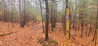
 I finished out my weekend of low impact hiking at Piscassic Greenway in Newfields. Another SELT property. I am really enjoying these walks through these forests/parks. Naturally it's nice to get a view, reward for the effort, but sometimes it's just nice to take a walk as well. I'm glad the AMC South Trail Guide includes these types of places, change of pace and wonderful to explore. I had my buddy Cameron with me today and we set out with the goal of redlining the entire property in 1 trip. I had figured it to be about 6 miles. The SELT properties are definitely some of the best maintained that I have encountered so far. Every intersection is signed with directions and mileage and the trails are blazed well. This property had quite a lot of extra maintenance with bridges and it looks like more to come as I saw quite a bit of timber alongside the trail in places. We started on Bald Hill Road on the Mraz Trail. It starts by crossing a farm before heading into the woods. We then came to the Byrne Trail, which we followed all the way to the end (by taking a left). I didn't actually see signage referring to it as the Byrne Trail, the signs had markers like "Wildlife Viewing Platform" and "Schanda Farm" but the yellow blazes matched that on the map. At the end of the Byrne Trail be on the lookout for a gate to the right of the trail, this is the SELT boundary. It appears a private trail continues straight, so if you're not paying attention you may not realize you've reached the end of the trail. Also of note, the map currently on the SELT website shows Byrne Spur Trail with Winter Access Only. This is outdated. They have since built a bridge to cross the marsh allowing for year round access. This also cut about a mile off our walk as we were able to link Byrne Spur Trail and Otis Hill Trail with a quick Class VI road walk of maybe half a mile. We were able to complete the entire map in just under 5 miles, and very little elevation change. I really enjoyed these trails and this little piece of forest. 

Strava Activity

Mraz Trail

Mraz Loop South

end of Byrne Trail at Rockingham Rail Trail

a private cabin alongside Byrne Trail

Byrne Trail

alongside Otis Hill Trail

Start of Otis Hill Trail off Neal Mill Road

end of Byrne Spur Trail at Neal Mill Road
new bridge on Byrne Spur Trail


wildlife viewing platform on Byrne Spur Trail

intersection of Byrne Trail and Byrne Spur Trail

gate at the end of Byrne Trail

Mraz Loop North

Mraz Loop North

interesting find along Mraz Loop North
intersection of Mraz Loop North and South


start of Mraz Trail at Bald Hill Road

parking on Bald Hill Road


Saturday, November 28, 2020

Great Bay National Wildlife Refuge Center

 To celebrate another spin around the sun, I was able to get my family out for a walk. This made me happy. I chose Great Bay National Wildlife Refuge. An area included in the AMC South Trail Guide for redlining. This area is near the Pease Airforce Base and has 2 trails. The Peverly Pond Trail is a 0.5 mile handicap accessible boardwalk loop past Upper Peverly Pond. Was a bit slick today after recent rain, but was still a super easy, nice walk. The other trail is the William Furber Ferry Way Trail, which begins across the street and starts off skirting a former weapons storage area (safely fenced off). This trail is a lollipop loop out to Great Bay on a mostly wide, easy grade gravel trail just over 2 miles long. It was a bit wet and mushy today without much to see as it's another grey, overcast day. I was just happy to be out with my family. 

Strava Activity


Peverly Pond Trail

Peverly Pond Trail

along Peverly Pond Trail

William Furber Ferry Way Trail

nice view across a former weapons storage area ;)

Field where the trail lollipops back around


Friday, November 27, 2020

Stonehouse Forest

 After a planned weekend off, I was ready to hit the trails again. I headed for Stonehouse Forest in Barrington. I had visited Stonehouse Pond many, many years ago when it was a meager herd path and a mish mash of snowmobile trails to hike on. It is now a bonafide trail system maintained by SELT. Completely revamped and a really great trail network. For the first time, I headed out without an actual plan. I had a map, and a rough idea of what I needed to do, but really went in with the idea of reaching an intersection and navigating with the map. My goal was to attempt to redline the entire forest in one go. Thankfully, the network is really well marked at every intersection with directions and mileage. This helped me accomplish my goal. I just took each section one at a time until I was done. There are several parking lots to reach the trails, I opted for Merry Hill Road knowing I could do a big loop and not have to do too many out and back doubling up of trails. I made really good time (for me) averaging just over 2 miles an hour. The trails were wet from rain the day before, but not so much that it impeded my progress. It was a grey, foggy day.. but there really aren't any scenic landmarks on these trails, so it was a perfect day to just get the blood flowing. The ups and downs aren't that bad to really slow you down, with just a few steeper pitches, that are all relatively short. The main sight in this forest is Stonehouse Pond with the  ledges overlooking it. I was able to enjoy this area solo where I stopped for a quick snack. Many of the trails are snowmobile trails, good footing and easy grades. I also passed lots of cabins, which I assumed were warming huts for the snowmobilers, I later learned they were hunting cabins as the land was previously a private hunting reserve. One word of caution if hiking during hunting season, wear your blaze orange, I did see 2 hunters actively out, so the need for safety is paramount. I'm pretty sure I say this every week, but the most amazing thing with this redlining journey is discovering new (to me) parks and trail systems. So many hours of work by trail maintainers put in to create these awesome places of recreation for all of us. I'm sure there are more efficient ways of accomplishing this, but 14.75 miles and just over  hours later, I completed every trail. Another successful day in the woods. 

Strava Activity

(my pictures uploaded in reverse order)

Gate for private property at end of Locke Trail


Kiosk at Parking Area on Rt 202


Stonehouse Pond

some cool caves along Ledges Loop Trail


Scenic view at the end of Brook Trail


At the end of Brook Trail at SELT boundary


Parking on Merry Hill Road